
Dehradun is many things to Indians but to us here, its identity is closely tied to elements such as its canals, litchis, basmati rice, undulating landscape, and a rather unique and interesting architectural language. Sitting in the Doon valley, nestled in the foothills of the Himalayas, the city’s landscape comprises forests, agricultural lands, canals, and orchards. As in most Himalayan settlements, Dehradun’s urban form and architectural character have been shaped by and around these landscapes.
The architectural character was a unique blend of native Garhwali traditions, British colonial interventions, Tibetan Buddhist influences, institutional footprints and post-independence developments. But its relationship with the water system, a network of canals first laid by Rani Karnavati and greatly expanded by English engineer Proby Thomas Cautley, has been so special[1] that Dehradun was often called ‘the Venice of the East’ and closely vied with Alappuzha, Keralam, as ‘the city of canals’.
The last of the canals was invisibilised a few years ago as roads were laid upon it to accommodate the growing automobile traffic in Dehradun. It is now hard to believe that the celebrated author Ruskin Bond had an affinity for walks along the Eastern Canal flowing along the Old Survey Road or that children spent long hours playing paper boat regattas in these waters. It is harder to believe that the modern Dehradun’s urban life and form have little to do with the canals or its hills. The description of Dehradun as ‘the city of canals’ does not reconcile with the city one encounters today.
The city’s relationship with water
The canal system was once visible, thriving, and a strong part of the urban fabric. Its foundations were laid in the 1650s – nearly 400 years ago – during the reign of Rani Karnavati. Subsequently, in the colonial era, it was expanded by Cautley who made Bijapur, Jakhan, Kalapathar and Rajpur canals integral to the public infrastructure of the 19th century.
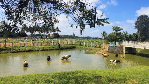
The canals were a part of everyday life here. Thoughtfully and intricately designed, they catered not only to the needs of people but also animals, their small ducts along the length offering water to horses and cattle. At places, the canal water allowed dhobis to wash clothes, farmers to irrigate the fields including those of Dehradun’s famous Basmati rice, sustained fruits orchards, including litchi plantations, and the traditional Himalayan flour mills that operated beside the waterbodies.
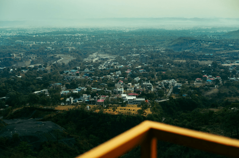
Photo: Unsplash
The canal network was, at once, Dehradun’s sustenance, infrastructure, public space and an ecological corridor. Residents came to stroll daily, houses and bungalows along the canals bore names like Litchi Bungalow, and, most of all, they regulated the micro climate of the Doon valley. They kept the city cool, their natural flow allowed the rain to drain, preventing water logging, and social life flourished. An example is Rajpur Canal water flowing into a pond near the Jhanda Mela Ground where locals gathered during Dussehra.
The 21st century Dehradun, however, lost sight of the significance of the canals in the urban form and life.[2] Far from seeing the canal network as an ecological corridor of the city, a critical part of the urban infrastructure for centuries, the modern city built over the canals, laying roads over them. The canals were, unfortunately, seen as obstacles to ‘development’. Now, Dehradun floods and, worse, struggles with water shortages forcing residents to do the unthinkable – rely on private water tankers.
Transformation over the years
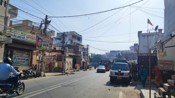
Rajpur Road offers a clear understanding of Dehradun’s transformation. Earlier, this corridor mediated the harmony between Dehradun’s built form and the valleyscape, offering beautiful visual connections. Rajpur Road witnessed a transition from a colonial carriageway lined with trees to a transit corridor for tourists headed to Mussoorie, and is now a bustling commercial and residential corridor. It is now called the ‘Old Mussoorie Road’. This transit corridor was more than a means of mobility; it was a gateway into the valley where the finest views of nature and architecture unfolded.
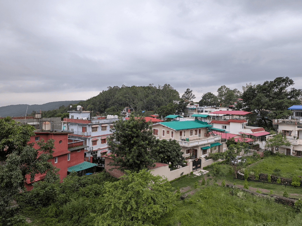
The ribbon development along this corridor had a residential fabric of modest heights, a porous relationship between built and open spaces, wide setbacks, gardens and orchards with litchi trees. This fabric can still be seen around in neighbourhoods such as Dalanwala and in pockets between New and Old Mussoorie Road. These bungalows showcased a unique relationship with open space, one that became characteristic of Dehradun.
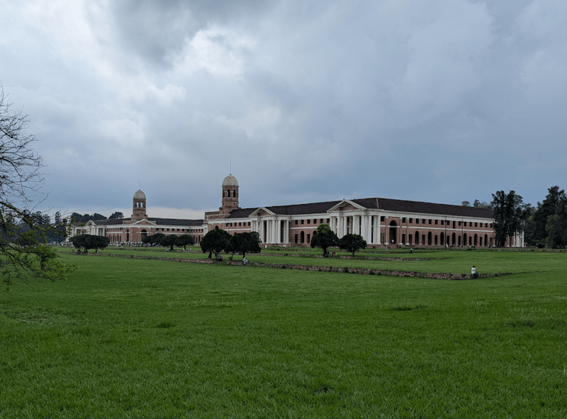
Photo: Ravjyot Kaur
Rajpur Road has changed. The scenic, tree-lined road that was once a gradual transition between the city and Mussoorie hills is now a buzzing commercial and residential corridor. Increasing traffic, commercialisation, and modern-day construction have altered its character. Residents and activists like Anoop Nautiyal have repeatedly raised concerns about the diminishing greens. The reason for the change: The road is now public infrastructure to facilitate mobility and ribbon development, not a public landscape that structured urban life.
Changing roles and makeover
Dehradun was made the capital city of Uttarakhand in November 2000. The new role came with responsibilities and happened to be the turning point in the city’s trajectory. This status called for creating employment opportunities, building institutions, getting investments into business and IT parks, accommodating migrants and a floating population of students. All these increased the demand for housing.
In the 2011 Census, the city’s population was at around 5.75 lakh and adversely impacting the urban fabric; it is now estimated at over 8.5 lakh, increasing the demand for housing and the pressure on its natural areas. The once low-rise city of generous setbacks, lush front yards, bungalows, and litchi orchards is now laden with towers and stacked balconies, showcasing a market-driven skyline once dominated by mostly ground plus one residential structures that now flaunt ground plus six and a wholly different design language.
The developers arrived in Doon, and how
Major developers with corporate ethos and profit-seeking capital, including from large metros, began business in Dehradun, recognising that the growing demand for housing as an asset could be monetised. Max Estates came in 2016 with 222 Rajpur, a boutique development near the Malsi forest. Recent additions include Excentia by Tatva, a luxury residential development I first encountered while strolling along Rajpur Road.
In the scale of the development, I could not help but notice ruptures in the visual harmony of the city. Walking past bungalows, I was suddenly seeing a large construction site concealed behind hoardings that advertised premium four- and five-bedroom apartments, showcasing high-quality renders with a generic design language. The visuals were visibly detached from the context they were in, from the Himalayan materiality, its people and scale. They represented a homogenised market-driven urban form, visible in some other parts of the city too, borrowed from the plains or dense commercial cities.
The hoardings and the constructions are an interesting paradox. The capital investment came to Dehradun’s landscape for its unique geography and urban form, but disregarded and eroded them with an urbanisation that dols hill-view and waterfall-view apartments. Dehradun’s mountains became mere ‘views.’ Trees turned into ‘amenities.’ And the network of canals virtually forgotten for roads; canals had been concretised. The landscape that was a living ecological system had been turned into a real estate commodity with manicured greens and plots.[3]
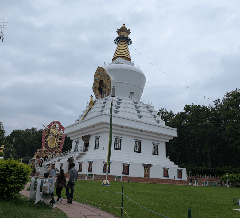
Photo: Ravjyot Kaur
The new ‘development’ not only damaged Dehradun but also diminished its native urban form. This is a major pain point. All these buildings have glass fronts, vertical fins and louvres, resort-like amenities, and housed in a gated complex. They could be in Gurugram, Noida, or Mumbai with some modifications. Dehradun’s local language of architecture was either bungalows with central courtyards, ornate arches, wrap-around verandahs, hand-crafted windows, and high ceilings or the modern maximalist approach of bold colour and multi-level spaces. The buildings blended the outdoors and the indoors, honoured the mountains and the biodiversity they supported.
This is where placelessness matters. Contemporary architecture of the metros has its fans and place, and Dehradun need not be frozen in an urban form of the past. If it aspires to look like a metro city, it could but certainly not at the cost of losing its historical and thoughtful architectural designs that included the canal system, its forests and greens. Contemporary buildings can respond better to the geography and the climate they are built in.
The worry
Dehradun’s proximity to Delhi-NCR brought in business opportunities; the newly-opened Delhi-Dehradun Expressway, which reduces travel time between the cities to approximately 2.5 hours, helped. The city’s transformation is likely to intensify. A city easier to access is attractive to invest in and expect a higher Return on Investment (ROI) from. This is likely to mean more pressure on its natural resources, rising property rates, and conversion of agricultural land to residential use to cater to the new demand. From 2001 to 2025, Dehradun lost 1,789 acres of tree cover; of this, only 133.4 acres was due to forest fires.[4] Environmental groups and residents have not been quiet. Their concerns, expressed through continuing marches and petitions, have repeatedly warned against road expansion and deforestation.[5]
People are the most important aspect of a city; Dehradun’s demographic is no longer native Garhwali. Students have come for higher education. Tourists troop in for the climate. Private sector professionals, government employees, and others come for the second home. The change in Dehradun’s demography is a cause for anxiety because locals who historically inhabited the hills, understood the ecology significance, and evolved a certain urban form no longer have much influence in how the city is being shaped. Their lived experience, the demands of the hills, the centrality of the canals do not seem to matter. Construction has become all about land use maps, GIS coordinates, and design elements imported from other contexts.
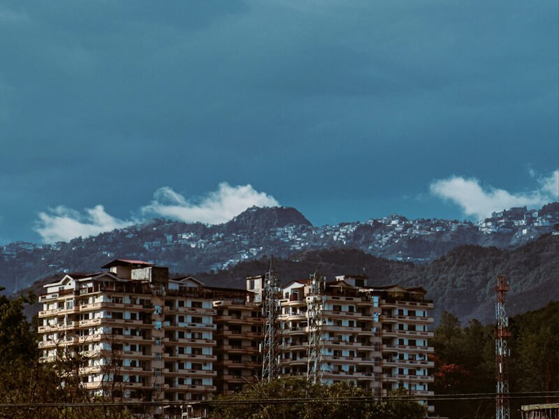
Photo: Unsplash
Losing its heritage
As the population increased and urban form changed to the ‘modern,’ the interest in documenting Dehradun’s architectural and historical uniqueness meant platforms such as ‘Been There Doon That’ made the city accessible to the world. The city’s older landscapes began to be showcased for tourists in curated heritage walks and Buddhist trails. That older layer is not even wholly existing today; it has been erased by the new ‘development’.
Why does this matter? We protect what we recognise, have lived with. The heritage walk that tells where the canals flowed and archival photographs that show the bungalows of Dehradun with their unique architecture are viewed, not lived, by those who came recently. Moreover, the local architectural elements do not find space in the building bye-laws and guidelines, or in conservation and landscape strategies of the city.
The goal need not be to blindly emulate old Himalayan facades or architectural styles or force a one-architecture-fits-all mould. The idea is to insist on context-sensitive design that was always a part of Dehradun’s urban form over the non-contextual stylistic imitations from other cities. It could mean retaining hundreds of mature trees and re-discovering the canals beneath roads. It could mean local involvement and guidance in determining the architectural response to the vagaries of local climate with orientation and shading. It could definitely mean calibrating building heights and setbacks differently from the national codes to suit this city.
The Uttarakhand government’s policy initiatives to standardise visual elements have so far been about shopfronts, colour and typography of shop names, which are largely cosmetic interventions in the urban form. It has done little to address the wholesale import of architectural and design elements. Essentially, the rules must change to enable approval systems to shift from building-specific to neighbourhood-based urban form. Buildings cannot be seen in isolation; only in relation to their context. The older principles of canals can be re-interpreted.
The question is not whether Dehradun can be a developed city. The question is whether its new architecture can speak to the place and honour its hill ecology.
Ravjyot Kaur is an architect, urban designer and published writer with research published in international journals. She holds a Master’s degree in Urban Design from the School of Planning and Architecture, Bhopal, where she was a gold medallist and batch topper. Raised in a small hamlet in the Western Himalayas, her early experiences of living closely with the landscape shaped her interest in the built environment and the ways in which cities and communities evolve. Her work lies at the intersection of architecture, urban design and research, with a particular interest in public spaces, urban form and the lived experience of cities.
Cover Photo: A view of the Dehradun skyline. Credit: Ravjyot Kaur