
Chennai is being remade. Glass towers rise along the Old Mahabalipuram Road corridor, the Marina gets periodic facelifts, and a “world-class city” is being shaped. But this gentrification is not merely economic; it is spatial and caste-based. As the city’s development pushes northward, the Ennore corridor – North Madras – is becoming visible. For long, north Madras was the constitutive outside, kept at a distance from Chennai’s aspirational self-image by the Cooum river and generations of upper-caste spatial ordering. Its neighbourhoods carried their caste histories in their names: Washermanpet, Choolai, Pulianthope.
Development now means a two-stage erasure. First, the Tamil Nadu Slum Clearance Board’s tenement blocks replace organic, community-built neighbourhoods with uniform, vertical, numbered, inward-facing structures. The theru, the shared threshold, and occupation-linked spatial arrangements that marginalised communities evolved over generations, were rendered illegible by a built form designed for surveillance and standardisation – density without community; shelter without belonging. The second stage involves resettling them in distant peripheries like Kannagi Nagar, roughly 25-30 kilometres away, which severs their occupational networks, kinship geographies, and the urban fabric of their livelihoods.
The city is not just rehousing the poor; it is excising them. This essay argues that, in North Madras, gentrification and caste dispossession are not parallel processes — they are the same process, written in concrete. Drawing on time spent here, it reads the built environment of North Madras as a site where caste hierarchy is not merely reflected but actively produced, block by block, resettlement by resettlement. As Chennai builds its world-class future northward, the question is not whether North Madras will change, but who will claim it and in what form.
Age-old challenge of caste-based segregation
Chennai is modernising at an unprecedented pace. Its built form includes glass towers rising along the Old Mahabalipuram Road corridor, periodic facelifts of the Marina, and a skyline that steadily populates. But it does not escape the age-old challenges of caste-based spatial segregation, dispossession, and gentrification – what Dravidian politics has generationally stood against, yet failed to resolve.
Chennai’s urban challenge is obvious across its beachfront. Going north to south, the city’s social fabric and structure reveals itself as the beachfront changes drastically from a militarised-industrial coast to an upscale cosmopolitan boardwalk, and finally to a secluded billionaire’s private paradise.
In the far north, the port area of Ennore is defined by thermal power plants, petrochemical refineries, and bustling fishing harbours like Kasimedu. The shoreline belongs to the Meenavar (fishing) communities; space is organised around fixing nets, parking boats, and drying fish. The beach is their functional asset, lifeline. Down, in central Chennai, is the Marina. It is the great democratic leveller – the seat of political power for stalwarts demised and around, but also belonging to everybody. It allows the city’s otherwise rigid spatial-social hierarchies to temporarily dissolve. It is sustained by informal vendors, most of whom live in nearby Slum Clearance Board houses.
Further south is a sharp cultural shift. The social fabric of Elliot’s Beach is defined by consumerism and upper-middle class lifestyle. Living, or even hanging out, here requires spending power. Beaches are more regulated and closed off, policed by Resident Welfare Associations, and populated by run clubs and pet shows. Further south, along the ECR Corridor, the beachfront becomes more private and closed off. Bordered by the tall walls of homes of celebrities and High Net Worth individuals, the beach stops being the commons.
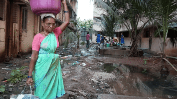
Chennai is no exception to urbanisation in which migrants from rural areas, escaping socio-economic marginalisation and discrimination, end up being squatters – disadvantaged and ostracised. Like other cities, Chennai too failed to account for homes for migrants. The city is now home to an estimated 2 million slum dwellers in around 1,350 slum clusters. But here’s the nub – nearly 1.35 million[1] of them are Dalits.
Historical hangover
The long-standing issue is that Chennai or Madras historically defined which parts of the city belong to whom. Established by the imperialists and cemented by post-colonial decisions, its demarcations remain rigid. It is a surprise to many that Madras was home to one of the earliest officially designated “Black Town” in the British era. Historian Sriram V[2] draws from the Grand Gazetteer of Exeter: “The whole town is divided into two, though some make of them three, towns which is the English or White Town, and the Black city on the north side called by the Moors Madrass or Chinnapattan…where the black water men and fishers live…”
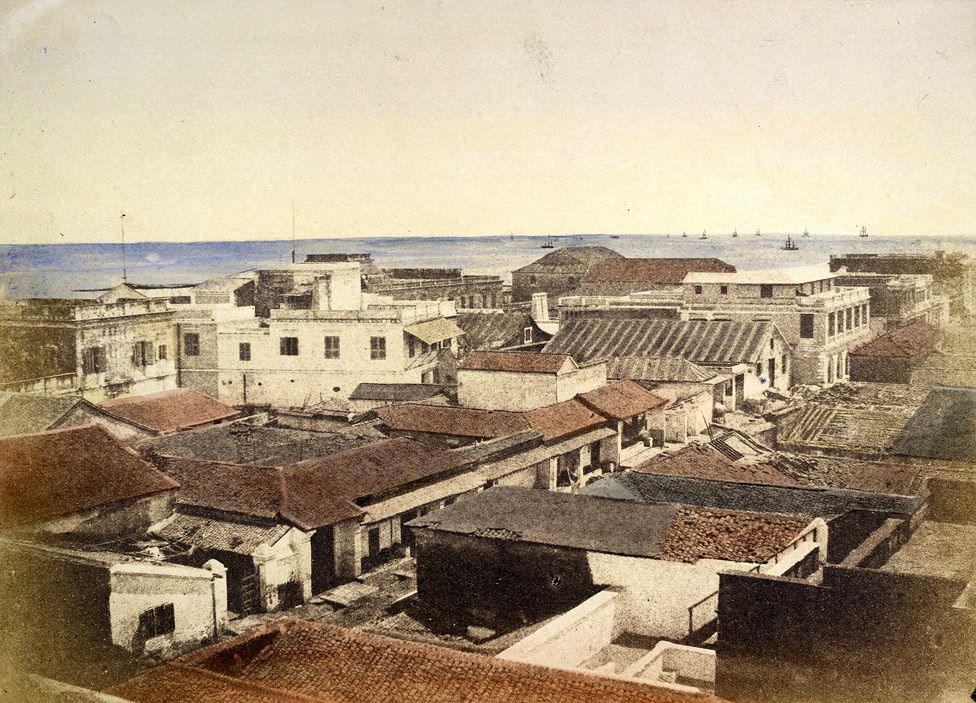
The Old Black town of the 17th century was re-organised into the New Black Town of the 18th century, remnants of which is today’s north-central Chennai. The city’s colonial history has much to do with its spatial caste-based organisation. It is how North Madras came to be, specifically demarcated for the marginalised. All of Madras was spatially constructed this way – artisan and merchant castes surrounded George Town, the weavers – Tamil Sengunda Mudaliyars – to the east, and Telegu-speaking Arya Vaishya Chetties in the west.
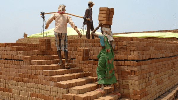
North of Cooum River, in Royapuram, Washermanpet, and Vyasarpadi, was where communities engaged in manual labour, dock work, leather processing – mostly Paraiyars and other Dalit groups – resided. Most localities here still carry caste-based names. Its later development as an industrial hub, with Binny Mills and Perambur Railway Workshop among others, brought intermediate castes too for employment. Slums followed, so did their sub-cultures.
These remain untouched by new urban development. Chennai continues to be organised by caste-class boundaries. Central Chennai, the historical core of affluence, has Brahmins and merchant upper caste elites; southern Chennai represents the upper caste elite with new money; and north Chennai is home to the generationally marginalised. Other parts of the city too have squatter settlements, supplying the informal labour that the elites depend on but north of the city is predominantly the caste-class marginalised.
How built form reproduces the segregation
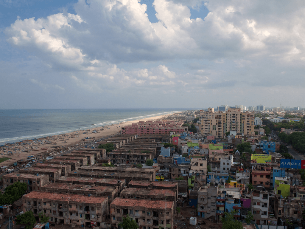
The reproduction of caste happens in a specific way through the tenement blocks of the Tamil Nadu Slum Clearance Board (TNSCB), renamed Tamil Nadu Urban Habitat Development Board (TNUHDB). While Chennai’s skyline from Thiruvanmiyur, through OMR and beyond, is dotted with glass skyscrapers, IT parks, and luxury housing complexes, that of North Chennai has the template Housing Board “colonies” – matchbox flats stacked, cramped, and dilapidated.
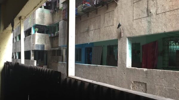
The standard block is a load-bearing masonry structure, a Ground+3 building with the 250 square feet units lined along a central corridor. Each comprises a room, a kitchen, and a bathroom. The ground floor is only the stairwell; no shops or flexible spaces. The building turns its back to the street and faces a compound wall. Windows are small and barred. The corridor and the small open ground are the only spaces that can knit the community.
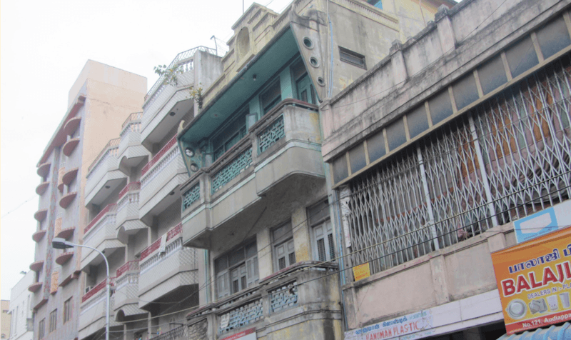
Photo: Wikimedia Commons
This TNUHDB block is unmistakable in Vyasarpadi, Perumbakkam, and Pulianthope. To live in one is to be legible to announce your identity. ‘Colony people,’ Chennai calls them. It’s a tag that sticks, travels with children to schools, and follows aspirants to job interviews. The building does not merely house; it marks an identity. I walked these neighbourhoods, visited the homes of some of my students in Pulianthope, and saw their lived realities.
The block wasn’t always what it is today. The structures of the 1960-70s had a certain logic— G+3 walk-ups, no lifts, concrete jali screens along open corridors to let the sea breeze in, deep chajjas over windows for the monsoon, blocks spaced to leave room for a courtyard for a wedding mandap, a cricket match, a funeral. They were not pretty but designed for Chennai’s heat, density, and community life. What killed this was scale.
As slum-free city ambitions grew, this contextual design was replaced by arithmetic of how many units, how fast built, how cheap. The courtyard became a compound wall; the jali, a barred window; and the ground floor reduced to a stairwell. The size of units shrank too. The Perumbakkam resettlement colony, which the Consumer and Civic Action Group audited in 2014, was planned at nearly double the permissible density – 294 units per hectare against the maximum of 150[3] under the National Building Code.
The legal story is bleak too. The Tamil Nadu Slum Areas Act (1971), which created the TNSCB, mandated in-situ rehabilitation with eviction as the last resort but required slums to be formally notified. However, the TNSCB has not notified a single new slum since 1985[4] leaving the non-notified slum to be termed ‘encroachers’ and relocated anywhere the state pleases. The Board’s motto ironically reads: “We shall see God in the smile of the poor”.
This is how Kannagi Nagar came to be – an entire community placed on the fringes of the city, nearly 30 kilometres from the sea that was their livelihood. Today, it houses nearly 1,18,520 residents across 23,704 tenements,[5] and remains the most discussed resettlement colony in Chennai’s housing discourse. A former researcher-architect at TNUHDB noted what the Board’s records do not show. The fishing communities moved to Kannagi Nagar-Ezhil Nagar complex after the 2004 tsunami but it offered them no connection to the livelihood they knew. Communities survived any which way they could, making the 60-kilometre trip every day to their workplaces in the city. In 2014, HLRN[6] found about 80 percent of the respondents had lost their jobs because of the distance. The stigma attached to Kannagi Nagar as ‘colony people’ was reproduced by resettlement that handed people a key and called it rehabilitation.
Yet, the people built what the state forgot – shops in stairwell corners, repair stalls along compound margins, an informal economy assembled from nothing. The communities are predominantly Dalit, Scheduled Tribe, Most Backward Class (MBC), and Meenavar fisherfolk – whose presence on the city’s waterfronts is inseparable from the caste history that placed them there. The TNUHDB’s official categories record none of this but turns every family into an “urban poor household” or “EWS beneficiary”. Whether it acts on caste or not, the outcome is caste-sorted tenements, caste-sorted peripheries. The built form does not merely house the low-caste urban poor; it spatially defines them.
The lingering discrimination
Would this be different for another community? Consider T. Nagar. In the 1920s, the Justice Party government used the Madras Town Planning Act[7] to reclaim the Long Tank of Mylapore, a 70-acre waterbody,[8] and laid out a planned township partly on its bed. Secular in layout, European in design, commercially self-sufficient, and centred on a public park. In a way, it explicitly broke the Brahmin elite’s spatial monopoly and handed the city’s west to the non-Brahmin merchants.
That land was a waterbody, an objectionable poramboke, the exact classification that the TNSCB later used to evict Dalit communities from canal banks and riverfront settlements. The difference was not the land but who claimed it. For the non-Brahmin elite of the 1920s, reclaiming a waterbody was urban development; for Dalit fisherfolk a century later, it was ‘encroachment.’
In September 2021, the Tamil Nadu Slum Clearance Board was renamed as the Tamil Nadu Urban Habitat Development Board. From ‘clearance’ to ‘habitat development’, on paper, signalled a fundamental shift in the state seeing these not slums to be erased, but habitats to be developed. The renaming, many aver, reflects the aspiration of the Board which involved housing experts, urban designers, NGOs, and architects. The institutional apparatus followed.
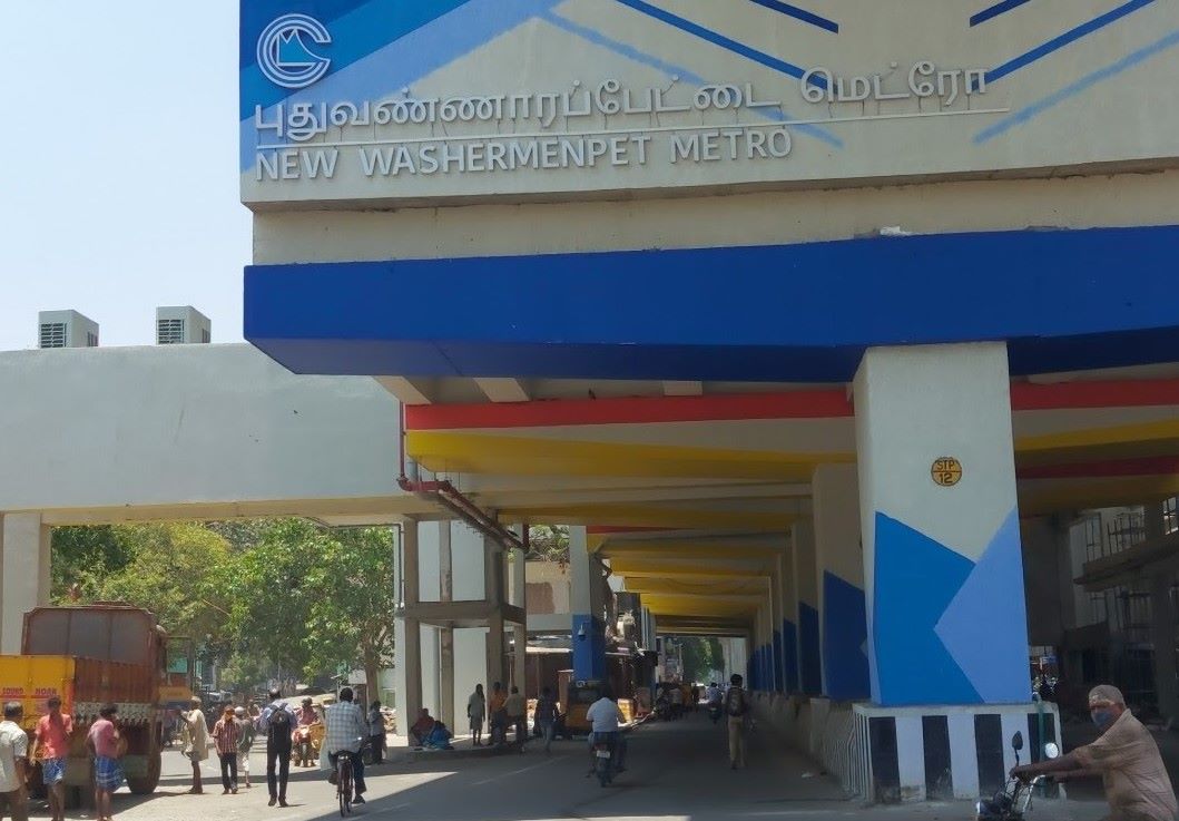
Photo: Wikimedia Commons
Two successive World Bank-funded Tamil Nadu Housing Sector Strengthening Programs, totalling nearly USD390 million, backed housing reforms. The former researcher-architect at TNUHDB noted that the surveys in Kannagi Nagar and Perumbakkam tracked livelihoods, children’s habits, community needs. Yet, legacy issues have gone unanswered.[9] The CAG’s findings on Perumbakkam – nearly double the permissible density, serious violations of building norms – were not addressed. In Kotturpuram, where a tenement was demolished and new homes promised by 2025,[10] the debris is yet to be cleared.
An institution’s name change does not mean the spatial form of 50 years would change too, nor the legal-administrative apparatus that produced it. To begin with, the communities have to be understood; their social structure, spatial logic, and fear must be studied before any design is done. People’s lives and wishes must be prioritised. In North Chennai, planning and built form can look different, especially as the city’s Third Master Plan is being finalised. The questions of who will be allowed to inhabit spaces and in what built form are still, technically, open. If history is any indication, then Chennai has known how to build, but never acknowledged who to build for.
Aishwarya Murugananthan is an urban researcher drawn to the sociology of cities: who a space is designed for, who can reach it, and who is left out. She began as a Teach For India Fellow in North Madras, where she learned to read a neighbourhood through its lanes and thresholds, and went on to pursue a Master’s in Development Studies at the Tata Institute of Social Sciences. At the Centre for Public Policy Research she researched SDGs 11 for liveable cities, urban housing and policy, and has also worked with WRI India and ORF. She is fascinated by how a city’s form, its morphology, shapes who gets equal access to it, and her passion for marginalised rights and representation continues to drive her work.
Cover photo: A housing board complex along Chennai’s northern beachfront, 2014.
Credit: Vinoth Chandar/Flickr