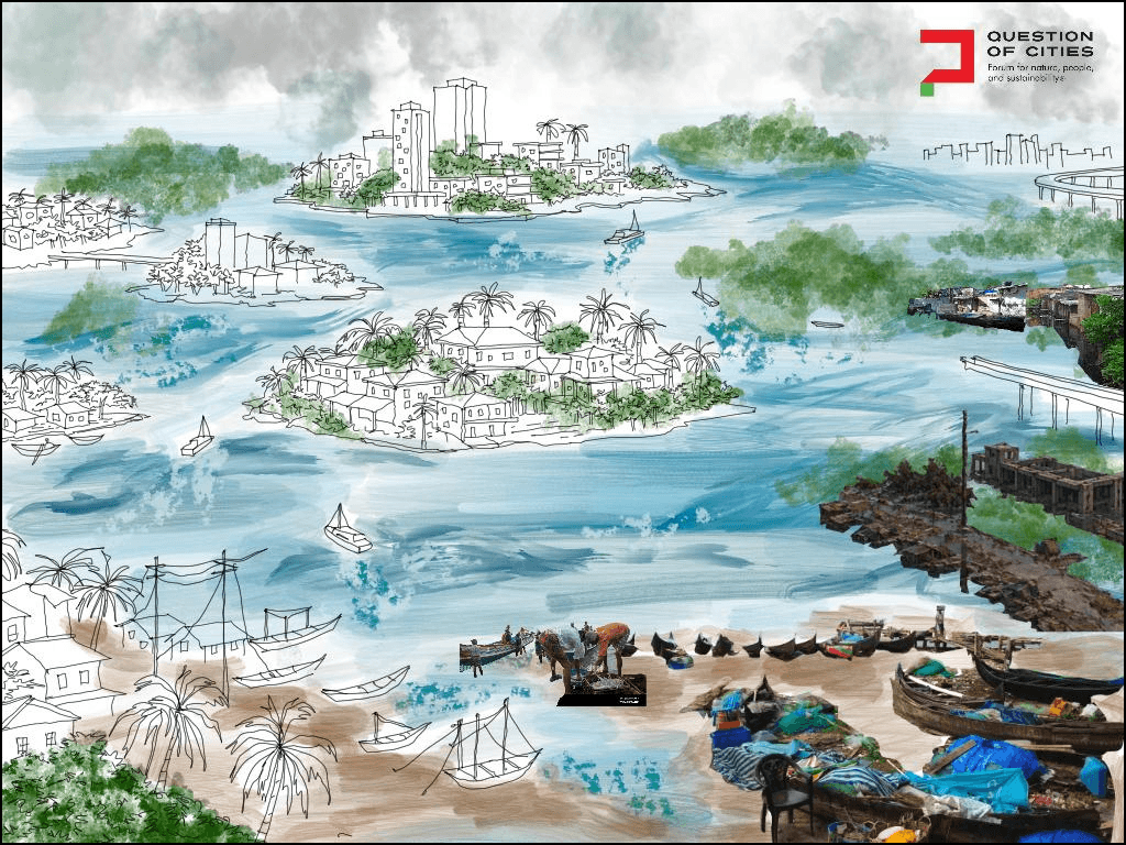

Kochi emerged from a flood; it was born in water. Its natural harbour and the surrounding network of backwater were created when the Periyar River flooded in 1341, destroying the ancient port of Muziris and carving a new deep-water channel into the Arabian Sea. As Ashish Nandy put it, Cranganore/Muziris had to die for Kochi to be born. The city’s origin is inseparable from ecological catastrophe and the consequent sedimentation resettlement. For nearly seven centuries, the network of beaches, tidal inlets, rivers, canals, backwaters, marshes, and streams defined life here. To live in Kochi was to live amphibiously, in rhythmic co-existence with water.
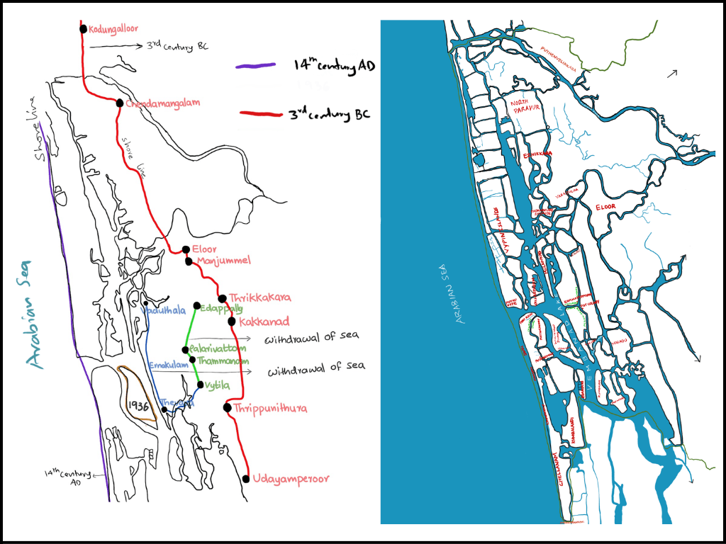
Drawings: Author
Now, the water returns, not as a catastrophic flood but as persistent accelerating inundation, the coastline is vanishing at 0.158 centimetres per year, and the sea level is projected to rise 20-30 centimetres by 2050. The city that water made, is being unmade by water. The acceleration is here. Between 2011 and 2022, the sea exceeded 1.5 metres in 11 days; it did so twice in 2023, 10 times in 2024, 23 times in 2025, and 15 times in January 2025 alone. For the first time in 2025, the slack tide held for roughly two hours (Nambudiri, 2024; IPCC, 2021; M. R., 2025)
But the unmaking is uneven. It follows the fractured violences of caste, class, and feudal-colonial spatial logic that have long determined who lives where. As Kochi gets absorbed into the rhetoric of development and global circuits of speculative finance capital, its watery foundations have been seen as extractable for profit or obstacles to be drained and paved over. This has produced an archipelagic urbanism: Islands of wealth and comfort amid scattered zones of ecological exposure and infrastructural neglect.
It is from these edges – stenching canals, sinking colonies, vanishing coastlines, and flood-prone wetlands – that this essay builds the argument for an amphibious turn. This requires a re-orientation of urban design and governance, away from the rigidity of dry-land engineering towards a fluid and relational framework, which embeds the entwined geographies of the Indian Ocean and the Western Ghats.
Chellanam: In the gap between sea and land
Chellanam, a coastal fishing suburb, is located about 20 kilometers south of Kochi. In the early 20th century, Chellanam’s shoreline lay 2.5 kilometres from residential areas; today, the sea stands at the doorstep. Decades of dredging by the Cochin Port Authority—deepening the harbour from 3–5 metres in 1924 to 14.5 metres now—combined with the construction of Chellanam Harbour, and the accelerating climate change, have brought the sea almost 2.5 kilometres inland. It has eroded the beaches and reduced the 25-kilometre coastal stretch from Fort Kochi to Andhakaranazhi to a narrow strip of dilapidated seawalls and sandbag groynes, in places less than a metre from homes (Nair et al., 2018; Ramakrishnan et al., 2022).
A Rs 344-crore tetrapod project, begun in June 2022, covers only 10 kilometres of this coastline; only its first phase was completed in 2025. A 2021 interim report found that intensified monsoon wave activity has weakened the existing seawalls. Thirteen traditional pozhis—tidal inlets that once balanced pressure between sea and backwaters—have largely been filled or neglected, removing an existing buffer.
Meanwhile, residents are suspicious of the state’s intentions. The central government’s Sagarmala Project envisions large-scale coastal development including a Special Economic Zone on Willingdon Island, and the “Punargeham” rehabilitation scheme. The latter offered Rs 10 lakh to relocate. But it invokes memories of Mararikulam where, as Chellanam Kochi Jankeeya Veedhi (CKJV) documented, families who accepted similar sums were replaced by large resorts. Between an encroaching sea, inadequate protection, and the spectre of displacement-as-dispossession, Chellanam’s residents live in the gap between sea and land.
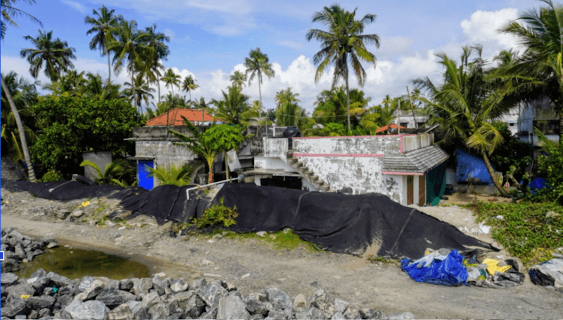
Photo: Author
Edakochi, Kumbalangi, Puthenvelikkara: The tidal interior
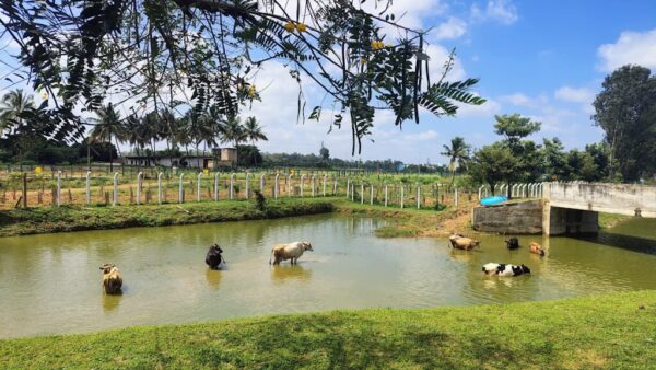
Chellanam faces the open sea. But the wetland settlements of Edakochi, Kumbalangi, Puthenvelikkara, Ezhikkara, and parts of Vypin confront a relentless crisis: Tidal flooding. In Puthenvelikkara, 300–400 homes flood nearly every day; in Kumbalangi, twice daily. It does not grab national headlines.
The scale is accelerating with the rising sea levels. Flood water sweeps garbage into homes. Saltwater corrodes not only wiring but also crumbles walls, destroys furniture, causes skin conditions, and compounds the financial precarity of vulnerable communities. It also exposes systemic failures. CRZ regulations deny tidal-flood victims access to housing schemes, trapping them in unlivable homes; compensation remains inadequate.
However, resistance is emerging. It is backed by the non-profit Equinoct, women affiliated with Kudumbashree[1], ASHA and MGNREGA in Kumbalangi, Ezhikkara, and Puthenvelikkara. They are measuring and mapping tidal floods, and transforming data collection into an environmental justice movement (Abraham, 2023; Padmanaban, 2023; M. R., 2025). Better CRZ boundaries are urgently needed (M. R., 2025). The declaration of tidal flooding as “state-specific disaster” is a significant step, but what’s next?
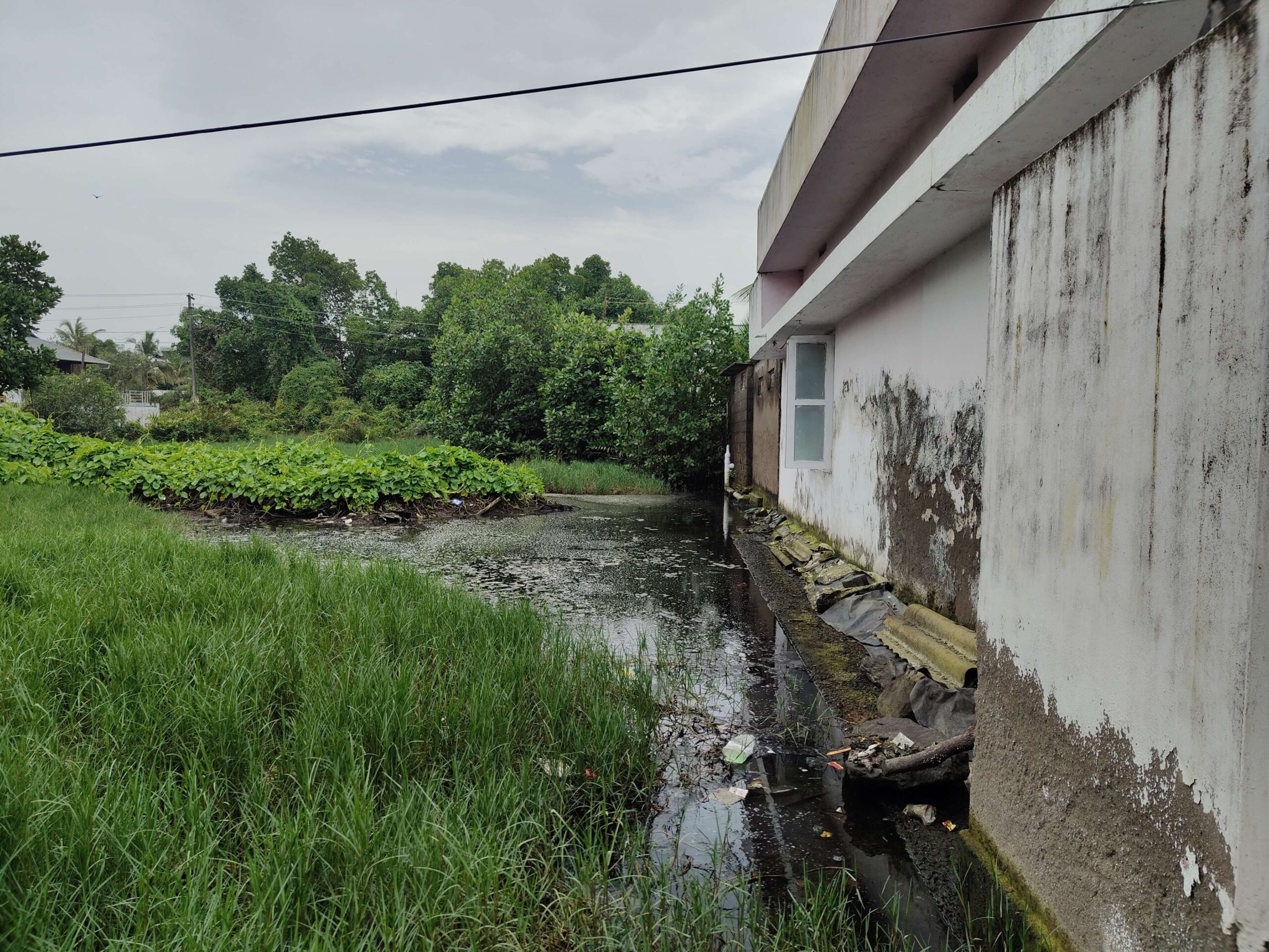
Photo: Author
Kammattipadam: the rail-locked pit
Nestled behind the Kerala State Road Transport Corporation stand and encircled by affluent neighbourhoods, Kammattipadam—named for the kammatti grass that once grew around its now concrete-filled paddy fields—is a triangular pit. Hemmed in by rail lines, it is home to 45 families, predominantly Dalits with some Christian and Tamil migrants. The once-fertile farmland, sustained by the Perandoor canal, was transformed when urban planning destroyed the existing drainage, while the Kottayam–Ernakulam railway line severed the landscape and trapped tidal and rainwater (Express News Service, 2016).
Residents say that every year the railway increases its height and they sink lower. The canal, once 13 metres wide, has narrowed to three metres, reduced to a stagnant, polluted ditch. The Dalits of Kammattipadam, lacking political leverage and social capital, are unable to force the attention of authorities.
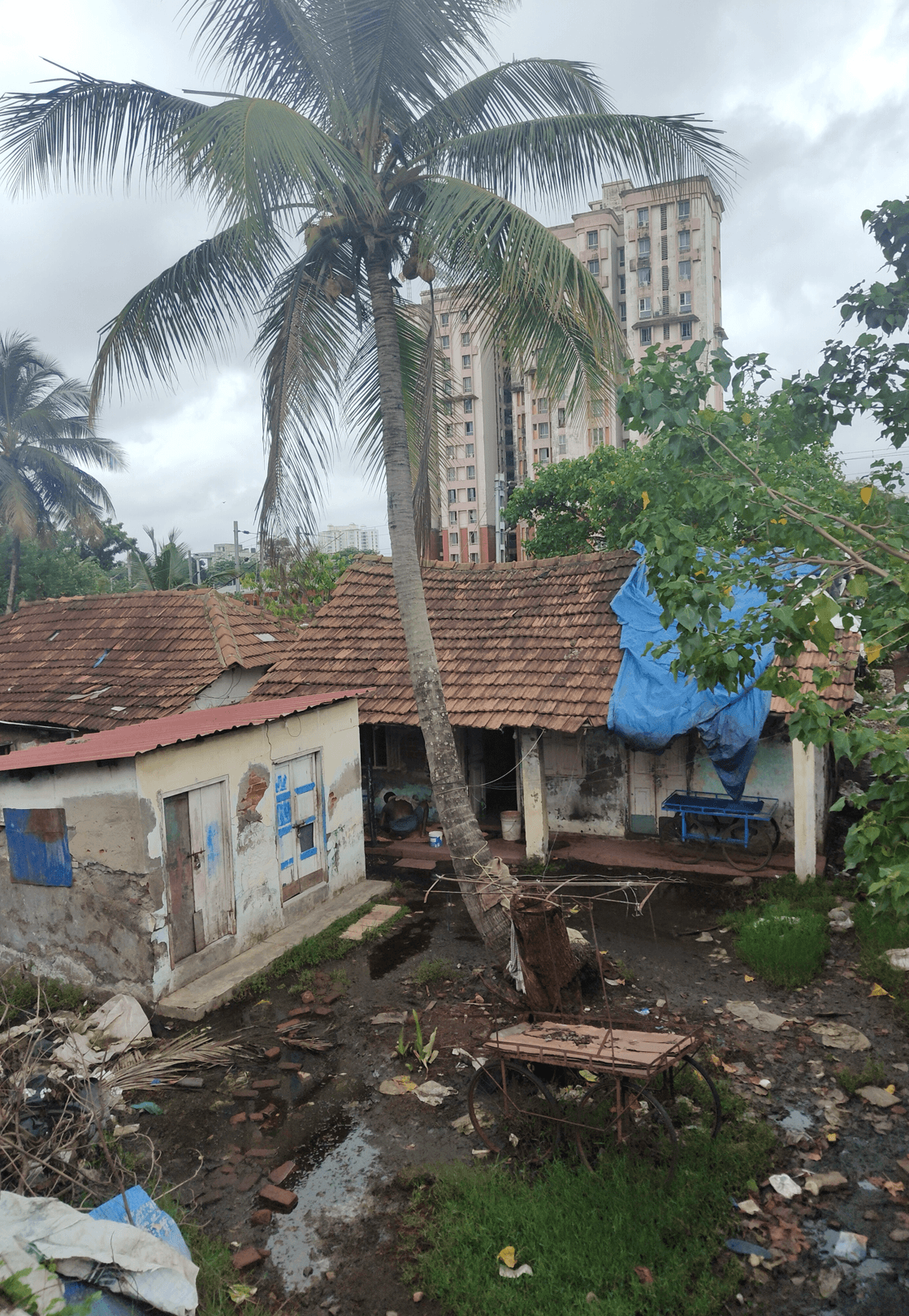
Photo: Author
P&T Colony: Rehabilitation as new dispossession
Life in the P&T colony—a Poramboke-land settlement of 80 Dalit, Ezhava, and other lower-class families along the Perandoor canal—was defined by floods and the canal’s stench. Their January 2024 rehabilitation was meant to end the indignity, but delivered a mobility problem, leaking roofs, cracked walls, rusting frames, poor structural stability, and a multi-storey building without a lift. Instead of water rising in the canal, it now drips from ceilings. The report of the IIT-Madras structural study, commissioned under pressure, remains unpublished stalling work on drainage, compound wall, overhead roofing. Residents continue to protest.
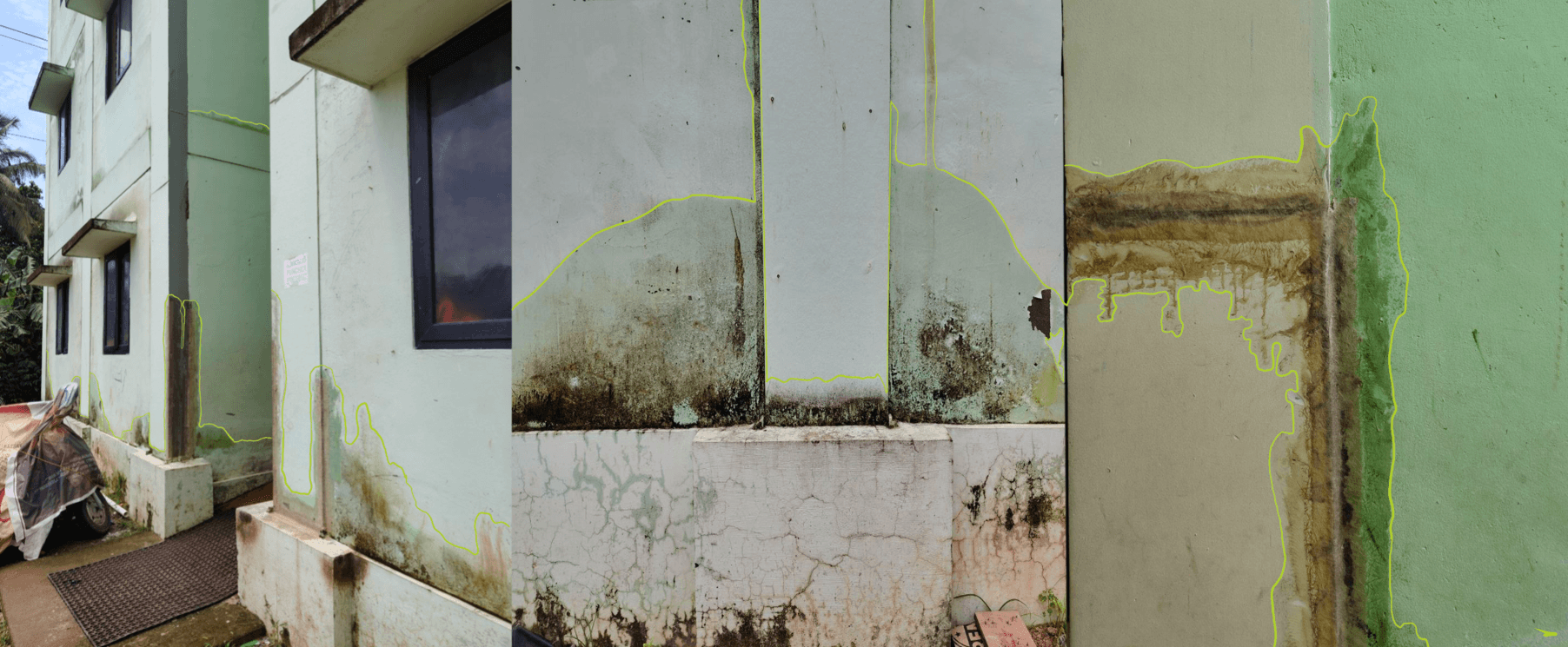
Photo: Author
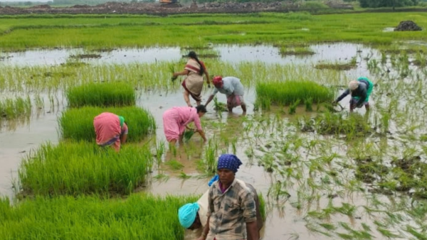
The city’s marginalised—the fisherfolk, domestic workers, Dalits, OBCs, wetland farmers, informal labourers, migrant workers—inhabit the brutal confluence where historical caste-class-geographies, contemporary capital flows, and accelerating ecological breakdown collide. The working class commute daily to commercial hubs of Ernakulam, Edappally, Vyttila and Kakkanad and sustain Kochi’s development, but reside in the vulnerable edges that are worst affected by climate change and urbanisation.
Moving beyond binaries like nature versus humanity or climate change versus urbanisation is essential to grasp the entangled margins of caste, race, class, religion, gender, region, citizenship on this canvas of climate change and urbanisation. It manifests as a tripartite marginality of social dispossession, spatial confinement to hazardous edges, and the relentless sensory violence of polluted water, incessant flood, and noise. The lens of tripartite marginality demands that these phenomenological experiences influence urban design at a fundamental level.
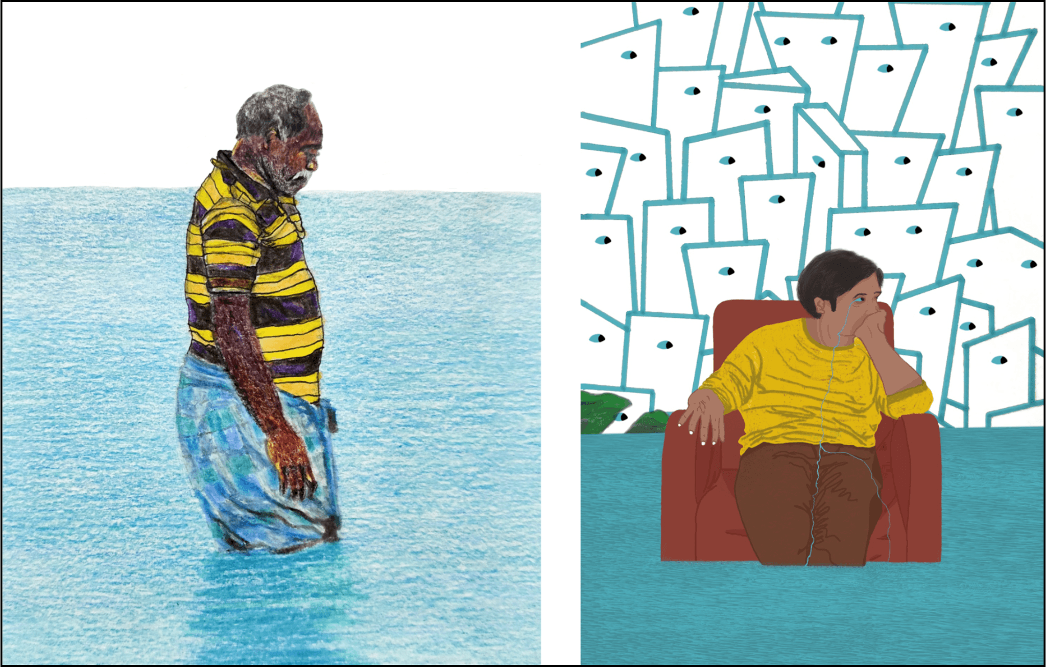
race, gender, religion, region and citizenship.
Illustration: Author
How history collides with the present
Fort Kochi and Mattacherry were the historical spatial core where modern urbanisation in Kerala originated. Kochi was shaped as a port city; its spatial organisation was governed by tides, monsoons, shipping, mercantile exchange, and colonialists. Fort Kochi functioned as a colonial administrative enclave and Mattancherry as a dense mercantile, working-class zone with godowns, narrow streets, mixed-use buildings.
This urbanisation process was discriminatory, producing a fragmented city in which the under-privileged castes and working class Muslims were largely confined to ghettoised labour colonies around the Calvathy canal; colonialists, mercantile elites, and the privileged castes lived in insulated enclaves. In the late 20th and early 21st centuries, Fort Kochi and Mattancherry were reimagined as sites of heritage and tourism. Colonial buildings were re-coded as aesthetic assets; tourism, boutique hotels, cafes, and art events were converted into consumable experiences. Fort Kochi saw heritage preservation and tourism-related investment while Mattancherry awaited slum redevelopment plans. The colonial spatial division was reproduced in a contemporary form.
The post-independence decades of state-led planning, industrialisation, and welfare governance informed the development of mainland Kochi-Ernakulam; nearby Eloor and Kalamassery became Kochi’s industrial hinterland, absorbing its ecological and labour costs. The Greater Cochin Development Authority (GCDA) rationalised urban growth through zoning and road networks; MG Road materialised the promise of a commercial city. In Mattancherry, informal settlements were redeveloped into planned colonies but with problems such as inadequate title deeds, lack of maintenance, and poor drainage. The built environment embedded the logic of stratification through LIG, MIG and HIG colonies – inherently unequal living environments. Today, as finance and private capital determine development, LIG residents cope with recurrent floods, contaminated water, and poor ventilation; the other two strata areas have been converted into boutiques, cafes and offices.
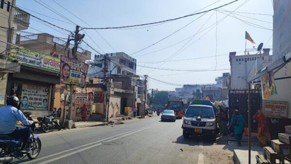
The eastward shift toward Kakkanad marks a fundamental re-organisation of spatial and political-economic logic. Inseparable from economic liberalisation of the 1990s, state-led courting of IT and logistics industries and the transformation of land into a financial instrument, Kakkanad is shaped primarily by speculation, financialisation, and anticipatory value. Infopark, SmartCity, gated complexes, malls, and SEZs function as insulated islands, surrounded by vacant plots, half-built towers, and unoccupied NRI flats suspended in speculative vacancy. Alongside these enclaves, makeshift labour housing, roadside kanji kadas, and 24-hour eateries serve informal workers whose labour sustains the speculative city. What appears informal is structurally necessary. The dominant binary here is not citizen-worker but consumer-investor; the dispossession of the working class is systematically produced by a nexus of lenders, bureaucrats, builders, lawyers and brokers.
So, Kochi produces an archipelagic urbanism in which climate vulnerability, infrastructural neglect, social hierarchies, and unregulated speculative urbanisation intersect. A dispersed constellation of enclaves—heritage and tourism zones, naval territories, port infrastructures, industrial zones, IT corridors, slums and colonies, caste-insulated neighbourhoods—all separated by wealth, water, and infrastructural gaps. The archipelago is not only geographic, it is equally spatial, structural, social, economic, political, and increasingly ecological.
Towards an amphibious turn
Kochi’s crisis is distinctive but not isolated. Across South Asian cities, urbanisation has produced unequal ecologies of inhabitation but Kochi’s margins are uniquely dispersed across coast, canals, islands, wetlands, and transport nodes. These are characterised by hybrid rhythms of tidal cycles, seasonal labour, partial infrastructure, and intermittent governance. Improved policies are necessary but it is more important that urban imagination is re-oriented to confront the structural problems produced by development.
An amphibious turn is one such change. People’s Right to the City should be articulated and emphasised. A rights-led unified coalition should demand climate-resilient housing, dignified public transport, and the formal recognition of wetlands and mangroves as critical urban infrastructure. Permanent councils of people of ecologically vulnerable areas, fishermen, and floating laborers should be included in planning bodies. Above all, the urban and climate crises should be reframed as a socio-political question grounded in redistribution, public ownership, and democratic planning.
For a city that emerged in the aftermath of the Periyar flood of the 14th century, Kochi’s future depends on how the intertwined geographies of the Indian Ocean and the Western Ghats—connected through rivers, lakes, canals, and streams—are collectively perceived, imagined, governed, and cared for. Recognising the city’s amphibious condition may be the first step toward envisioning more just and ecologically attuned urban futures.
References:
- Nandy, A. (2000). Time travel to a possible self: Searching for the alternative cosmopolitanism of Cochin. Japanese Journal of Political Science, 1(2), 295–327.
- Nambudiri, Sudha. (2024, August 7). Rising sea threatens major urban spots in Kochi by 2040. . The Times of India.
- M. R., Arathy. (2025, June 20). Mapping tidal floods: How women in coastal Kochi villages are building climate resilience. BehanBox.
- Intergovernmental Panel on Climate Change (IPCC). (2021). Sixth assessment report (AR6): The physical science basis. Cambridge University Press.
- Nair, L. S., Prasad, R., Rafeeque, M. K., & Prakash, T. N. (2018). Coastal morphology and long‑term shoreline changes along the southwest coast of India. Journal of the Geological Society of India, 92, 588–595.
- Ramakrishnan, R., Remya, P. G., Mandal, A., et al. (2022). Wave induced coastal flooding along the southwest coast of India during tropical cyclone Tauktae. Scientific Reports, 12, 19966.
- Kerala University of Fisheries and Ocean Studies (KUFOS). (2021). Restoration of Chellanam Panchayath: Interim report submitted to the Hon’ble Minister for Fisheries, Culture and Youth Affairs, Government of Kerala.
- Abraham, R. (2023, August 11). Kochi, caught between the Periyar, surging sea and tidal floods. Question of Cities.
- Padmanaban, D. (2023, November 22). Homes flooded twice monthly & lives disrupted in Kerala, as rising seas provide a foretaste of what’s coming. (2023, November 22). Article 14.
- Express News Service. (2016, May 30). Kammattipadam: Saga of a lost era. The New Indian Express.
Indirect References:
- Bristow, R. (1959). Cochin saga: A history of foreign government and business adventures in Kerala, South India, by Arabs, Romans, Venetians, Dutch and British together with the personal narrative of the last adventurer and an epilogue. London: Cassell & Company.
- Christy K J, C. (2024). Women protestors from the islands in Kochi: environmental justice in South Asia. City, 28(1–2), 280–292.
- Day, F. (1863). The land of the Permauls, or Cochin: Its past and its present. Gantz Brothers, Adelphi Press.
- Devika, J. (2016). Cochin Creole and the perils of casteist cosmopolitanism: Reading Requiem for the Living. The Journal of Commonwealth Literature, 51(1), 127–144.
- Express News Service. (2020, December 3). Awaiting a RAY in their lives. The New Indian Express.
- Fels, P. (2006). Setting straight the priorities: A conservation report from Kerala. Places, 18(3).
- Goswami, B., Kumar, N. A., & George, K. K. (2015). Patterns of commuting for work: A case study of Kochi city(RULSG Occasional Paper No. 2015:5). Centre for Development Studies, Research Unit on Local Self Governments.
- Goswami, S. (2025, December 12). Working-class priorities as the principle for climate action. Alternative Viewpoint.
- Government of Kerala, Local Self Government Department (Planning). (2024). Master plan for Kochi Municipal Corporation area–2040: Volume I—Study and analysis. Government of Kerala.
- Government of Kerala, Local Self Government Department (Planning). (2024). Master plan for Kochi Municipal Corporation area–2040: Volume II—Proposals & Development Control Regulations. Government of Kerala.
- Greater Cochin Development Authority, Kochi Municipal Corporation, & German Agency for International Cooperation (GIZ). (2011). City sanitation plan for Kochi.
- Hashir, K. (Director). (2013). A journey through filmic ghettos of Mattancherry [Film documentary]. India.
- Indu, P. (2023). Exploring the right to the city: An enquiry into the social production of Kochi in select Malayalam films (Doctoral dissertation, Mahatma Gandhi University, Kottayam).
- Kishore, A. (2025). Archipelago of margins: Caste, class, climate change and the urbanisation of Kochi. Fourteen Magazine.
- Malekandathil, P. (2020). Maritime histories, Indian Ocean and port-towns: Changing dynamics of urban spaces in pre-modern India. Atna Journal of Tourism Studies, 15(2), 115–147.
(Numerous news reports and other articles/papers are also there)
Abhinand Kishore is an interdisciplinary researcher, artist, and social practitioner based in Kerala, committed to integrating academic rigour, artistic expression, and community-and ecology-oriented practice into everyday life. He holds a PhD in Political Science from MG University, Kottayam, where his research focused on Kochi’s housing inequity, regimes of dispossession, and socio-ecology through political, narrative, and visual ethnography. He holds an M.A. in International Relations and Political Science, and a B.Tech in Electronics and Communication Engineering. He has worked with Anannia, an NGO serving LGBTQ+ communities and marginalised children, and as a Project Executive at the Centre for Management Development, Kerala. His visual essays, paintings, and research have featured in publications, exhibitions and academic conferences, alongside his collaborations with public policy initiatives.
Cover Illustration: Nikeita Saraf