Lush green mangroves, an ecology at the creeks, hills and hillocks, verdant forest rich with flora and fauna, and an enviable coastline along the Arabian Sea — these are what India’s financial capital Mumbai boasts of as its natural wealth, hidden in plain sight. Our sight usually fixes on the completed and under-construction skyscrapers, bridges built over water, the Coastal Road, traffic-clogged highways, and over-crowded public transport. How many of us are aware that the elusive civet cats live in the Aarey forest, that the golden jackal inhabits the city’s mangroves, and the glowing zoanthids on the coast present themselves only for a few days when the tide is really low? The natural wealth is around but we rarely, if ever, see it with the wonder and reverence it requires.
Mumbai, built after landfilling seven islands that between them had rising hills, thick forests, watercourses with rivers and streams running along, has seen much of the natural ecological wealth erased to accommodate the bludgeoning growth of buildings and infrastructure.[1] When it could not be expanded anymore, the new city of Navi Mumbai was built to reduce the burden on Mumbai which too is a rich ecological tapestry.[2]
The choice is not between construction or ecology, development or environment, but an ecological-sound framework of development. Nature extends across the Mumbai Metropolitan Region (MMR); the boundaries are essentially administrative. The MMR, with a population of 24 million[3], comprises the city of Mumbai and its satellite cities of Navi Mumbai, Thane, Kalyan-Dombivli, Mira-Bhayandar, Vasai-Virar, Ulhasnagar, Bhiwandi-Nizampur, and Panvel. With nine municipal corporations and nine municipal councils – in Ambarnath, Kulgaon-Badlapur, Matheran, Karjat, Khopoli, Pen, Uran, Alibaug and Palghar – the MMR is one of the more challenging regions for ecological governance.
Beyond this materiality lies its bewildering array of flora and fauna, unique to a place in the larger MMR but also evocative of the region itself. In the larger cities of Mumbai and Navi Mumbai, this natural ecological wealth has not been all registered or deliberately nurtured and protected. The initiatives have come largely from people and NGOs to protect it – such as Vanashakti in Mumbai agitating for forests and mangroves and the wetlands activists in Navi Mumbai – or to push the government directly or through the courts to prevent it from being erased for construction activities.
Construction has taken over the cities. Mumbai lost 40 percent of its green cover between 1991 and 2018.[4] Mumbai lost 71 percent of its wetlands between 1970 and 2014, from 4.58 to 1.3 square kilometres, found a study by Wetlands International South Asia (WISA). In Uran, in 2018, the state government hacked 4,500 mangrove trees and another 4.5 hectares were choked by blocking seawater for the construction of a bridge linking the Jawaharlal Nehru Port Trust.[5]
The skylines in these cities have been dotted, especially after the pandemic, with building cranes rather than birds soaring high. As plans are afoot to open the salt pan lands for construction of houses for slum dwellers from Dharavi, to mention one possible assault on natural wealth, we went around the region to capture some of the less-seen or unseen sights and views.
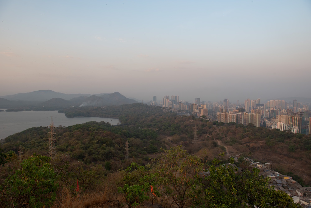
This is the concrete Mumbai as seen from the perspective of the Vihar Lake (left) and the rolling hills of the Sanjay Gandhi National Park (SGNP) in the foreground, through the lens of photographer Aniket Gawade. The concrete buildings are located in the suburb of Mulund, a bustling one with high commerce and expensive apartments, but all of it pales when seen this way. Shot from the IIT-Bombay campus, this frame conveys Mumbai and non-Mumbai at once.
Under the pristine forest of the SGNP, the road connecting western and eastern parts of the city, the 6.5 kilometre Goregaon-Mulund Link Road, has been planned and has received most of the clearances. How the construction here will impact the green swathe, the mind-boggling variety of wildlife species that it nurtures, and the Adivasis who still live in the forest is anybody’s guess. These issues may have arisen for a city otherwise fixated on adding that road to its Google Map if only people could truly see the landscape.
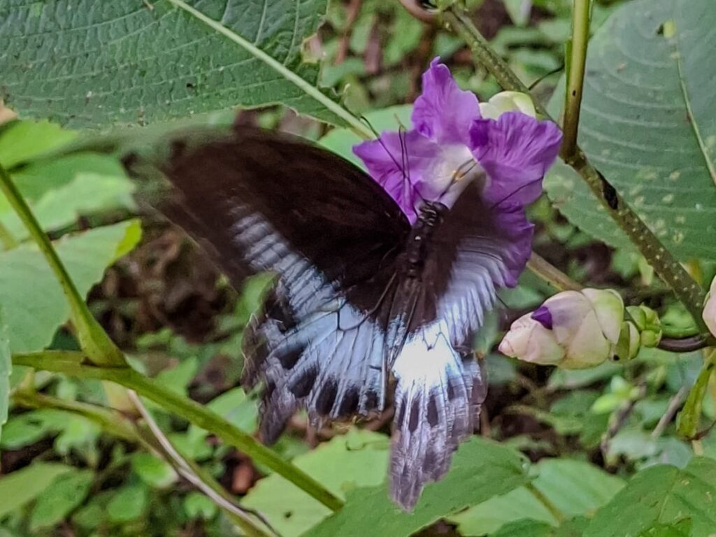
This is the Blue Mormon butterfly, the state butterfly of Maharashtra and one of the five largest butterfly species in India. The photo taken by Navjot Singh in Aarey forest shows the butterfly perched on a Karvi flower, which blooms once in eight years and is the host plant to five species of butterflies – Dakhan Spotted Flat, Dusky Spotted Flat, Common Spotted Flat, Chocolate Pansy, and the Sahyadri Blue Oak Leaf.
The study ‘Biodiversity of Aarey Milk Colony and Film City’ by researchers Zeeshan Mirza and Rajesh Sanap in 2007-2009 confirmed that the Aarey Colony is home to at least 76 species of birds, 86 species of butterflies, 46 species of reptiles, 13 species of amphibians, 34 species of wild flowers, 16 species of mammals, five species of scorpions and several species of spiders. Considered to be a green lung of Mumbai, the Aarey, or a large part of it not designated as forest, is being eyed as a potential development. The metro carshed is probably only the start of de-greening of Aarey.
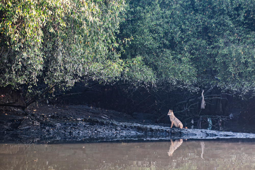
Photographer Aniket Gawade could not believe his eyes or his camera lens when this Golden Jackal appeared in its view late last year. Basking along the Thane creek, near the dense mangroves at Bhandup pumping station, seeing it barely a few kilometres away from the concrete jungle was a treat for Gawade and his band of nature lovers.
The occasional deer and many leopards have been spotted in the Sanjay Gandhi National Park (SGNP) and parts of Aarey, but the lesser-known Golden Jackal has eluded nature-watchers. The presence of this shy animal in the region was documented since the early 20th century but rapid urban expansion has restricted it to the mangroves of Thane creek. What threatens the mangroves? Irresponsible dumping of garbage and plastic waste, of course.
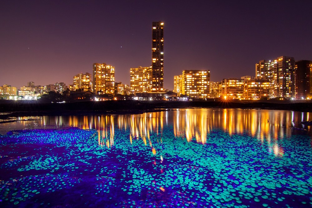
This ethereal image, a real one and not AI-generated, of zoanthids was shot by photographer and conservationist Sarang Naik at Malabar Hill in south Mumbai. It’s a colony of green button polyps (Palythoa mutuki), also called zoanthids, glowing under an ultraviolet flashlight against the backdrop of Mumbai’s skyline. Zoanthids are an order of cnidarians, similar to corals, and commonly found in coral reefs and seen on Mumbai’s rocky shores during low tide. While shooting a zoanthid colony, Naik and other conservationists realised that they glow brilliantly under UV light.
This long exposure shot brings together two sides of the city of Mumbai – the gleaming neon-lit and bustling metropolis and the marine wildlife that lies hidden on the other side, literally hidden in plain sight. Mumbai’s marine life is under constant threat as the sea continues to be land-filled, or ‘reclaimed’ to build more. Seeing this nature should make us reflect: What gets destroyed when the authorities plan to ‘reclaim’ and when did the sea and its treasures belong to us humans that we now ‘reclaim’ them?
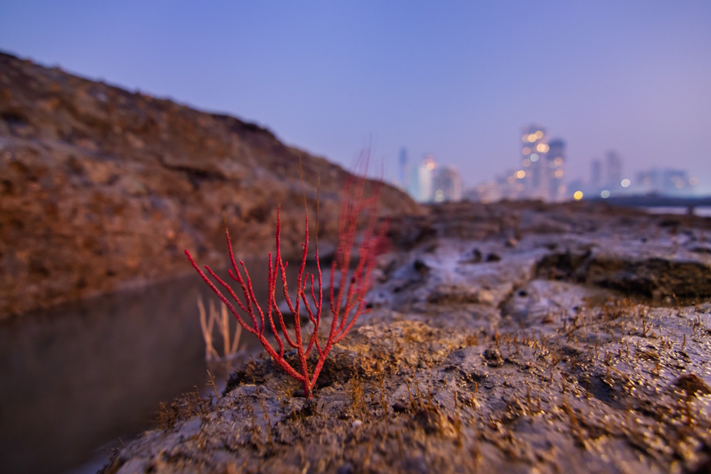
This stunning shot, also by photographer Sarang Naik, shows an Indian Sea Plume coral (Pseudopterogorgia fredericki) exposed during a low tide in the spring season at the Mahalaxmi rocky shore in Mumbai. Did you know that as many as eleven species of corals have been identified at intertidal zones and rocky shores along the Mumbai coast?
During the COVID lockdown, when parts of the sea hugging the shore were land-filled for the Coastal Road project, many coral colonies got demolished. A few were saved, by sheer accident perhaps and not because the road builders were concerned about protecting them. This photo was shot in the fading evening light, framing the sea with Mumbai’s buildings in the background showing the resilience of such natural habitats in the face of construction.
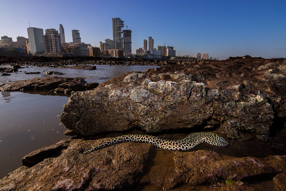
This is a close-up shot of the Honeycomb Moray eel (Gymnothorax favagineus) stuck on a rock during low tide on a rocky shore in Mumbai that photographer and conservationist Sarang Naik caught in his lens. After shooting a few frames, a marine biologist who was with him, safely released this eel in the tidepool.
This was in March 2020, a few days before the nationwide Covid-19 lockdown, which was the last time that the Mumbai shore at Worli was visible. It is also the last time this shore looked untouched. The state government and the Brihanmumbai Municipal Corporation began to landfill the shore soon after for the controversial Coastal Road Project. By the end of November that year, the upper and middle intertidal area was completely ‘reclaimed’.
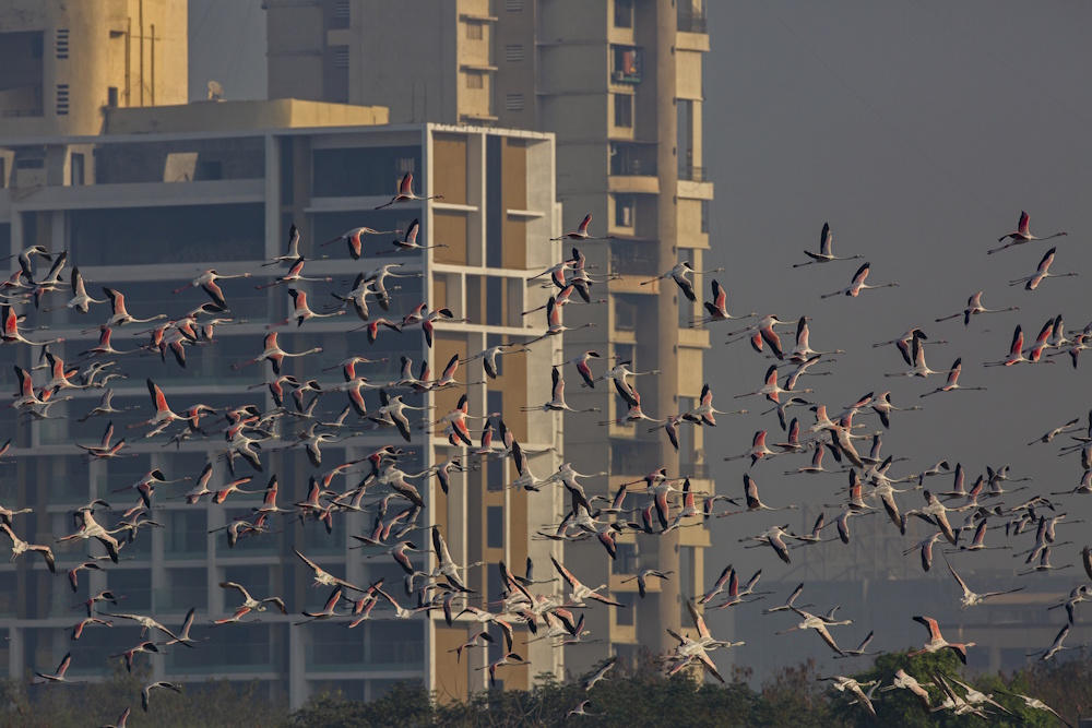
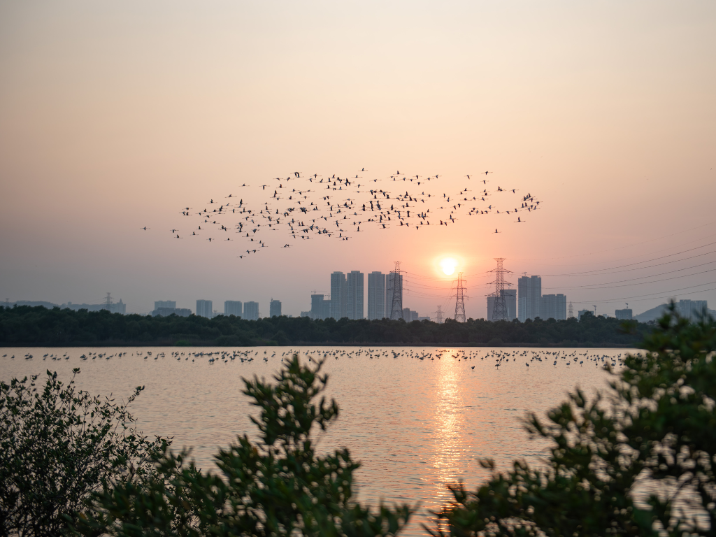
The annual visit of the flamingos to the wetlands of Mumbai and Navi Mumbai is a much-awaited event for nature lovers. This unusual photograph by Aishwarya Sridhar captures a flamboyance of flamingos against a typical city highrise. The recently introduced mangrove safari takes people close to these birds. In 2015, Mumbai got its first flamingo sanctuary as a trade-off for the Mumbai Trans-Harbour Link (MTHL) or Atal Setu which occupies mudflats in Sewri in Mumbai and Nhava in Navi Mumbai. The sanctuary spans across 896 hectares of mangroves and 794 hectares of a water body.[6]
However, the region has more than flamingos. The unique and perennial ecosystems here predate the constructed city. A biodiversity map of the MMR by artist Rohan Chakravarty, released in 2022, illustrates 17 species of flora and 78 species of fauna, and also highlights the interdependence of the indigenous Kolis and tribal Warlis on the local biodiversity.[7]
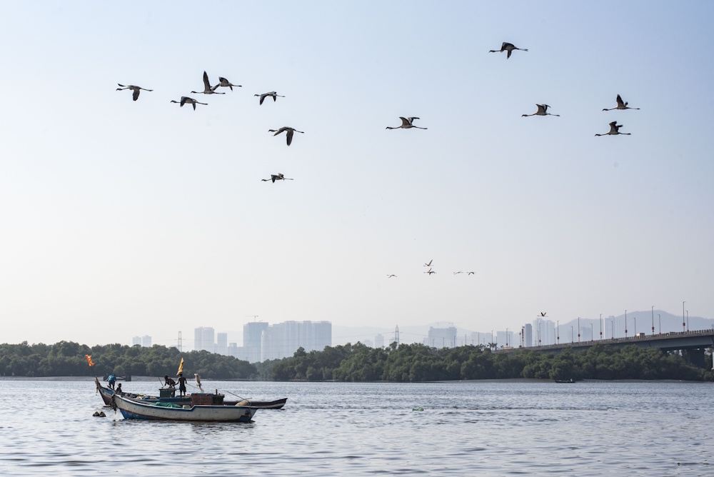
Across Mumbai’s harbour and dotted along Mumbai-Navi Mumbai creeks is the fishing community, the Kolis, considered among the first settlers. This shot by photographer Aniket Gawade shows the city as a far reality against the tidal waters and fishing boats. In the construction spree, over the decades, the Kolis have lost their old fishing corridors which used to have innumerable species of fish, as well as access to water when projects like the Coastal Road were built.
In the Bombay High Court which heard challenges to the Rs 12,500 crore project, representatives of the community stated that nearly 430 fishing trawlers and about 1,000 of them would be adversely affected but the road was built anyway. It improved connectivity for private vehicles but at what cost to the sea, the shore, its inhabitants and their fishing? Imagine this: Fish has ceased to be a part of the staple diet of the fisherfolk.[8]
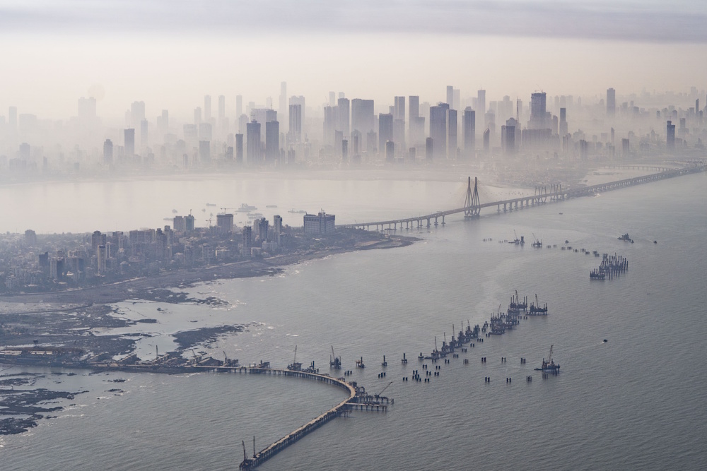
A view from above the sea of the Coastal Road under construction, shot by photographer Aniket Gawade, shows human encroachment in the water. The Coastal Road, built to ease the traffic congestion and cut travel time on the city’s western edges, has taken away the sea from Mumbaikars at places and has had an adverse impact on the coastal marine ecology, according to the marine diversity report by Vanashakti.[9]
This report showed that the project negatively affected 36 marine species such as corals, crabs and oysters, among others, some of which were on the Schedule I of the Wildlife Protection Act, 1972, and should have been given the same protection as tigers and lions. The ‘reclaiming’ or landfilling of more than 100 hectares for the Coastal Road has also damaged Mumbai’s natural buffers against storms and floods, and affected mangroves which are breeding grounds for fish and birds.[10] The Brihanmumbai Municipal Corporation was even fined over Rs 250 crore for environmental violations but few now remember. Will Mumbai ever calculate the full ecological price?
We treasure and preserve what we see and know. If only people would see a lot more of the natural flora and fauna around in cities, these might stand a fighting chance at survival amidst the concrete.
Cover photo: Aniket Gawade

