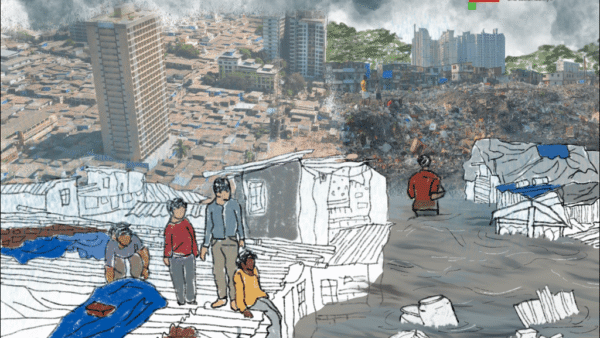
For people in Bengaluru or in other cities which too get similarly flooded now and then, fixing an issue at the micro or local level seems the way out. Yet, unless all stakeholders including civil society, academia, corporates, political representatives are brought together in a co-created system of planning and the government holds this structure together, we cannot hope the India’s urbanisation will be sustainable. No Indian city has such a co-created system yet but it is the only way forward. For people to be involved in planning cities which are nature-led, where natural areas such as wetlands and lakes are seen as networks for water rather than individual isolated pieces, in such a co-created system, authentic and authoritative information is essential which is often lacking.
Harini Nagendra, professor of sustainability at Azim Premji University and author, speaks to Question of Cities about the aftermath of the Bengaluru flood, its causes and solutions. She rues that there is no conversation on sustainability, nor about issues like public transport, energy use, and all the other factors which lead to flooding. Urban flood should be an eye-opener for agencies to plan for the city as a whole rather than allow private fixes of certain areas, she says.
When Bengaluru flooded earlier in September, it hit the wealthier and posh areas. Did it change the conversation around the flood or make a difference to how urban flood is addressed?
The flood hit international news. So did the conversations around the flood. The talk was about how it affected the wealthy areas, that the high-end cars were submerged, posh homes were submerged and so on, but these people could call for help and get evacuated even in the middle of the night. Low-income homes were even worse affected. There was a divide in terms of areas that were flooded – the areas between Bellandur and Varthur, the lakes, and the in-between areas. This is the newer and wealthier part of Bengaluru, the fact that these were flooded has driven a lot of the conversation. Will this change anything? That’s the key question. It will probably result in local fixes such as widening a few stormwater drains on the Outer Ring Road where the office complexes, IT spaces are. The level of conversation has increased after the flood but I don’t know if any substantial rethinking of our approach to urban planning is on the cards.
The concern is about the kind of conversations too. Are they only about personal losses and damages, or are they graduating to larger and long-term issues of sustainability?
Yes and no. Now, people are discussing how we can prevent “our” areas from flooding in the future on social media. Maps of flooding and low-lying areas being circulated, and so on. People are beginning to understand the importance of wetlands and lakes in their areas. There’s talk about preventing encroachments in the future. The conversation is centred on the wetlands of Bellandur and Varthur, but that area has already been built upon. We have to worry about the peripheral parts next circle around the city which will be built in the next 10 years, which still has thriving and flourishing lakes and wetlands, large number of trees, orchards and agriculture as in any rural parts. There’s absolutely no talk of better planning for these areas. It’s all about fixing the flooding in one’s own area. No, there are no conversations on sustainability, nor are there conversations about related issues like public transport, energy use, and all the other factors which exacerbate flooding.
Bengaluru has a large number of academic institutions, professionals, thinkers, intellectuals, people with expertise in these subjects. How has their expertise benefited the making of the city, infused urban planning? If it has not, then why not?
There have been a number of different ways that people have reached out with governments in the past. For instance, a number of lake restoration groups have worked with the Bruhat Bengaluru Mahanagara Palike’s Lakes Department to restore lakes. There are court-appointed committees with academics such as a tree expert to look at tree felling or a lake expert to take up rejuvenation of lakes. But if you are looking for a large macro platform on which different expertise is brought together, then that would difficult to find. The academia is stepping in with information. Increasingly, academia and civil society are forming networks – Zoom and the like have helped – to organise meetings for citizens who want to know more about these issues. In these ways, by making information available and by making people aware, the academia is doing a lot. But in terms of engaging with the government, there may not be much progress because, frankly, it’s very difficult to get a foothold in the top levels of governance.
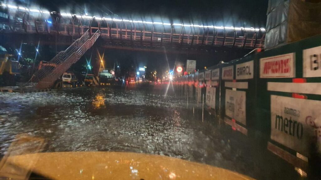
Photo: Abhilash Gowda
Is it because typically, traditionally, governments do not want to engage on issues of sustainable development or sustainability beyond using these as buzzwords?
Various people are called for consultation meetings, but what we need is to co-create a planning system in which all these issues can be properly addressed. Parastatal advisory boards will not help. These have had mixed results because they are not part of the political system. Largely, it is corporate groups which have the ear of the government and come in to advise it or help. A co-created system, which brings together civil society, corporates, academia, political representatives and governments is necessary for India’s sustainable urbanisation to go forward, but I can’t think of any Indian city where this has been done.
Do you see dialogues between the government and private planners because there would have to be some city planning structure which goes beyond band-aid solutions, as you had mentioned?
The challenge is about who will hold that planning structure. The government has to hold it, ideally. If civil society called the real estate groups or corporate groups that are involved in planning and building areas of a city, would they even come to the table? I doubt that. These different groups have always worked in silos; they do not have a good mutual understanding, there’s mistrust on all sides. But importantly, why would these groups talk to the civil society, where are the incentives for them to align? The government has to hold that structure in which all these perspectives can be brought in. Otherwise, you see private fixes. For instance, organisations get together to build a skywalk across the ring road for their employees. Such private fixes may work for a certain section at a certain time, but cannot provide a long-term way forward. We need to think and plan for the city as a whole.
Clearly, their conversations with the government or their recommendations are self-centred. Yet, sustainability of the city would have to be discussed at the table at which all the interest groups are together. What is the way forward for that to happen, where do we start? Or have these conversations started but we do not hear them?
No, I don’t think these kinds of conversations have started. But who is the ‘we’? Ideally, governments have to take up the multi-pronged approach. Can one hope to convince either the national or the state government to recommend to city governments? This is not just about Bengaluru or Mumbai, it is about building cities right. The cities that are already built and locked in have issues that are harder to fix but what about those that we are going to build? What about the Khammams and Adilabads? We cannot work with city governments, one by one, because each one is so different. But in all these urbanising places, there are civil society groups. How does civil society engage with these issues, do they have a platform? A NASSCOM or similar industry platform would be well placed to take up questions of urban resilience by setting up roundtables and other fora.
You mentioned NASSCOM may be because of Bengaluru’s association with the IT sector but do you think an industry platform like NASSCOM could play a role?
Larger industry networks have an important stake in the sustainability of a city, far more than some of the smaller real estate companies or industries who may have compulsions of focusing on short-term profits. Platforms like NASSCOM would be invested in a city long term. You could find similar stakeholders who are pan-India, who are invested in cities for the long term, and who would be willing to take the onus of creating these dialogue centres where these conversations can be had.
What has been the role of Bangalore Sustainability Forum (BSF) which has been doing wonderful work, with which you are affiliated?
We have had workshops where we have been able to generate some dialogue around sustainability, get people together for two-three days to have thoughtful conversations, and curate those conversations. People get to know other people, and rich conversations continue beyond the limited duration of these workshops – these networks, along with the small grants BSF provides, have been some of their most useful contributions to larger critical debates.
Are governments part of these dialogues?
Government agencies are always invited. They may not be able to make it for the entire duration of the workshop over multiple days, because of demands on their time. They do participate listen to the different points, and are part of the conversations. Whether all of this makes its way into planning is hard to say – there are many factors that shape the way in which urban planning takes place on the ground.
For civil society to be involved, there must be information and mapping of the natural areas. How do you know what and how much Bengaluru has lost, and what needs to be preserved?
It is difficult to map and store all the information about natural areas in meaningful ways. There is remote sensing data but that can be misleading too. Areas look green because there’s agriculture, tree cover, lakes covered with green and so on. The picture also looks different from one season to another. There are numbers floating around, some say 63 per cent of Bengaluru’s natural areas are gone but others give different numbers. We are not even talking about planning and building the city from the same level we all agree on. Lately, some organisations have begun mapping efforts at the local level, getting people to record where flooding happens, where lakes were, and so on. But this is at micro or local levels. There should be mapping at the larger level and the GIS information should be made transparent at the larger city level – which only the government can do. Citizens can go to courts and ask that certain projects be stopped, but on what basis? Accurate information and mapping are critical aspects of building cities but have not been taken seriously.
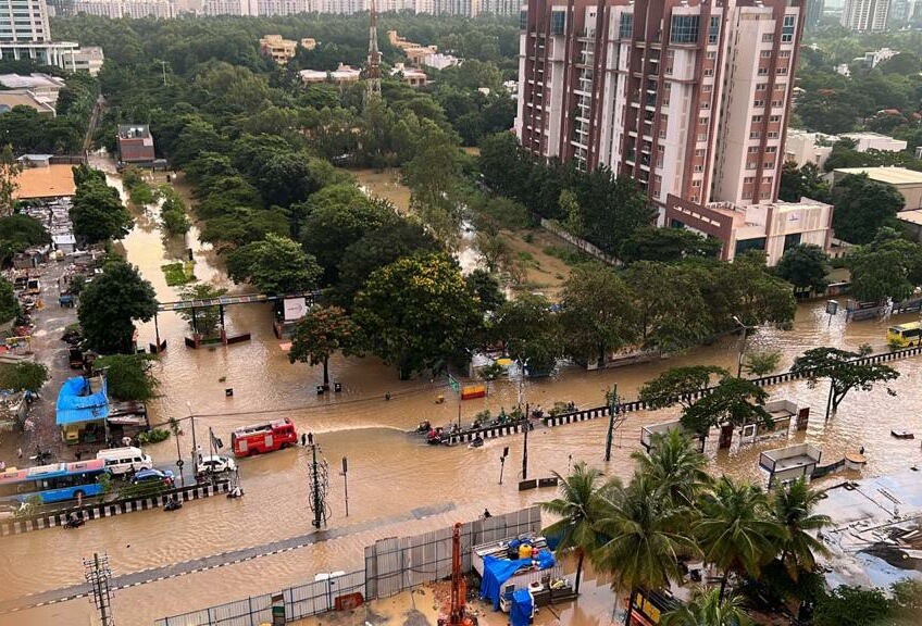
Photo: Abhilash Gowda
Yet, governments are unlikely to do this because, more often than not, they tend to speak the language of ‘development’ which is politically seen as a binary to environment and sustainability.
Well, yes, in a sense. The civil society often does the ground work, takes the issues to the government or the courts, yet sees that there is little impact on construction itself. In the area between Bellandur and Varthur, which were affected this time, there is what is popularly called the ‘real estate mafia’ — which is often a real mafia with money and muscle power. If you want to do anything with participatory and political networks –it is not possible for local or civil society groups to do it by themselves. The reason is that in some cases land or natural areas have been taken away, documents have been altered because there are powerful forces at work. When citizen groups seek to restore lakes and waterways, what they need is transparency. The city or state governments have the survey maps somewhere, because they are doing enforcement drives based on these maps, but they need to make them transparent — which they do not. Only if mapped information is transparent, uploaded where people can access, people can then go to government or court and say ‘I went here, the lake is not there but XYZ building is’. There are all kinds of maps now floating around on social media but they do not have legal sanctions. In fact, it creates possibilities for misinformation too. We need maps and transparent information from governments.
Assuming this authentic and legally-backed information is available, will governments work with people because what we see happening is that governments are more inclined towards the real estate lobby or ‘mafia’ as you said?
Citizens’ groups have managed to make themselves heard through Public Interest Litigations, at the National Green Tribunal, the Lokayukta, and of course in courts from the high courts to the Supreme Court. They have used these platforms very effectively to break into the set notions, raise issues, and get some changes done. But for it to make a large difference, they need some sort of legal backing or authentic information that is not disputed. You can’t simply go to the court saying ‘we are a civil society group, we put together a map of how things have changed, stop this project’ because your maps will be disputed. But if you go to the court and say ‘here is the government map that’s available from the government website, and these changes have happened to the area which should not have happened’ then the courts will take cognizance. It is important, or critical, that we have that level of transparent information from the government itself.
Of course, this is not only about Bengaluru because other cities get flooded the same way too. Going forward, would you say that unless urban planning becomes nature-led and unless Climate Change is factored into it, cities are doomed to be flooded?
Absolutely, yes. Even with Climate Change planning, which is a very important factor, the tendency is to plan cities for the average expected rainfall but what’s needed is planning for the extreme climate scenarios. That’s not happening as much as it should. There is this Reserve Bank of India document which examines the impact of Climate Change on the Indian banking system, RBI put out some reports too pointing out that when banks plan for resilience strategies they do for the averages of the model – as cities would too – but Climate Change is all about extremes. So, we need to plan for the extremes. For instance, how do you plan the drainage system of a city to deal with four times the amount of the intensity of rainfall that you get? Nature-led development is very important but we have to figure out what that really means and how it translates into planning language. The natural areas – valleys, wetlands, lakes, the interconnecting channels – have to be seen as networks, not as individual isolated pieces. For this, then you need the maps and transparency, so if a builder is offering a house owner or a corporate group a plot of land — as responsible members of society, they can know what they shouldn’t be building on. We cannot build sustainable cities without government mapping, and making that information available to all.