The overflowing waters of the Yamuna touched the Red Fort in mid-July after decades, establishing the severity of Delhi’s worst flood. The once flowing river and the lifeline of the city has been reduced to a strip of polluted water; its floodplain encroached and abused – thanks to city planners. If the floodplain is not restored to the river or more encroachments and abuse are allowed, then Delhi should be ready for more destruction and damage, says environment activist Bhim Singh Rawat, who is also an associate coordinator of the South Asia Network on Dams, Rivers and People (SANDRP).
“The continuous degradation of the Yamuna has severed every connection of people with the river – be it social, cultural or recreational…The Yamuna seems eager to reclaim all its channels and encroached floodplain areas. It is imparting essential lesson to us time and again: keep the floodplain as undisturbed as possible,” he says in this detailed interview to Question of Cities about the importance of floodplains, the need to involve all the river’s stakeholders, including citizens, in reviving and restoring the waterbody.

What were the reasons that New Delhi-NCR flooded so much in July?
It is a complex puzzle. We can blame Climate Change, heavy rainfall and water discharges from the HathniKund Barrage (HKB) in Yamuna Nagar district, Haryana, for the flood but these are the easy parts of the puzzle and shift attention from important human-made reasons. The flood and the unexpected rise in the water level of Yamuna River at Old Railway Bridge or Delhi Railway Bridge (DRB) is more due to anthropogenic reasons. This demands a complete overhaul in the prevailing approach of floodplain and river management by all government departments in the NCR.
We must recognise that flooding is a natural cycle and an essential feature of a river. If anything, this flood has once again reinforced the significance of a river floodplain for a city. When kept intact, it provides multiple benefits; if encroached and abused, the Yamuna floodplain has the potential to jeopardise India’s national capital, make large parts of it go under water.
I want to emphasise that this flood is not a repeat of the 1978 flood but a trailer of bigger floods which will hit the city in the coming years. If decision makers and planners go on with their business-as-usual syndrome, if the floodplain is not restored to the river but more encroachments and abuse are allowed, then Delhi should be ready for more flood destruction. The change in land use across Delhi, the increase in built areas with growing concretisation, the decline in water bodies and green spaces in NCT also played their roles in aggravating the flood situation. The concretisation means there has been a decline in groundwater percolation and the runoffs to the river are higher; the decline in water bodies and wetlands means the flood cushion is lower, but we must pay attention to the Yamuna.
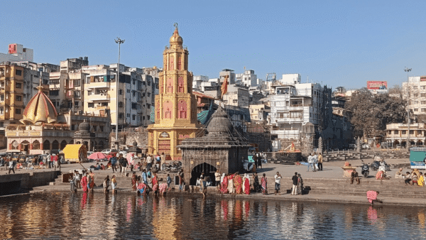
Credit: SANDRP
Why do you say that the main cause was encroachments and abuse of the river?
The Yamuna seems eager to reclaim all its channels and encroached floodplain areas. The river set 208.66 metres as the new Highest Flood Level (HFL) on July 13 this year which is 1.17 metres higher than the previous high of September 9, 1978. Based on the available data of peak discharges from the HathniKund Barrage and the corresponding flood level, it appears the discharge was not the major cause of the flood.
The highest flood level was not breached at any of the other five flood monitoring stations of the Central Water Commission on the Yamuna. It was 0.25 metres to 1.16 metres below the highest flood level except at DRB where it was higher by 1.17 metres. Though there was far higher than normal rainfall, the peak flood levels at the five stations, particularly at Baghpat and Palla, show that it was not the major factor for the Yamuna setting a new high flood level. The reasons point to the Yamuna floodplain. Over the years, various kinds of encroachments – government and private – on the floodplain and riverbed have reduced its flood carrying capacity.
Would you elaborate on the encroachments?
Of the total 9,700 hectares of the floodplain, about 3,638 hectares are regulated by the Delhi Development Authority. It is not clear whether this area is totally built up but experts – including the late Manoj Misra of Yamuna Jiye Abhiyan – have highlighted that more than 1,000 hectares have been encroached over the past 15 years by various permanent structures with the CommonWealth Games (CWG) Village, Akshardham Temple, Yamuna Bank Metro Depot, Shastri Park Metro Depot and IT Park being the major ones as reported. The details, as given by writer Nivedita Khandekar, are below:
Name of structure Floodplain area encroached
CWG Village 63.5 hectares
Akshardham Temple More than 100 hectares
Yamuna Bank Metro Depot More than 40 hectares
Shastri Park Metro Depot More than 70 hectares
I know of an email exchange between the DDA and the forest department in July 2022 which revealed that “there has been encroachment/development of 2,480 hectares of land in Yamuna floodplain since 2009…” which tells its own story.
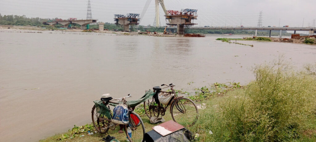
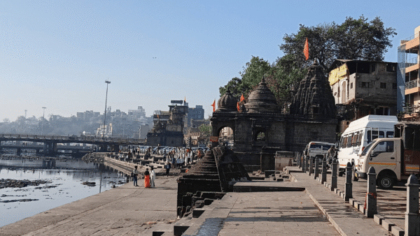
Photo: SANDRP
What are the other factors?
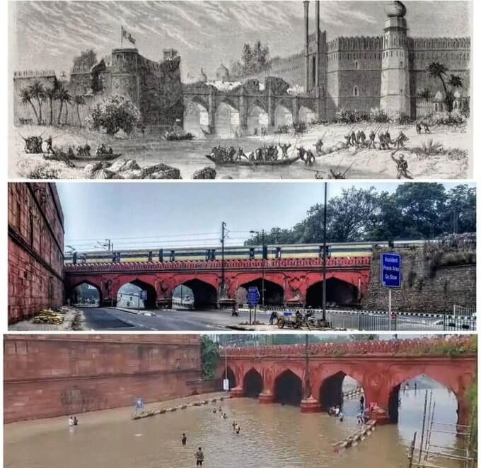
The construction of new bridges and roads along and across the river in Delhi have straight-jacketed the floodplain from both sides, adversely affecting the passage of water. For example, about 26 bridges have been built, four more are under construction in addition to three barrages at Wazirabad, ITO and Okhla in the 22-kilometre stretch of the Yamuna in Delhi. This has fragmented the floodplain and obstructed its natural flooding pattern. The three double-lane bridges at Nizamuddin have created a bottleneck. These were detailed out in a report by the South Asia Network on Dams Rivers and People (SANDRP).
Two things happened simultaneously – these structures significantly reduced the floodplain available for flood absorption, and they caused stagnation as well as back-flooding. The cumulative impact of all these factors was the unusual rise in flood level at DRB and the unexpected flood in Delhi. Then, in the past five years, the DDA has abused the floodplain in the name of ‘restoration’ and ‘beautification’ projects such as riverfront development, compensatory plantations, making a ‘biodiversity park’ and ‘eco-tourism’ sites. There is reason to believe that this increased encroachment, disrespecting its hydrology and ecology, altered the floodplain.
What measures need to be taken to prevent another massive flood?
Many things need to be done urgently. First is the coordination between the Flood Control and Irrigation departments of the three states involved – Delhi, Haryana, Uttar Pradesh – and that is the CWC’s responsibility. There is a big question mark on the latter. Ironically, the CWC is a central body headquartered in Delhi, has resources to monitor rainfall and river flow to issue timely flood forecasts and warnings, it is supposed to proactively coordinate with the three states during the monsoon, it should monitor and publicise the hourly discharges in Delhi especially during annual flood spell, but above all, it should assess the situation of floodplain encroachment, siltation, impact of growing infrastructures and release an annual report publicly.
Second, Delhi needs to keep the Yamuna floodplain intact. There is an urgent need to increase the flood cushion in the city stretch, for which the DDA must reveal the actual and present status of the floodplain detailing the land leased out to construction companies and overall encroachments in Delhi. In fact, it must initiate the process of reclaiming the floodplain encroached by influential players and restore it to the river.
Third, the Yamuna in Delhi is already overburdened with back-to-back bridges, and barrages suffocate the river; its eco-system cannot afford the construction of any new structure without compromising the flood carrying capacity. In my view, the ITO barrage is serving no practical purpose now and decision makers should chalk out its decommissioning process. Then, the siltation load in Delhi’s stretch of the river needs to be studied and corrective steps taken. The DDA and other agencies should stop the floodplain ‘restoration’ projects. They deliberately ignored warnings by experts resulting in the waste of public money; the accountability for these losses must be fixed.
The Yamuna is imparting essential lessons to us time and again: keep the floodplain as undisturbed as possible. Besides, Delhi must do a lot more in terms of rainwater harvesting, protection of water bodies and green spaces.
Besides these, what else is responsible for the worsening state of the Yamuna?
There are many reasons. First, it is due to the decline in the environmental flows in the river during the lean season of October to June over four decades. The flows have been increasingly diverted to meet the ever-growing irrigational, drinking and industrial water requirements in an unsustainable manner, converting the river from perennial to seasonal in the upper segment. Other reasons for its sorry state: the release of untreated or semi-treated effluents from urban and industrial areas, dumping solid wastes, the failure of state and central pollution control boards and environment departments, the failure of Upper Yamuna River Board, over-exploitation of groundwater, throwing cultural waste, the disconnect of society from the river, the neglect of river-dependent communities, the failure of the highest judiciary which has dealt with the Yamuna pollution cases for three decades and the National Green Tribunal.
Presently, the 1,376 kilometres river is flowing for only about the first 100 kilometres without impact of dams and barrages, but for most part the mighty river is either a stream or remains bone dry between Hathnikund Barrage, Haryana and Wazirabad Barrage in the city, while downstream from Delhi, it only carries mostly untreated effluents. This stretch is also facing the brunt of large-scale illegal, mechanised sand mining for the past several years. The untreated sewage, and industrial effluents in growing volume is being discharged into the river in the upper segment, including Haryana and Delhi. In a true sense, the Yamuna in Delhi is a linear pond of stinking water except in the monsoon.
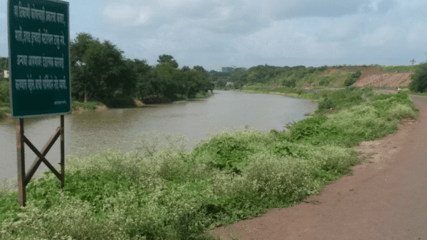
Photo: Goutam Dutta/ Creative Commons
How have the people of Delhi been affected beyond being at the receiving end of the flood fury?
Despite being the water lifeline and a prominent geographical feature of Delhi, the continuous degradation of the Yamuna has severed every connection of people with the river – be it social, cultural or recreational. The increasing pollution and lack of sufficient water often during peak summer time have frequently contaminated and disrupted potable water supply to large parts of Delhi. The state has given no role to the people either by sharing information or by providing them a say in governance and accountability of the river-related works. People have also failed to stand up for the cause of the river.
The monsoon and flood-related ailments are known, beyond that there has been a gradual increase in water and mosquito-borne diseases in areas under river water supply. The shallow aquifers and groundwater adjoining river have been contaminated further taking a toll on people’s health. The perennial stink makes people avoid visiting the river. The livelihoods of the key stakeholders – fishermen, boatsmen, floodplain farmers – have been among the most affected. The ‘development’ works, including riverfront makeover and beautification of parks, have only worsened the situation.
What interventions has the state made to reduce pollution?
The government interventions so far have been limited to cleaning, through externally funded and centrally aided controlled projects such as Yamuna Action Plan (YAP) I, II, Namami Gange with great emphasis of construction of Sewage Treatment Plants (STPs) and Common Effluent Treatment Plants (CETPs) without concrete success and without ensuring credible governance that will ensure that these plants work as designed.
The DDA as city planner sees the floodplain through real estate and development prism, and has been pushing riverfront, beautification parks, and compensatory plantation without involving or consulting the concerned citizens and in sheer disregard of ecological and hydrological aspects of the river and its floodplain.
How can the Yamuna be sustainably incorporated into Delhi’s development plans?
Policy makers and city developers must remember that all the plans ultimately have their footprint on the city’s natural resources, including the river. The new developmental plan must have a river-centric approach. First, the city needs to reduce its potable water demands and dependence on the river. For this, there is a need to manage the water supply efficiently and bring down distribution and seepage losses. Reviving water bodies, maximising rain water harvesting, recycling and reuse of wastewater are urgent measures.
Citizens should have a much greater role in governance of water and the river. Every STP needs to have a management committee in which at least 50 percent should be local, independent citizens. The encroachments affecting the water bodies also need to be removed. Every government building, flyover, park, school, college, metro, railway station, mall, multiplex, office complex, and embassy must not only harvest rainwater, but also recycle the sewage they create. Information about this should be mandatorily in the public domain, and consequences must follow for violators. Citizens also need to have a role in functioning of the pollution control boards.
The river and the floodplain still offer great opportunities to the agencies and planners to make the city liveable and sustainable. It is imperative to keep the floodplain free of abuse and encroachments. Declaring it as a no-construction zone and restoring the abused areas is the need of the hour. The floodplain is vital for water security, it not only provides flood protection but also recharges groundwater. A healthy and protected floodplain can be Delhi’s biggest natural resource for most of its water requirements. And a large part of farm produce including fruits, flowers and vegetables can be naturally, organically grown in parts of the floodplain. This will not only reduce the city’s water and carbon footprints but also provide livelihoods to thousands of farmers and migrant workers living there.
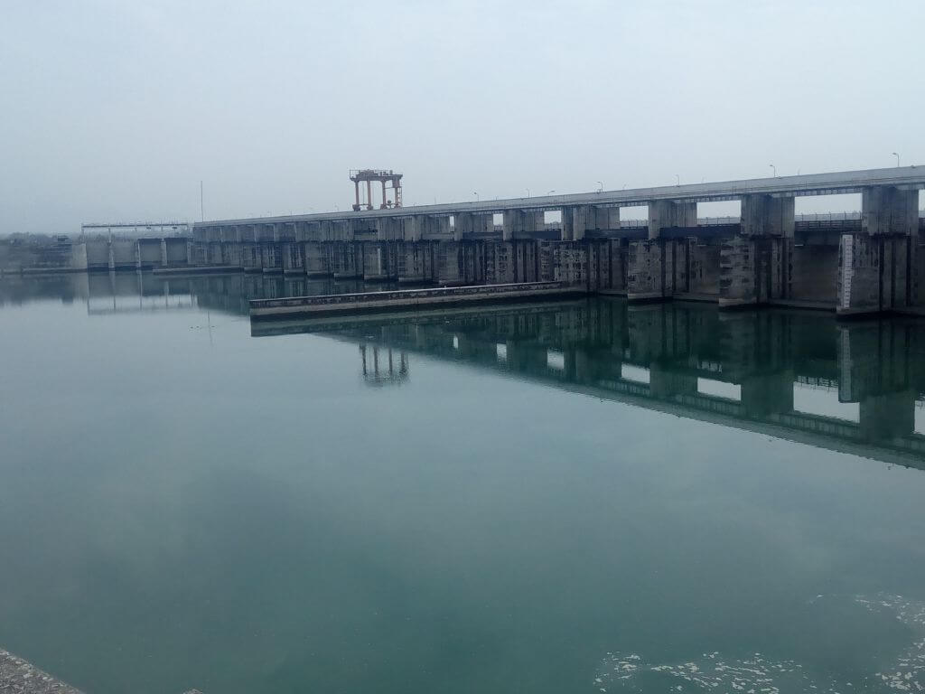
Cover photo: HathniKund Barrage on the Yamuna. Owais Khursheed/ Wikipedia