Women’s experience of streets, like everything else in their lives, is dictated by their gender. Blending into streets is a constant challenge. Would it make a difference if women micro-mapped their streets instead of only men? It appears so, given my experience this past Sunday morning.
Streets, like other public spaces, have meant I conduct myself a certain way. I do not make myself too visible but I am afraid if nobody can see me, which makes it unsafe. I want to believe that this too is my space as much as that of any man. However, as soon as I step out into the streets, perhaps after years of conditioning and practice, my shoulders become taut, jaw is clenched, and I am looking over my shoulder while dodging the uninvited male gaze or ‘accidental’ physical touch. There is a persistent sense of being ‘looked at’, an awareness that young women – all women – are familiar with. All of this is heightened when there are no or low lights.
My experience is not unique; in fact, it is universal going by the accounts and experiences I hear and read. The report released recently, She RISES: A Framework for Caring Cities by SafetiPin called for responsible, inclusive, safe and equitable cities[1] alludes to this experience of every woman. Urban sociologist Saskia Sassen has written about how urban planning renders women invisible, writing that “Urban planning is not gender neutral.” [2] In a separate co-written essay, she argues that the use of time and space should be central to gendered planning if our understanding of cities and potential policy reforms are to enhance social progress.[3]
These thoughts were top of mind when I joined the Walking Project (WP) last Sunday. The WP has brought Mumbai’s residents together to talk about their observations-experience of walking in different areas of the city. These, peppered with discussions about the right to walk, and standards for footpaths, streets and roads, should ideally lead to awareness and policy reform. The venue was Borivali; the WP had previously done walks in Bandra and Dadar. This micro-mapping of streets or public places is important for what it nudges people to ‘see’ in areas they are familiar with, where they looked but did not really see. I made a note of my points as we walked.
How the walk was done
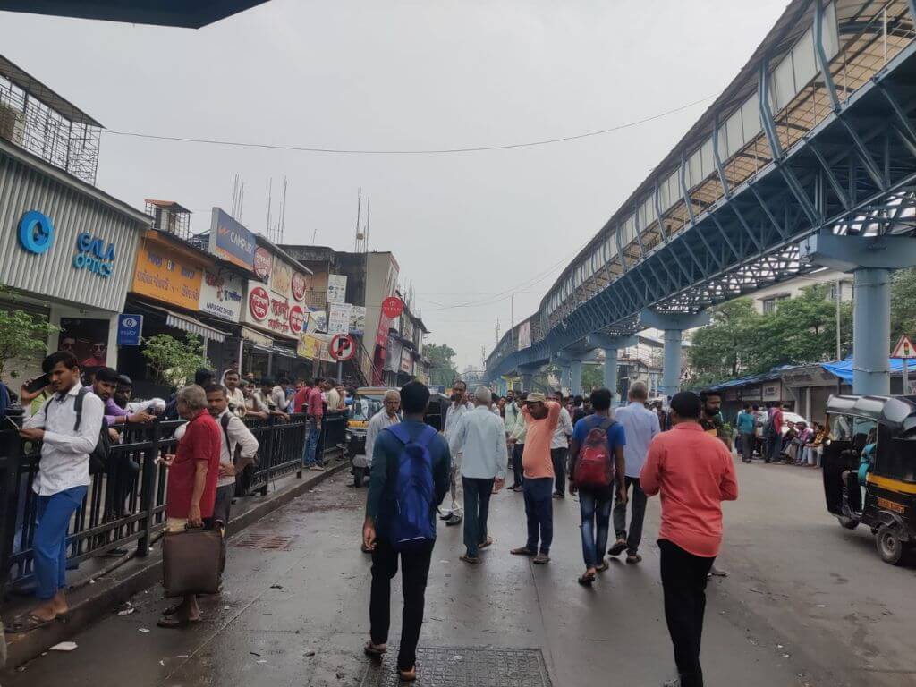
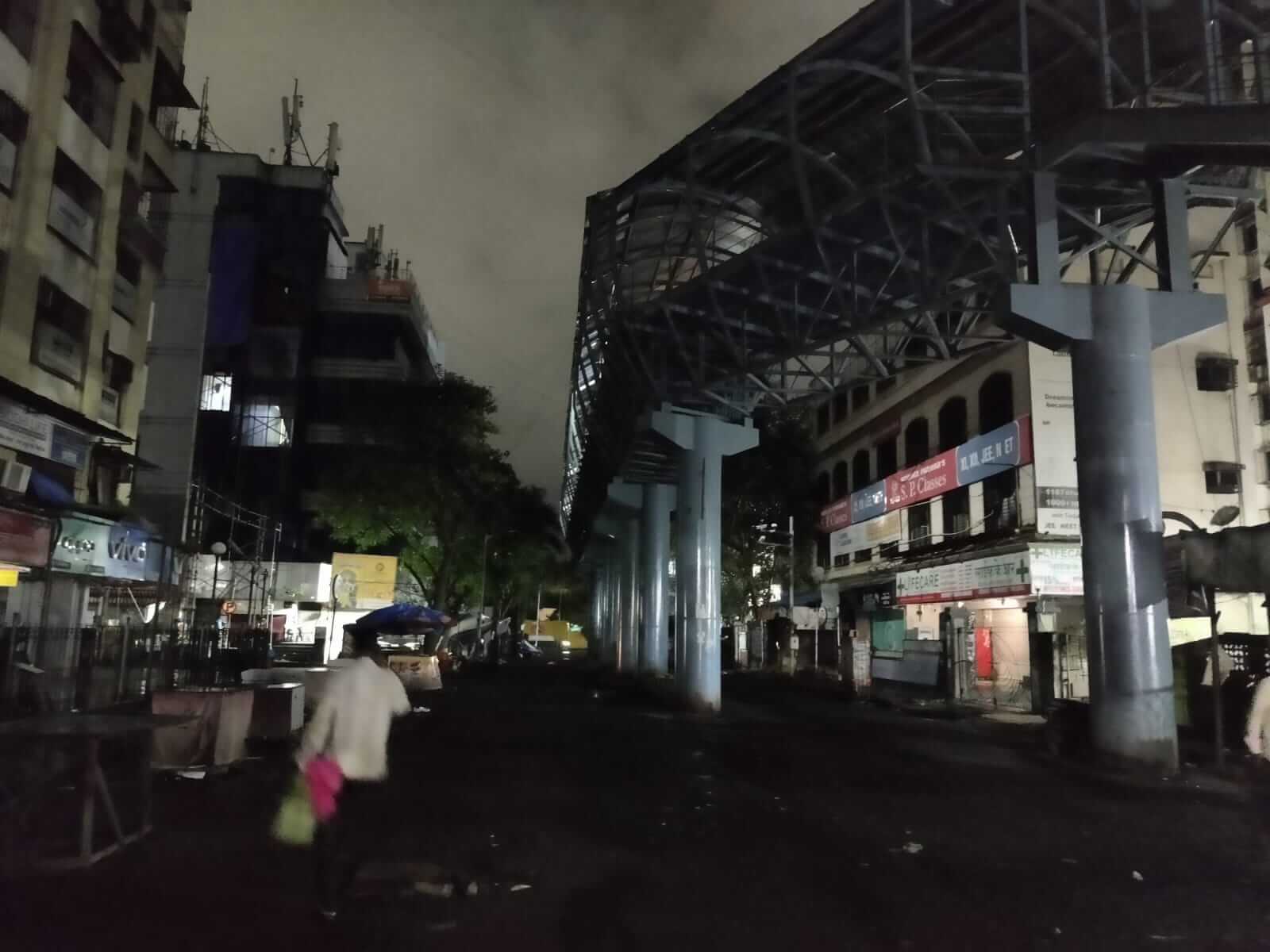
The walk was scheduled to begin at 8am from the road opposite the last north-side exit of Borivali railway station which registered nearly three lakh commuters a day some years ago.[4] That’s an overwhelming number of people using the streets in its vicinity. All streets leading to this important station in Mumbai’s northern suburbs, also a major junction for long-distance trains, are always congested with vehicular traffic, filled with air pollution and high-decibel noise. Pedestrians are forced to jostle for space to make their way in and out of the station.
The road is flanked by informal markets and shopping complexes on both sides. The skywalk to the west is rarely used; pedestrians are on the streets. Footpaths are missing in patches; those that exist are either occupied by shops or too narrow and damaged to walk on. Yet, every nukkad or street corner has hawkers, shoppers, and commuters.
The walk began with the group’s decision to take the barricaded footpath. My experience of navigating the city’s streets as a woman would inevitably inform my walk; I was the only woman in that group. I hesitated to take the footpath; it did not feel right. Walking and mapping it explained why. It had no exit points and could barely accommodate two people walking side-by-side. The railing was so high that it blocked the view of the street. I was compelled to point out how unsafe I would feel if I were walking alone.
We found out later that there was no logic to the design of the railings, and were allegedly a ruse to utilise allocated funds. They also violated the guidelines of the Indian Roads Congress (IRC) which states that railings ought to provide access to road crossings and facilities like bus stops. She RISES also observes that, “Unobstructed, wide, and well-lit pavements enhance women’s safe mobility in public spaces. This becomes more essential if they are accompanying children or the elderly.”
Point 1: Footpaths have to be even, accessible and have exit points; railings along them must offer a view of the street rather than block it.
Skywalk space is no one’s land
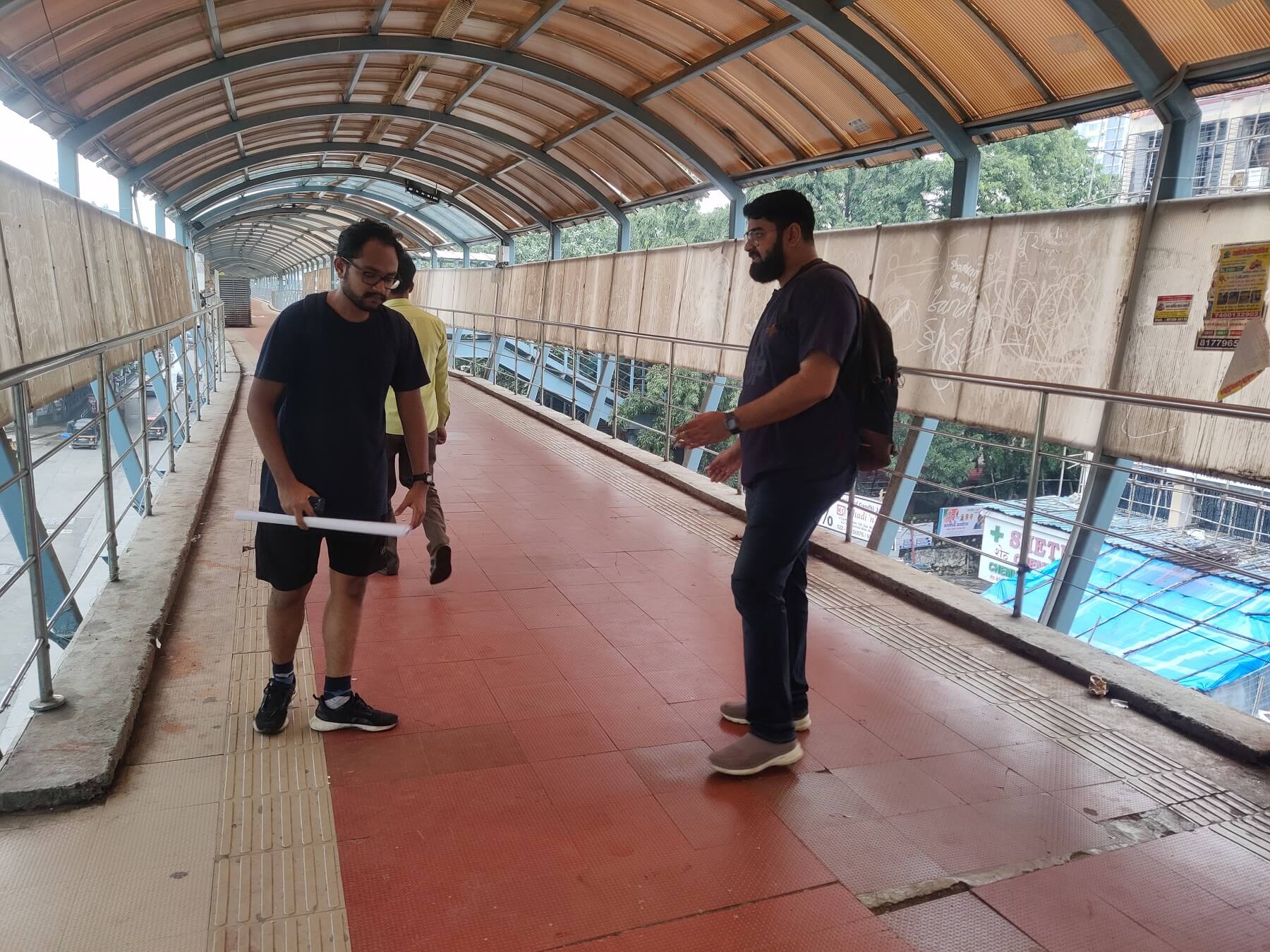
The Borivali station skywalk, on the western side, has an exit beside a famous shopping complex, Moksh Plaza. It is planned so that commuters do not have to negotiate the super-dense congested streets below. Yet, the skywalk has few people. Along its length, garbage is overflowing from bins, tiles are chipped, and rainwater has collected in places. Hawkers, homeless people, and lovers actively use this space. The presence of hawkers makes me feel relatively safer here.
We took the stairs to the skywalk. The tiles on the steps were chipped, cracked, or missing. One of us stumbled on a broken tile. The staircase itself is a safety hazard with openings after each step. It takes 60-odd steps and two turns to access the skywalk, our walk leader and program manager of Walking Project, Vedant Mhatre, measures the width of the walking area on the skywalk. It was approximately three metres.
Point 2: The skywalk is not perceived as an alternative to the street even if the street is congested; its design, poor maintenance, and the presence of drunkards do not make it safe for women.
On the footpath
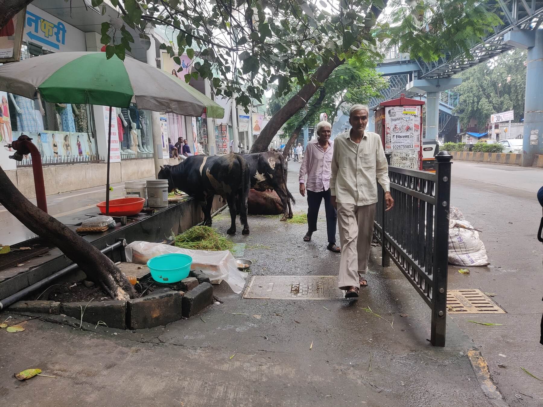
The walk continued towards another footpath which was occupied by cows. Their swinging tails nearly got us. Mhatre drew our attention to the stamp concrete material used for the footpath which, according to architects, wears off quickly but helps to cut costs and allows for easy sloping needed for wheelchairs. This footpath had a sloped opening. The walk continued till the penultimate exit of the skywalk where the staircase turns and opens exactly behind a bus stop, which is dim even in the day. Taking this exit at night would make me extremely cautious.
We turned into a narrow lane towards Shimpoli Road. The footpath measured 1.8 metres and we learned that the width is determined by usage; since Mumbai is mostly mixed use, the ideal width should be 3 to 3.5 metres – footpaths that are not sufficiently wide can be hazardous. We then measured the height of the footpath from the street. It was about a foot high but, farther ahead, it measured 1.4 feet. We discussed the difficulties older people face when using such uneven footpaths before veering to the subject of wide footpaths and walking-friendliness in Bandra Kurla Complex (BKC). “Yet, why is it so difficult to walk there,” asked one.
Point 3: Footpaths need to follow guidelines for height and width. Their occupation by vendors – legal or illegal – and accessibility to the old and children must be borne in mind by the authorities.
Towards destination
On Shimpoli Road, we head towards the garden where the walk is slated to end. Children outside the Gokhale School march, chanting slogans about the Swacch Bharat Abhiyan, ironically, on relatively unclean streets and footpaths. We walk towards an intersection where Mhatre points out that the pedestrian signals need to be longer – the official guidelines say a minimum of 20 seconds on a 30-metre road – and shorter distances to minimise accidents. He talks about the need for table-top crossings which allow pedestrians to cross a road at the same level as the footpath. We discussed, again, how roads are planned for traffic and cars, but not for people.
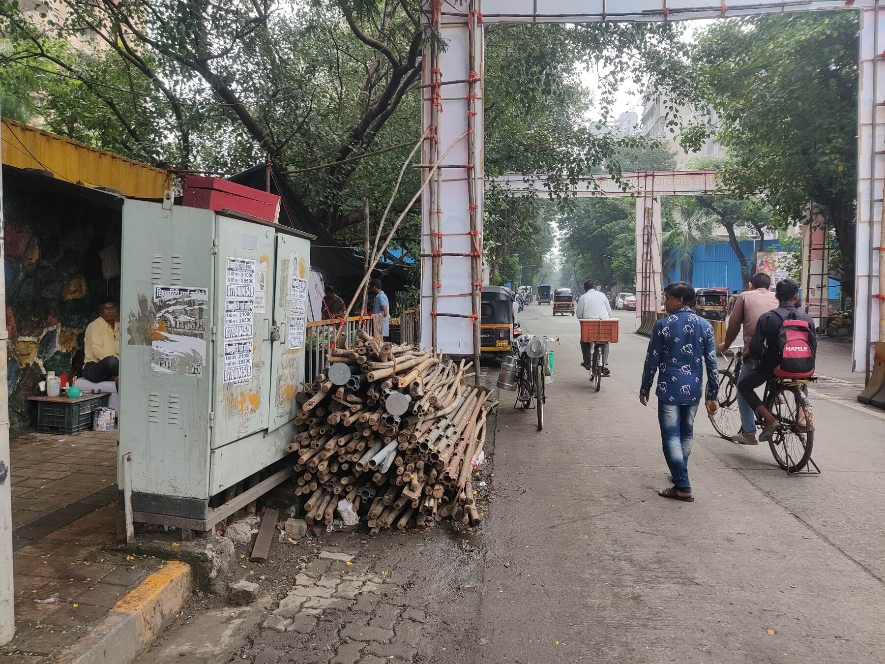
We observed that the footpaths on Shimpoli Road have bollard barricades across their width. These can be a safety hazard for the elderly, people on wheelchairs, women with prams, and ironically, people running for safety. Additionally, the footpath is uneven because, every few metres, it is sloped to allow entry to buildings. It is also difficult to ignore wobbly manhole covers and uneven surfaces. Where we finally met a wide footpath, it was claimed by vegetable vendors, a chaiwala, and a food cart. It appeared chaotic but it felt ‘lively’. To me, this was a hurdle-filled walk but it felt safe; I remembered the phrase ‘eyes on the street’ by Jane Jacobs, the doyenne of urban planning.
In their book Why Loiter?, authors Shilpa Phadke, Sameera Khan and Shilpa Ranade wrote about an exercise with students of architecture. It asked if the students would walk on a well-fenced street lined with trees or a residential street with activity spilling onto the streets; women students chose the latter despite it being the “nightmare of city planners”. We finally reached the garden, found a spot to sit, and realised that we had not come across green spaces throughout the 2.3 kilometres walk. I avoid walking by green or open spaces if there aren’t people in them but the eye needs the green amidst the grey concrete.
Point 4: Streets and footpaths with activity and informality can make even modern design interventions fall flat if they do not ensure people’s safety and comfort.
Authorities should read the micro-mapping
The WP is in touch with the BMC to communicate these and other outcomes of the various micro-mapping exercises. But the civic body’s perception, they say, is informed by the question “Car se kya accha dikhega? (What will look good from cars?)”
Yet, if the BMC were to take such walking exercises seriously and factor in the outcomes of micro-mapping into its plans for streets, pavements and skywalks, walking would be a far more pleasant, less hazardous, and safe activity for millions. The design of streets and footpaths does matter in how liveable an area – or a city – is. Our walk micro-mapped this one area during daytime; nighttime would add more layers of challenges and anxiety for walkers, perhaps.
The Merriam-Webster Dictionary defines the flâneur as ‘an idle man-about-town’. Lauren Elkin, author of Flâneuse: Women Walk the City correctly points out that as long as there have been cities, women have lived in them but few choose to be a flâneuse. She reflects that the word is attributed to a sex worker, a homeless woman or someone ‘whose circumstances forced her onto the street’. Elkin writes, “Today, when most women you meet in the city have a tale or two of street harassment to tell, the notion of wandering the streets alone seems a fraught proposition.”
Why does walking on streets matter, especially to women? The study Activity Inequality found that women are less physically active than men, particularly in cities with unpleasant or unsafe walking environments; India ranked 38 out of 46 countries.[5] As planner Abbey Seitz writes, “Compared to men, women typically have a greater diversity of travel needs. They tend to make shorter, more frequent trips dispersed throughout the day, when compared to men” or combine with other women in “trip-chaining”[6]
Unequal access to streets, badly planned and laid footpaths and so on can be both mentally exhausting and physically unsafe for all but hold different meanings for women. Women have rarely been involved in the planning and design of these streets, especially at neighbourhood levels. In the rush of everyday life, we complain about how streets and footpaths fall short and move on, without allowing ourselves a moment to reflect on what exactly we see and how we could intervene. The WP walk offered me these moments – to consciously think about streets and transit spaces, road and footpath design that is not gender-friendly, safety on streets, and what it would take to make them functional, well-lit, spacious and safe transit spaces.
I want to relax while walking, I want to loiter and linger when I choose to, I want to cross a road without fearing for my life. This is, categorically, my right to the city.
Jashvitha Dhagey is a multimedia journalist and researcher. She developed a deep interest in the way cities function, watching Mumbai at work. She holds a post-graduate diploma in Social Communications Media from Sophia Polytechnic. She loves to watch and chronicle the multiple interactions between people, between people and power, and society and media.
Photos by Jashvitha Dhagey

