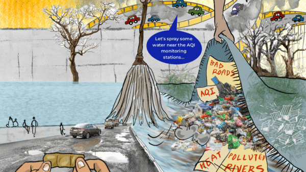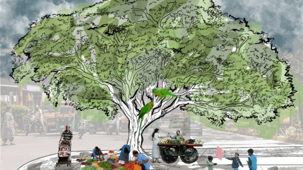
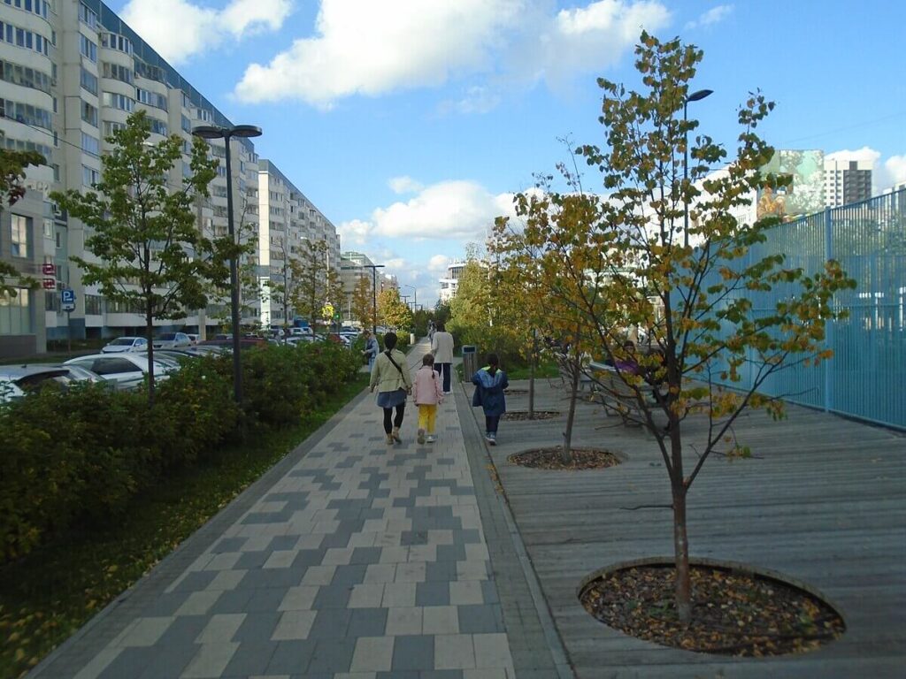
The dire need of green spaces in densely packed urban areas is evident in the way our cities are planned and designed. Long stretches of accessible and open parks make cities liveable and vibrant. Cities around the world have transformed unused areas to build linear parks, or greenways, acknowledging the importance of such green spaces. A linear park is a type of park that is significantly longer than it is wide. These linear parks are strips of public land running along canals, rivers, streams, defensive walls, electrical lines, or highways and shorelines.[1] Such parks not only keep citizens healthy but are cooler areas of a city and they are known to help combat climate impacts.
The renovation and revamping of unused parking lots, defunct railway lines, shuttered industrial areas or vacant land into linear parks connects neighbourhoods and offers space to interact and spend time cycling, walking and loitering. It may be community-driven like the linear park in Toronto which, last year, opened a two-kilometre multi-use trail, surrounded by 16 hectares of restored meadow, in the Meadoway at Highland Creek. “The project shows the power of community-driven projects, transforming an under-utilised hydro corridor into an ecologically rich greenspace and vital recreation and transportation corridor. It also creates a haven for local wildlife, offers recreational and educational opportunities, and strengthens community ties.”[2]
Other cities have set examples of how spaces can be transformed to make them more inclusive, democratic and greener — these aspects are usually missing in city planning. The green zones also turn into a city’s lungs — a reprieve in the concrete maze of urbanisation. The transformations are a template on how urban areas can include nature to make cities sustainable and healthy.
White Flowers Boulevard, Russia
This is a public linear space in Kazan, Absalyamov street, in Russia, designed with the residents of the district in 2018. The park, which was a parking lot, became “a notable case study in participatory, horizontal urbanism for Russia, where participatory approach is extremely new, undeveloped and non-binding”.[3]
The constant conflict between cars and pedestrians was dangerous, as there was no pedestrian route from houses to bus stops and the school. Within the project, a landscape was formed, fertile land was brought and more than 1,000 large-sized trees and perennial shrubs were planted. At all stages of the project, local residents, communities, teachers and students from local schools took an active part in both the preparation of the design assignment and discussion of the preliminary concept.[4]
High Line, New York
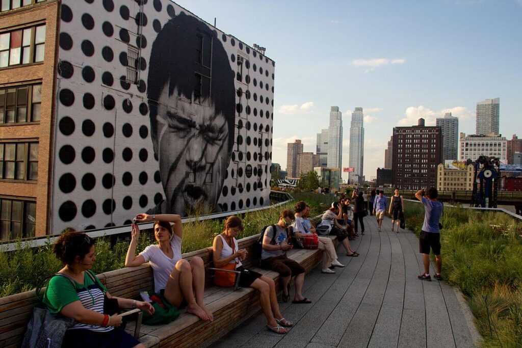
Photo: Mike Peel/ Creative Commons
One of the most famous linear parks in the US, the High Line in New York is a former elevated train line transformed into a linear park, opened in 2009. With some of the best views in the city, the High Line—modelled off of the Promenade Plantée in Paris—incorporates perennials, grasses, shrubs, and trees into beautiful gardens that line a walking path. Other features include art installations, overlooks, a sundeck with water, and a lawn area with teak seating for picnics.
While it drew accolades, it also attracted criticism for gentrification of neighbourhoods along its stretch. “It spurred a real estate boom around the park, and condos near the now-popular tourist destination are more than 100 percent pricier than the real estate one block to the east. This ‘High Line Effect’ has prompted the creation of the High Line Network, an organisation of 19 park projects that aims to share resources and knowledge about how to equitably create new green spaces.”[5]
The Bowline Park, UK
Photo: Creative Commons
The iconic and previously derelict, 125-year-old Category B Listed railway viaduct at Bowling Harbour, West Dunbartonshire, was transformed into a linear park and active travel connection as part of the wider regeneration of Bowling Harbour by Scottish Canals. Bowling Harbour is an important destination for boaters, cyclists, walkers and other visitors and local residents. The harbour and the railway viaduct that crosses it had fallen into disrepair since both the canal and the railway were closed and were not contributing socially, economically or ecological to the local area.[6]
The new active travel route and elevated linear park with viewpoints bring back into use the disused Bowling Viaduct and its listed swing bridge. The elevated travel route eliminates a dangerous road crossing on the A814. The project marks a significant stage in the wider regeneration of Bowling Harbour that includes the regeneration of railway arches and the public realm around them. This transformational work, undertaken in partnership with the local community, has brought new businesses, activities, and economic benefits to the canal and celebrates Bowling’s important role in Scotland’s industrial past, developing a new leisure destination befitting of the western gateway to the Forth & Clyde Canal.[7]
Jinqiao Caojiagou Riverfront, China
Caojiagou is a tributary of the Huangpu River, which is excluded from the key channel system of Shanghai. In contrast to the renowned Huangpu River or Suzhou Creek, the Caojiagou riverfront was enclosed, poorly maintained, desolate and lacked interaction with local inhabitants and urban functionalities. How to transform the small channel side space from the backend of the urban landscape to the front side of public daily life was the key point of the renewal design.
Dense trees at the riverfront are relatively well established at the site of Caojiagou. However, there were also problems such as inconsistent pathways, lack of necessary functional space, poorly maintained ground cover, and congested car parking. All issues contribute to an abandoned “urban backside” feeling. On the other side, the real challenge of the renewal originated from the basic current site character. The total length of the Caojiagou riverfront within the design scope is about 560 metres, of which 70 percent has merely 12 metre-wide linear space. So, a boring pathway winding through the narrow riverfront was avoided and a more public open space was created through the renewal scheme.[8]
Chicago Riverwalk
The Chicago River has a long history that in many ways mirrors the development of Chicago itself. “Once a meandering marshy stream, the river first became an engineered channel to support the industrial transformation of the city. Following the famed reversal of the river, in which the city reversed the flow of the Main Branch and South Branch to improve sanitation, architect and urban planner Daniel Burnham introduced a new civic vision of riverside promenades with the addition of the Wacker Drive viaduct. Over the last decade, the role of the river has been evolving with the Chicago Riverwalk project—an initiative to reclaim the Chicago River for the ecological, recreational and economic benefit of the city.[9] ”
The dock wall along the main branch has evolved from an industrial sink, forgotten through the decades, to a recreational asset. After 15 years of planning and construction, what might have been unimaginable has been achieved; an activated riverfront and continuous river level path in the heart of a booming urban core.
“Conceived as a ‘series of rooms’, the Chicago Riverwalk acts as a thread tying the city fabric to the water’s edge. Each block, or room, takes a unique form and programme: Bridge House Museum Plaza, Wabash Plaza, Chicago’s Vietnam Veterans Memorial, Marina, Cove, River Theater, Water Plaza, Jetty, and Riverbank…The Chicago Riverwalk has become the city’s living room.” Scenes of young office workers sipping drinks and kayaks scooting along the water have become normal and mobilised the city’s newest public space with unthinkable energy.[10]
Hyperlane Linear Sky Park, China
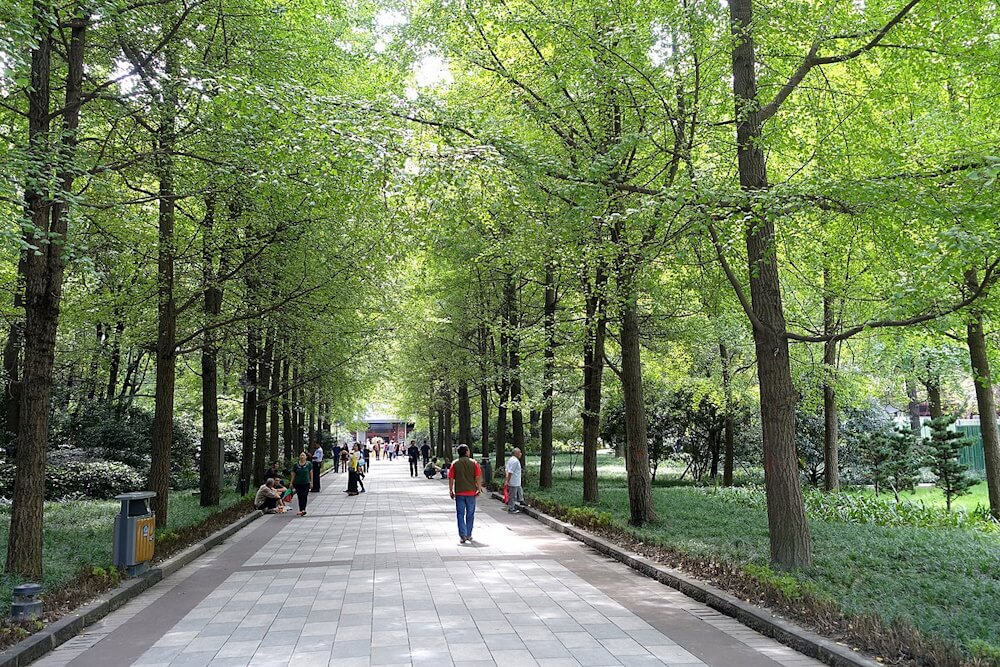
Photo: Creative Commons
Hyperlane is a 2.4 kilometre multi-level linear sky park, youth culture and lifestyle destination at the heart of the Sichuan Conservatory of Music University in Chengdu. “It is a vibrant and fun youth, music and life oriented linear space, linking the local transportation hub with the university community and campus in Chengdu. The Urban Gallery, the initial phase of the project, has recently opened. Hyperlane is invested, built, and operated by the core team that once operated Chengdu Taikoo Li project. Sixty percent of the commercial products are self-sustaining, adhere to the long-term business philosophy, provide professional support, and realise long-term commercial value.”[11]
Crescent Park, New Orleans
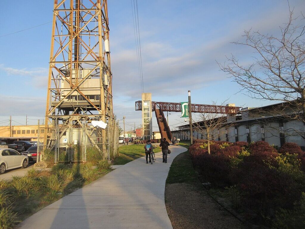
Photo: Creative Commons
“Crescent Park was designed to reconnect people with the river and transform the remnants of the city’s industrial and maritime past into a verdant, accessible, community asset.” The project was provoked by Hurricane Katrina which offered an opportunity to reevaluate a languishing stretch of waterfront and reflect New Orleans’ unique character, unusual street grid, and historic architecture.
The Park grants unparalleled physical and visual access to the river, creating an environment for people to interact and promote a healthy, active lifestyle with unrivalled vistas of the city skyline and the picturesque Crescent City Connection Bridge. This linear park includes 20 acres of indigenous landscaping; a network of paths for walking, jogging, and biking; picnic areas, a dog park, and the adaptive reuse of two industrial wharves: the Piety Wharf and Mandeville Shed. Both structures have been stabilised and repurposed to accommodate public gatherings, festivals and art exhibitions throughout the year.[12]
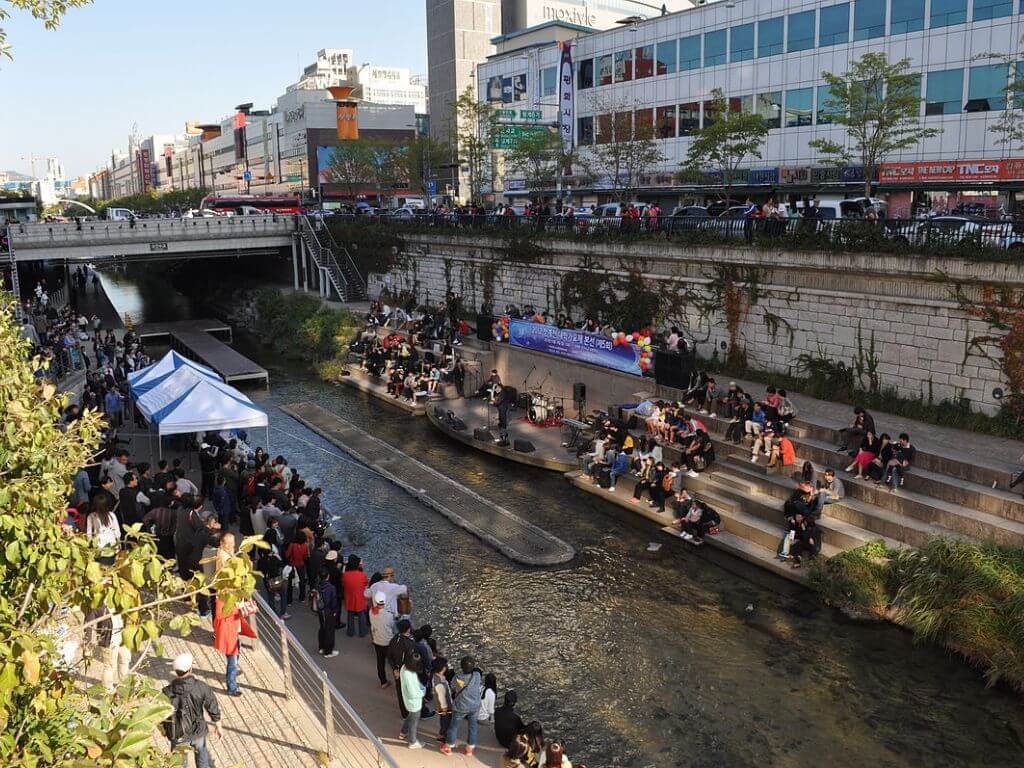
Cheonggyecheon Stream Restoration Project, Seoul
Seoul is in the process of a paradigm shift in its urban landscape, recognising the importance of functioning ecosystems. By demolishing an elevated freeway and uncovering a section of the historic Cheonggyecheon Stream, the restoration project created both ecological and recreational opportunities along a 3.6-mile corridor in the centre of Seoul. “The project has proven catalytic, spurring economic growth and development in an area of Seoul that had languished over the last several decades.”[13]
Cheonggyecheon is an urban intervention with far-reaching significance for the city as a whole, as the project is more extensive than the linear park. “Environmentally, the restored waterway and plantings have changed the ecology along its banks and have affected the climatic conditions in the city centre. Economically, the Cheonggyecheon has stimulated business activity in the surrounding area and, for the first time in Seoul’s modern history, effectively linked the north and south of Seoul while reducing traffic pressure on the central business district by increasing the transportation capacity of buses and subways.” The project shows that coordinated urban design can catalyse economic development, reinforce connection with the natural environment, and improve the quality of the urban condition for residents and visitors alike.[14]
Madureira Park, Brazil
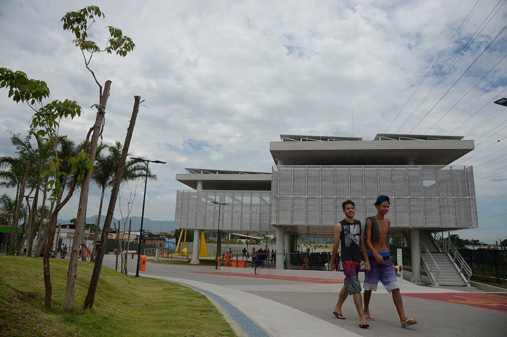
Photo: Creative Commons
Launched in 2012, the large Parque Madureira has soccer fields, basketball courts, ping-pong tables, a bike path, Brazil’s largest skate park, an arena, a public square for samba, a public information technology centre, an artificial beach, and an open-air gym.[15]
The park became a space for social encounters and public gatherings. It houses several open sport and leisure spaces which range from soccer and bocce ball courts, gym exercise areas for the elderly, an open public gym, ping pong tables and bike lanes with public bike stops. There are also cultural quarters. The Praça do Samba, or the Samba Square, is one of the greatest open air stages in the city. There is also a centre for environmental education. The ‘Madureira beach’ is also an important attraction, as is the skate park, one of the largest and most diverse skate parks in Latin America.
The sustainable aspect includes green roofed buildings, wildlife rehabilitation, planting over 800 trees and 400 palm trees, solar panels to supply for the park’s energy consummation, an efficient residue and waste management, water reuse system, permeable paving and the use of LED lamps for public lighting.[16]
Cover photo: Live music on Cheonggye Stream, near Dongdaemun market. Photo: Schellack/ Creative Commons