Circa 1341. It was the year when the Periyar River, in present-day Kerala, is said to have altered the geography of Kochi in a cataclysmic flood that gobbled up large areas of land, yet formed many new islands with the silt it carried down from the mountains. After this massive flood, the ancient port town of Muziris that had trade relations with Europe and is depicted in several antique maps, vanished from the face of the earth.[1] The lure of the fragrant spices ended thus. The flood waters are said to have breached extensive land mass and opened the Kochi estuary and harbour, as they are known today. The island of Vypin rose out of the Arabian sea that year.
However, extensive historical records do not exist except for accounts by foreign travellers.[2] The understanding comes mostly from the geological studies in Vypin and Fort Kochi, and the archaeological excavation findings in the stretch from North Paravur to Kodungallur and especially Pattanam, which historians believe is the long-lost bustling town of Muziris.[3]
Periyar River, the longest in the state at 240 kilometres which originates in the Western Ghats and empties partly into the sea and partly into the backwaters, flooded massively once again in 1924. This flood also led to an extensive death toll and destruction. For many, the documented accounts of the 1924 flood came to life in 2018 when the river, in all its fury, submerged vast areas of Kochi, especially its northern parts. Since then, intense rainfall in July and August causes panic here.
The Periyar River has the most number of dams and barrages in the state – 19 including the grandmother of all dams, the 126-year-old Mullaperiyar, made with Surki – a burnt brick powder – and limestone. There have been demands to decommission the dam ever since IIT-Roorkee[4] and IIT-Delhi, in independent studies, found that the dam was structurally weak and may be vulnerable to damage in case of an earthquake or a huge deluge.[5]
Tidal floods bring misery too
However, the phenomenon of heavy floods which last for days or a week is not the same as the tidal flooding which causes an almost year-long misery for the residents of coastal areas and islands of Kochi. Tidal floods wreak havoc too. A phenomenon that was limited to the Malayalam month of Vrishchikam (mid-November to mid-December) – locally known as Vrischikapokkam – now extends to April; in some areas like Puthenvelikkara and Kumbalangi, tidal flooding lasts throughout the year.
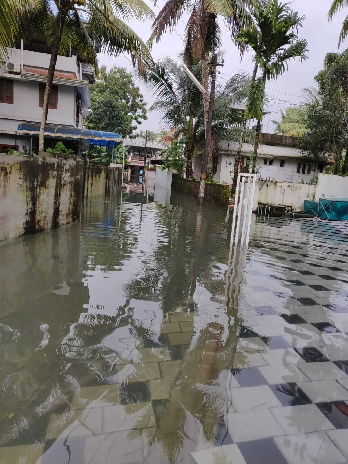
Sea-level rise, along with land subsidence, are driving residents out of their homes to become climate refugees on the mainland and elsewhere, which this writer saw and others have documented.[6]
Those who can afford to migrate, did so, but many rice farmers and fisherfolk who have been living here for generations have nowhere to go. “We thought we in Puthenvelikkara were the most affected until we got to know the situation in Vadakkekkara, Ezhikkara and Kumbalangi,” said Rosy Joshy, Puthenvelikkara panchayat president. As many as 20 panchayats and two municipalities have been affected by tidal flooding in the last decade.
Often sandwiched in the narrow stretches of land between the sea and the Vembanad Lake, people have to wade through knee-deep or ankle-deep water in some areas to reach their places of work and study, fight skin diseases caused by the constant presence of dampness in their homes, besides finding money to repair the houses. Tidal flooding which used to happen for only two months now stretches across 10-12 months. “There has to be scientific solutions to the structural damages of the houses caused by tidal flooding,” said KG Sreeja, research director at Equinoct, a non-profit which provides science-based solutions to the many challenges of Climate Change, especially tidal flooding.
Tidal flooding has become more severe and frequent as a result of Climate Change around the world.[7] On Kumbalangi island, famed for Chinese nets and termed the model tourism village, flooding happens twice a day, every single day of the year. At least 300-400 houses in the Puthenvelikkara panchayat are inundated almost every day in a year. “Basic necessities are an issue here, the residents are not even able to use the toilets,” said Rosy Joshy. They initially tried to resist the flow with sandbags and mud banks, but the water that came over the top of the sandbags did not exit, and stagnated in the courtyards and houses. The panchayats had to give up.
While the state government remains in denial, Equinoct along with Tata Institute of Social Sciences (TISS), MS Swaminathan Research Foundation and the local bodies joined hands to push decision-makers to consider measures such as involving local communities, including Kudumbashree workers, in floodplain mapping and planting mangroves as a buffer against flooding and high tide waves[8]
When the sea swallows homes
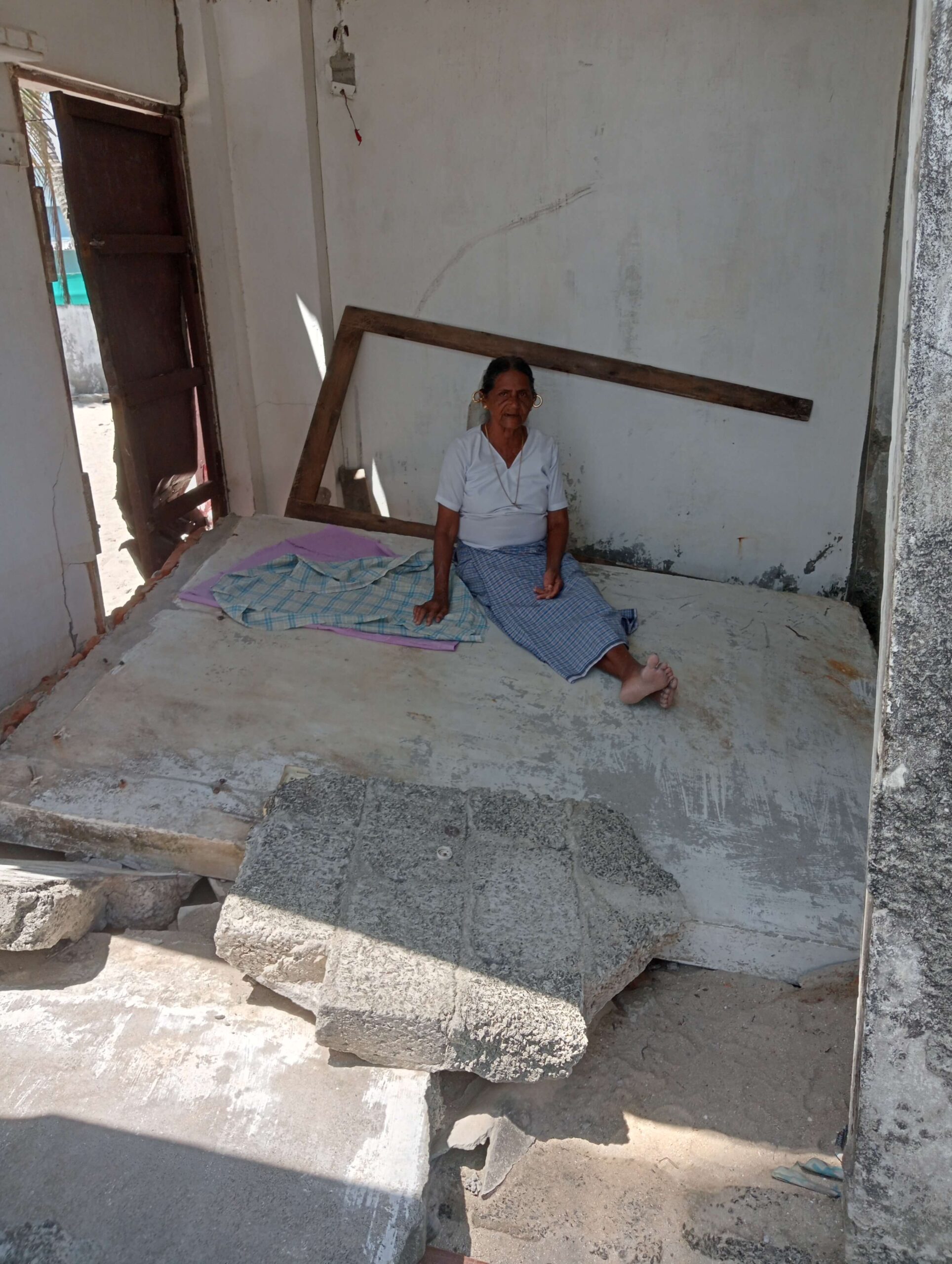
On the western side of Kochi city, there is not a lane where you do not hear the whispers of the sea. What are murmurs of the waves from a distance turn into a roar near the shores as tide after tide crashes on the seawalls made from rocks and boulders. A hundred odd feet away, on the crashed wall of her house sits Victoria, 89, looking into the sea. She does not live here anymore but comes every morning, reminiscing about the good old days in the house. The sea barriers block her view but she knows that the day is not far off when the sea wall will force its way in like last year. True to the fear of residents here, this year too, the sea crashed into their houses in late July.
The Chellanam-Cherai stretch of the coast – of which Kannamali is a part of – has been bearing the brunt of huge sea surges in the past few years. Victoria, who has lived there for over 60 years now, says that tides coming in is not strange but the sea water creeping into houses during the rainy season is. Furious waves thrash over the sea walls and, then, the roofs of the houses.
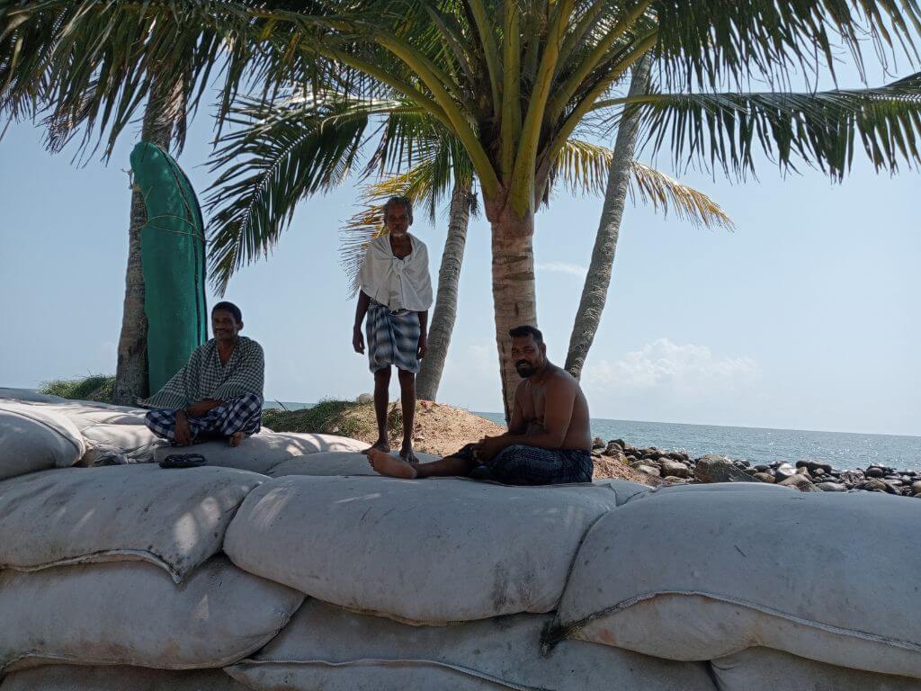
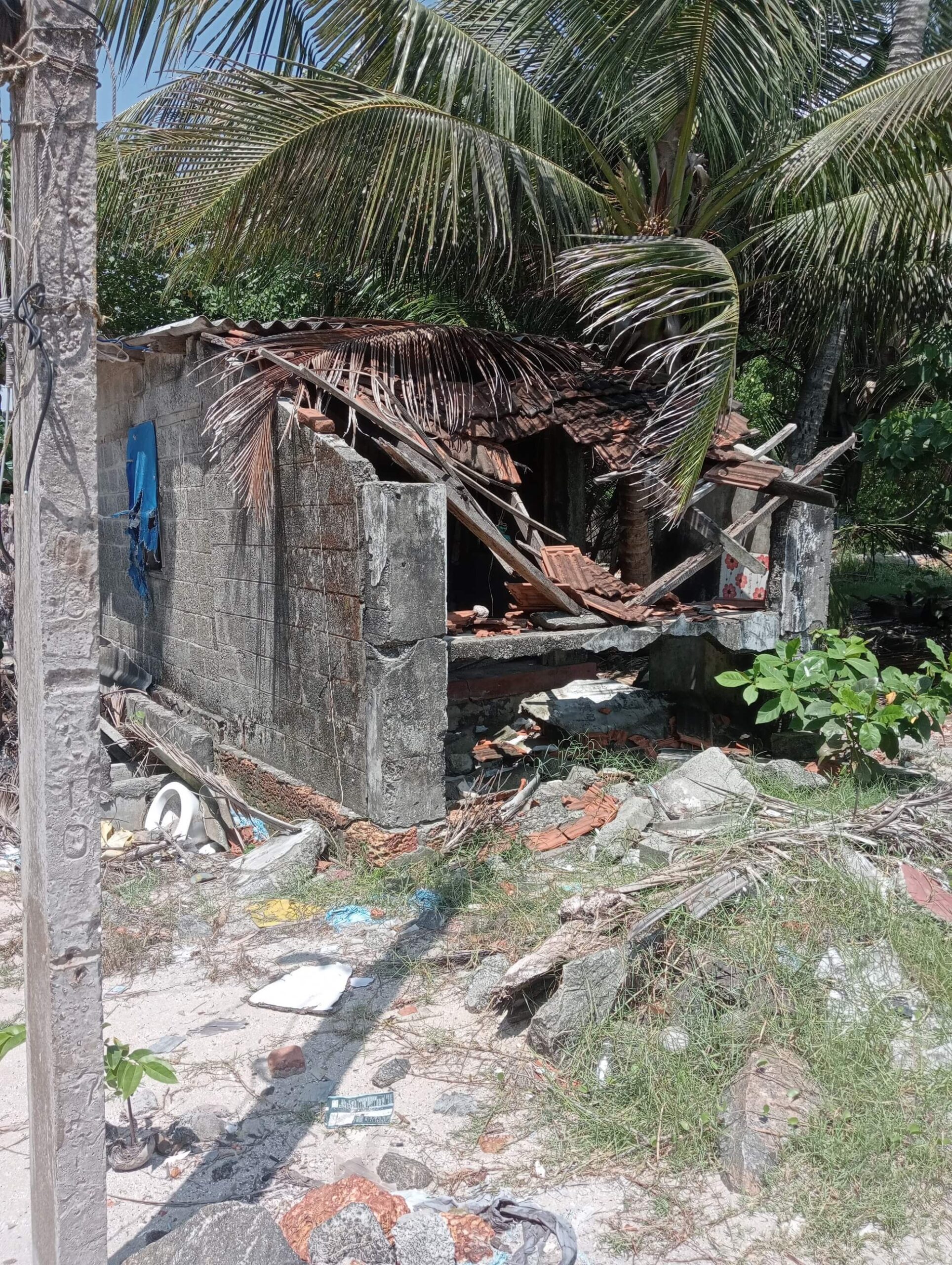
With the temperatures soaring and monsoon gathering steam, anxiety is at an all-time high among the fisherfolk who predominantly inhabit Kannamali. Ajayan, Babu and Vinson, pointed to the ghostly white geo-tubes (essentially sand-filled geo-textile sacks to block the waves) on the shore saying, “where the tubes are now, there were five houses till last year.’’ In one of those houses was a bed-ridden boy recovering from a motor accident. “Fortunately, we could save him,” said Ajayan. The houses were swallowed by the floods.
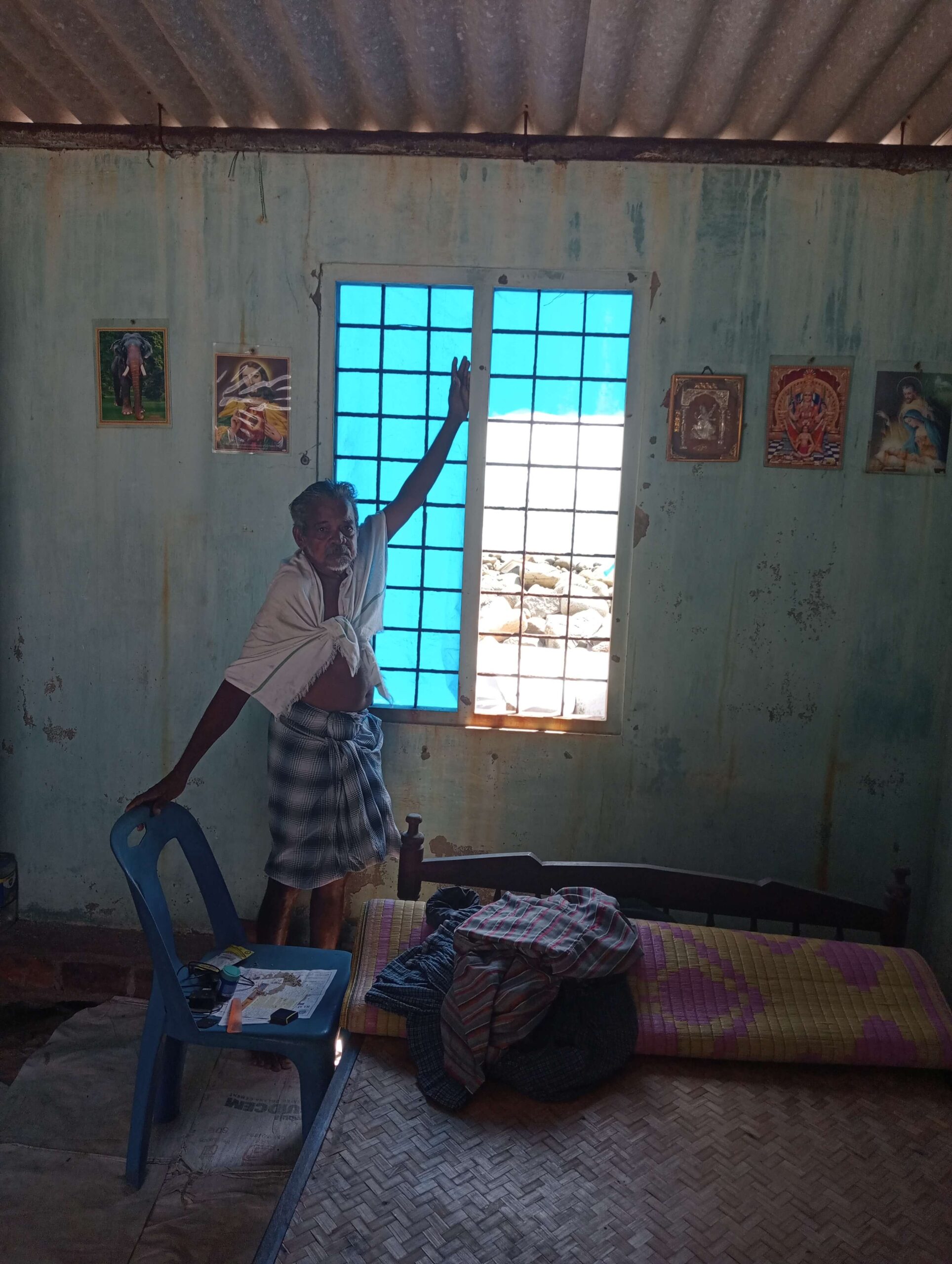
Building houses requires savings of a couple of generations; the strong sea waves wipe them off in only a few hours. Most houses collapse, unable to withstand the erosion of the soil beneath, like that of Thankachen’s. He had lived in his newly-built house for two months when the sea lashed its walls and destroyed it. For the past two years, he and his family have been living on rent even as their house rotted on the seafront. Like Victoria, Thankachan too comes to his destroyed house every morning to watch life pass by. Next door, Unnikrishnan’s red-oxide floor in the kitchen is perfect, but the floor in bedrooms and living room have been literally taken away by the sea leaving huge craters.
Warning signals
Old-timers here say when sea waves are blocked at a location, the south of that area is safe while the north becomes vulnerable. “Now that the government has put up tetrapods in South Chellanam, the stretch from Kannamali to Fort Kochi with no tetrapods has become vulnerable,” said Suja Bharathi, a coastal protection activist. While panic-stricken coast-dwellers of Kochi watch out for warning signals such as strong wind or change in the sea colour, others are worried about stormwater flooding and waterlogging for days. The rainwater mixes with filth before entering houses and courtyards, often polluting the underground water storage tanks too. Low-lying areas are the worst affected with residents forced to shift to temporary shelter camps.
As in any urban area expanding beyond its seams, floods in Kochi too can be traced to changes in land-use patterns. Where wetlands and paddy fields stood many decades ago, high rise residential and commercial establishments now do. The concrete does not permit the rainwater to permeate into the ground. Water has no place to go, not even to the drainages and canals that crisscross the heart of Kochi.
The high rises should be encouraged to make available more unbuilt area which will allow the rainwater to percolate to the ground, said May Mathew, founder of Centre for Environmental Efficiency and former retired senior town planner at the Greater Cochin Development Authority (GCDA), “Tax incentives should be given to those who are containing their stormwater and wastewater.”
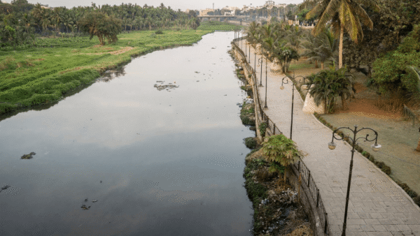
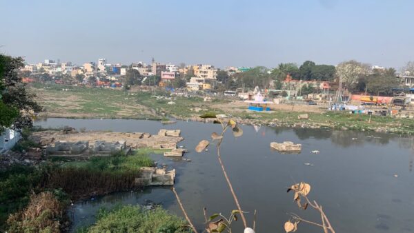
The flow of water through the channels like Mullassery Canal, Thevara-Perandoor canal, Karanakkodamthodu, Koitharathodu, Edappallythodu, PoorniPuzha, Changadampokthodu, Khareethodu and Punchathod is blocked due to many reasons, including encroachments, according to a study by Subha V, professor of civil engineering at the Cochin University of Science and Technology (CUSAT). Subha and her students found that domestic and plastic waste, and construction and commercial establishments’ waste all ended up in the canal network, drastically and visibly reducing the width, depth, flow and carrying capacity of the canals.
Several canals are covered with concrete slabs and converted to footpaths, roads or even streets with make-shift shops for shoes and clothes. “It is not easy to solve the problem of encroachment when both private and government establishments are at fault. For change to happen, you need proof; and when collecting proof itself is made impossible, there is little you can do,” said CG Madhusoodhanan, chief executive officer at Equinoct. While covered canals prevent dumping of garbage, it also makes cleaning difficult; many waterways once wide enough to carry the surface run-off have now become non-functional.
The Thevara-Perandoor canal, running nearly 11 kilometres, was once used for transporting goods and also played a significant role in flood alleviation till the Kottayam-Ernakulam railway line bisected it. Certain segments of the canal have excessive amounts of silt, construction and domestic waste; others are brimming with aquatic weeds. All of them block the natural flow. “We found that this canal which is 13 meters wide at Thevara is just 3 metres or less in Kaloor,” which is just six kilometres apart, said Subha V. The team suggested that the canal network can be made functional by desilting, sidewall protection, induced flow generation and providing alternatives to dumping of solid and liquid wastes, besides setting up sewage treatment plants and a sewage network.
Cleaning drives
Meanwhile, the state government has initiated cleaning drives codenamed Operation Breakthrough and Operation Vahini to clear sediments and blockages in the water bodies. As many as 179 small canals and streams were cleaned under the first phase of Operation Vahini and the ongoing second phase is expected to facilitate water flow in 38 water bodies including Manjaly Canal, Edappallythodu, Muttar River and Kaipettippuzha Canal.
Twelve machines have been deployed to remove silt and weeds. The Kochi Metro Rail Limited (KMRL), which faced the accusation of improper drainage systems contributing to the flash floods in the city in the previous years, was quick to respond by providing pipes down the metro pillars to the drains on the road below, so that there is no overflowing or water spills from the viaduct.
If sedimentation and siltation cause water-logging in residential areas like Panampilly Nagar, Maradu, Thripunithura and Gandhi Nagar, the illegal encroachments and diversions of channels in Kalamassery and Manjummal cause water logging. With its proximity to the Periyar River and its tributaries, Kalamassery witnessed unprecedented floods in 2018. “I had water up to my chest, inside the house that year. We lost all furniture made of plywood, so the next year we were better prepared and kept all beds raised and all documents at a height,” said Annies George, a resident of Kalamassery. But by 2020, she and her husband P.P. George had enough. They decided to raise their house by four feet. It meant new flooring and plumbing, fresh plastering and painting, but the elevated house is now flood-proof. Many houses in the low-lying areas of Ernakulam and neighbouring Alappuzha have been thus elevated after the once-in-a-century flood of 2018.
Circa 2023. The monsoon made a late entry and June witnessed no heavy spells. In July too, there was a deficit. But the shadow of previous floods, especially of 2018, looms large because of the tendency of the south-west monsoon to reveal its fangs in August. In 2018, there was 180 percent excess rain in August; the following year saw an excess of 13 percent by the end of September and, in 2020, several intense short spells through August made up for the deficit till then. Temperatures are soaring this August and the water levels in the dams are dipping. Will intense rain spells hit Kochi – and Kerala – triggering floods and worst memories? Hopefully, the lessons from the past can guide them through it all.
Reema Abraham is a science journalist with over a decade’s experience in print media. Recipient of the national award for science communication, Government of India, and also the Green Journalist Award by the Government of Kerala, Reema is passionate about environmental issues.
Cover photo: Ajayan, Babu and Vinson, on the sand-filled geo-textile sacks.
Photos: Reema Abraham

