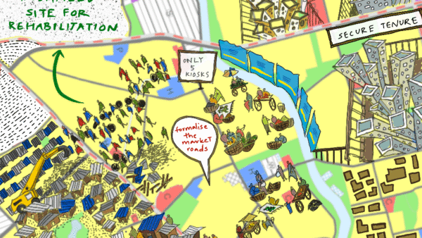

Less than 30 percent of India’s cities are formally planned, according to NITI Aayog (2021). Goa is an exception. Vasco-da-Gama (1752) and Panaji (1776) were among the earliest planned cities in India (Faria, 2007). By the late 20th century, Goa had prepared not only Development Plans for its main towns but also a Regional Plan with zoning across the state’s landmass. It represents a rare case of longue durée planning in India; longue durée, in French, literally means “long duration” and refers to an approach focused on slow, long-term social, geographic, and environmental structures.
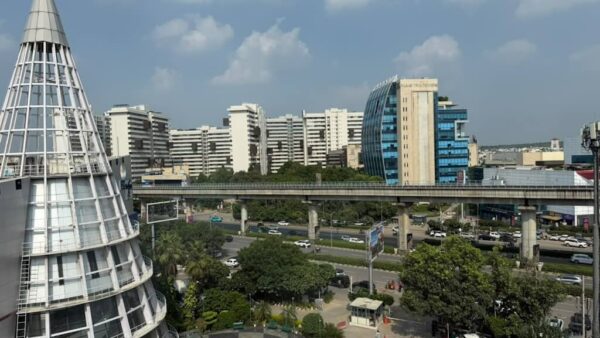
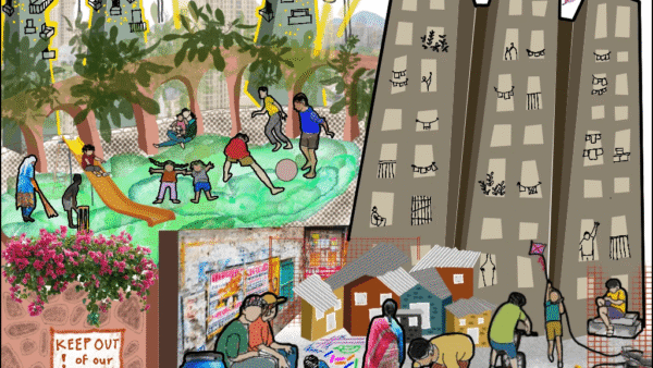
Between the historic city centre and the ‘alternate urbanity’ that is characteristic of rural Goa[1] (Da Silva, 2024), the city edge looks unorganised. Tall buildings rise besides paddy fields. Luxury gated colonies appear in fishing villages. The roads and infrastructure struggle to keep up. A spectator may attribute this uneven urban form on the periphery to squatting and illegal construction. Teresa Caldeira and James Holston (2008) caution that peripheral landscapes cannot be understood simply through a bird’s-eye narrative of urban disorder; urbanisation is “superimposed, multilayered, entangled, and contradictory.”
In Goa, a closer look shows that the apparent disorder is neither informal nor illegal. All the ‘uneven’ buildings carry a full set of permissions, sanctioned by the state. This essay argues that the apparent disorder of Goa’s urban periphery is the product of planning through an incomplete instrument called the Outline Development Plan (ODP).
The idea that Indian cities can be governed through plans emerged from a post-independence faith in comprehensive planning. Mapping and zoning became the principal instruments to order a rapidly changing city. In his account of Delhi’s urbanisation, historian Ravi Sundaram notes the role comprehensive planning played in the formation of a post-independence capital city: “The Masterplan-zoning-law triad [along with land assembly]…provided a visual and geographical device to interpret a new post-colonial Delhi…but also staked [the planners’] claim as the legitimate, technical guardian of that vision” (Sundaram, 2009: 48).
Goa adopted the language of comprehensive planning but not the practice. The Goa Town and Country Planning Act, 1974 envisioned a hierarchy of planning instruments. Regional Plans guide the long-term development at the state level, Comprehensive Development Plans (CDPs) grounded in studies of population, infrastructure, environmental, urban design and implementation strategies, provide detailed local frameworks. Outline Development Plans (ODPs), by contrast, were conceived as temporary measures to regulate development until more CDPs could be prepared (Government of Goa, 1974). The cases of Sancoale, just outside Vasco, and Poder-Dando in Panjim, show how ODPs have enabled long-term decisions about ecology, infrastructure and livelihoods without the evidence, participation, or design obligations expected of comprehensive plans.
Why do we even have interim plans?
The origins of the ‘outline’ or ‘interim’ plan lie in the fact that often, cities grow faster than plans can be prepared. Planning, as a concept, emerged in the 1950s. Post partition, Delhi was transforming quickly. Demographic data was not available, the new nation state was still assembling land, and new colonies were appearing, but mapping and studies would take years. The Interim Plan was a stop-gap mechanism. It allowed planners to regulate critical land-use decisions in the present while data could be gathered for a more comprehensive planning exercise.
By the 1990s, spurred by a boom in tourism (Da Silva, Nielsen and Noronha, 2026), rapidly urbanising coastal settlements in Goa needed a quick planning device. The Goa Town and Country Planning Act, 1976, (GTCP Act) empowered state planners to identify broad land use zones and regulate development in the interim via ODPs. Goa’s ‘master’ plan was the Comprehensive Development Plan. By law, this needed to identify projects, establish urban design guidelines, set out transportation and traffic circulation programmes for the present and future, and identify all current and future amenities, services and utilities.
The Act also stipulated that ODPs should be turned into CDPs “as soon as may be, and no later than three years”. In practice, this did not happen. Instead, the ODPs were repeatedly extended and revised. Why? A part of the explanation lies in law. There were no statutory consequences for failing to prepare a CDP. In the High Court, the Government of Goa explicitly acknowledged that it was in default of the law, but noted that “the Act does not contemplate any consequences for non-preparation of the Comprehensive Development Plan” (Pandita, 2020: 52). The problem arises when provisional temporality becomes the permanent mode of planning.
When describing peripheral urbanisation in the Global South, scholar Gautam Bhan asks us to recognise practices that “measure [themselves] against limited temporalities” and “move forward incrementally” as possibilities for state action, including “policies, programmes and plans.” (2019: 645) But legal amendments alone cannot explain the persistence of ODPs. Permanent temporality also proved politically useful to developers and politicians. Preparing a CDP is an expensive and time-consuming exercise requiring surveys, projections, environmental studies and difficult political choices of where growth should occur. An ODP demands much less; a land-use map is sufficient.
When Interim Plans meet physical ground
Governing through interim plans or ODPs has ecological and livelihood consequences, as Mormugao and Panaji illustrate.
Sancoale, Mormugao
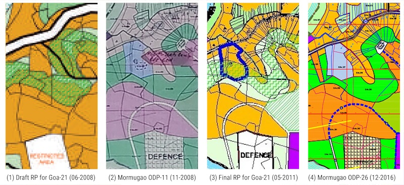
Since 1995, all hill slopes in Goa have been regulated under Section 17A of the GTCP Act. Land steeper than 25 percent gradient is defined as “no development slopes” (NDS) and cannot be developed. Yet, the state Town Planning Department decided in June 2008 that the village of Sancoale, around 14 kilometers from the municipality of Vasco-da-Gama (now Mormugao), should be brought into the Mormugao Planning Area. The Mormugao ODP was revised to incorporate Sancoale that November. This was done even as the Regional Plan for Goa, 2021, was being finalised.
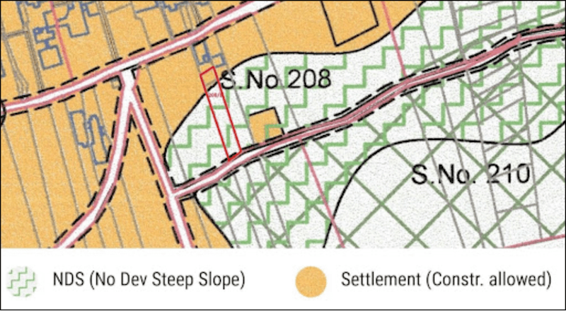
A perusal of the two plans offers an interesting finding. The draft Regional Plan maps all 25 percent (+) slopes in Sancoale and recognises them as NDS but the ODP shows these as ‘Natural Reserve’, ‘Residential’ and ‘Commercial’ zones. Given its new status as a planning area, Sancoale no longer fell within the ambit of the regional plan. Instead, it stated about eco-sensitive zones: “Such zones are indicated in a separate index over the proposed developable zones…It shall be enjoined upon the Government and the Planning and Development Authorities (PDAs) to review such zones for restoring Eco Sensitive Zones” (RP-21, 2011, Release 3, p.4).
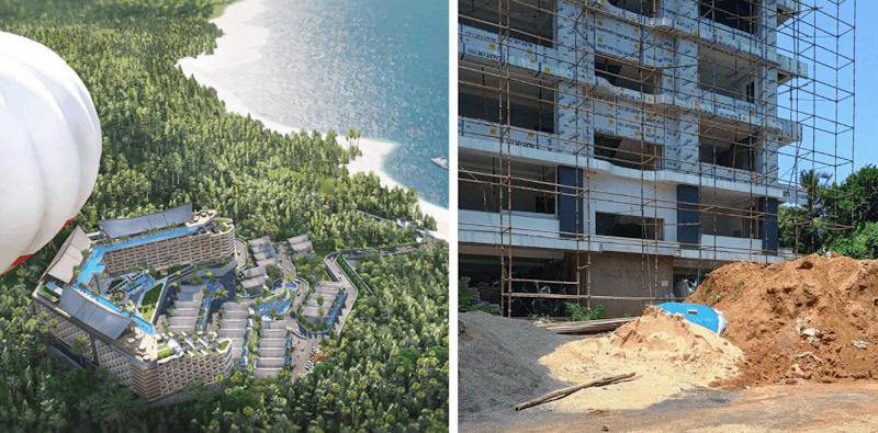
To date, the Mormugao ODP has been amended four times, in 2011, 2016, 2021, and a draft is out for public comments in 2026. Across these iterations, the statutory NDS markings never appeared on the Sancoale slope. In August 2025, a construction company obtained permission to erect a gated township on the northern slope of Sancoale. The project comprises more than 1,000 apartments, 70 villas and hundreds of private swimming pools. The consequences of governing through an interim plan are now physical in the periphery of Goa’s oldest planned city. Land identified as a statutory no-development slope became available for urbanisation without addressing questions that a comprehensive plan should have: Can the water supply meet the demand of these pools, will the traffic overwhelm the 5-metre access road to properties, should construction occur on this slope at all? The ODP allows development to proceed in the present while comprehensive planning is perpetually deferred.
Poder-Dando, Panjim
The consequences are equally visible in the fishing village of Dando, situated within the capital city of Panaji. Here, the issue is more specifically one of livelihoods and everyday life.
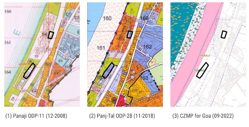
The CRZ Notification of 1990 had put a moratorium on all construction between 0-200metres from the High Tide Line; the fishing hamlet of Dando fell within this statute. Yet, one hotel was constructed, with permissions allegedly obtained pre-1991, after which neighbours ensured that no new construction could come up. This included marking their neighbourhood as a low-rise, fishing/farming ward (R4) in the ODP of 1999. In 2011, the CRZ Notification was amended to give ‘special consideration’ to Goa. In fishing wards falling in the CRZ, descendants of fishing communities obtained privileges to construct and reconstruct their residential structures. In 2017, the state undertook an exercise to revise its Coastal Zone Management Plan (CZMP)and mapped the high-tide line. It was shifted 39 metres seaward. As a result, conveniently, Dando fell outside the CRZ.
When the Panaji and Taleigao ODPs were revised in late 2018, for the first time since 1999, Dando was re-zoned. The 2018 Panaji-Taleigao ODP-28 showed two parcels in Dando re-classified from fishing/farming ward (R4) to CBD-Commercial. One is owned by a company allegedly linked to a sitting cabinet minister. The rest of Dando remained R4. In September 2022, the final Goa CZMP confirmed the exclusion of this parcel from CRZ while simultaneously marking all of Dando in the ‘hazard zone’.
In 2023, a 13-storey apartment building was permitted in this old fishing village. When constructed, it will become Panaji’s third tallest building. All the fishermen who still live in the area are upset. For the people of Dando, the plan failed them. Dando also complicates what we mean by an urban periphery. This is a fishing settlement surrounded by the planned city, transformed by formal construction. One influential private company was able to make decisions about the future of the neighbourhood and have them inscribed onto the landscape through the interim ODP.
Why is it possible under an ODP?
Both Sancoale and Dando point to a similar institutional question: Why were these decisions made through ODPs?
The answer lies in the different burdens of proof imposed by the two instruments of planning. While law requires CDPs to justify its land use prescriptions, an ODP requires no such evidence. The planner can designate or re-designate land uses but is not required to demonstrate that roads, drainage, public transport, water supply or ecological systems can support the decisions.
A project like the township in Sancoale raises obvious questions about access, water demand, and hillside stability. Likewise, Dando raises questions about sea-level rise, infrastructure capacity, the future of fishing livelihoods, and the rule of law. The CDP mandates such questions to be a part of the planning exercise; in the ODP, they remain external and unaddressed to the benefit of developers and their political masters.
Conclusion: Unfinished plans
The case studies of Sancoale and Dando reveal the paradox in Goa’s planning trajectory. As villages on the edge and older neighborhoods within cities are formalised for urban development, they acquire the unevenness that’s characteristic of the urban periphery. The ODP was conceived as a temporary instrument. Instead, it has become the principal means through which long-term land-use decisions are made without regard to livelihoods and ecology. The provisional plan thus has permanent effects on the ground.
I do not argue for a return to rigid master planning but show that Goa’s experience demonstrates how flexibility in planning, without evidence, can be as problematic as comprehensive planning without participation. The challenge is, therefore, to institute a planning process capable of combining ecological knowledge, local participation, clear enumerated projects, and a spatial vision. I hope this could constrain the influence developers and politicians currently hold over shaping our cities.
To make the interim a little robust requires recovering the principle originally imagined in the Act. State planners must prepare Comprehensive Development Plans for existing urban areas. Local governments, fishing communities, and villagers must be allowed to participate in identifying areas suitable for growth and areas that should remain protected. The interests of residents, particularly marginalised communities, must be prioritised. Equally, Goa’s ecological features such as slopes, wetlands, flood zones, and coastal systems must be mapped before development potential is assigned, not afterwards. Planners must justify urban futures through evidence. The promise of the Comprehensive Development Plan was “normative administrative function, guided by science and operating on the entire population” (Sundaram, 2009: 36). Fifty years later, that promise remains unfulfilled.
References
- Bhan, Gautam. 2019. “Notes on a Southern Urban Practice.” Environment and Urbanization 31 (2): 639–54.
- Da Silva, Solano. 2024. “The Making and Unmaking of Goa’s Unique Alternative Urbanity”. Question of Cities, November 15.
- Da Silva, Solano, Kenneth B. Nielsen, and Tahir de Noronha. (2026). ‘From barren to beautiful’: land fictions on an Indian tourism frontier. Globalizations, 1–21. https://doi.org/10.1080/14747731.2026.2654345
- Da Silva, Solano, and Tahir de Noronha. 2026. “Planning for Chaos: Goa’s Land Use Planning-II.” In Fish Curry and Rice: A Source Book on Goa, Its Ecology, and Life Style, edited by Claude Alphonso Alvares. Goa Foundation. 5th revised ed. Ocotillo Bloom.
- Faria, Alice Santiago. 2007. “Pangim between the Past and the Modernity. Building the City of New Goa, 1776-1921.” Murphy – Revista de História e Teoria Da Arquitectura e Do Urbanismo (Coimbra) 2: 66–92.
- Ghorpade, Maitreya P. (n.d.) “In Water-Stressed Sancoale, Locals Protest Bhutani Project with 700 Swimming Pools | South Goa, .” Land Conflict Watch. Accessed June 2, 2026.
- Goa Town and Country Planning Act, 1974, Pub. L. No. Goa Act 21 (1975).
- Holston, J and Teresa P. R. Caldeira. 2008. “Urban Peripheries and the Invention of Citizenship.” Harvard Design Magazine 28, 18-23.
- Kumar, Ashok, Sanjeev Vidyarthi, and Poonam Prakash. 2020. City Planning in India, 1947–2017. Routledge India.
- NITI Aayog (2021). Reforms in Urban Planning Capacity in India. 2021.
- Pandita, Rajinder K. (2020, September 17). [Affidavit in Reply of Respondent No. 10] in Edgar Ribeiro v. North Goa Planning and Development Authority (No. PILWP 10/2019, High Court of Bombay at Goa).
- Sundaram, Ravi. (2009) “A City of Order: The Masterplan.” In Pirate Modernity: Delhi’s Media Urbanism. Routledge
- Times News Network. 2024. “Bhutani Project Exposes All That’s Wrong with Goa Planning: GBA.” The Times of India, October 28.
Tahir Fernando de Noronha is an architect, regional planner. He is a PhD Candidate of City and Regional Planning at the University of California, Berkeley. His research areas are planning law, local knowledge, the real estate industry, and land use, within the context of second homes and climate change.
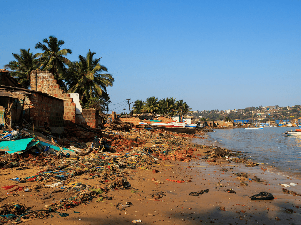
Cover photo: A beach in Vaddem, Vasco da Gama, Goa; Credit: Wikimedia Commons