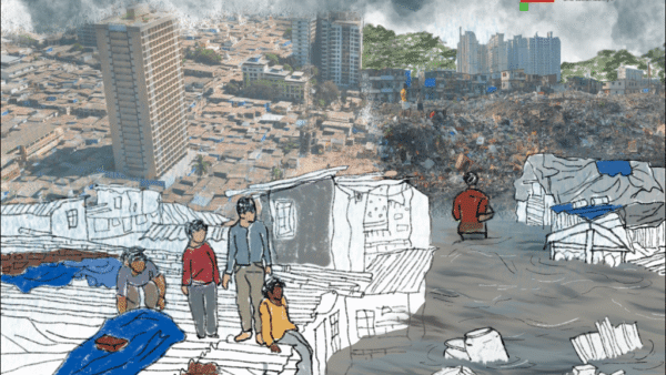
On June 21, as the Municipal Corporation of Delhi demolished 350 slum tenements, or jhuggis, in the makeshift block near Metro Vihar along the Yamuna bank, the river swelled and flooded the plains. Forty-five-year-old Indu Devi recalled a similar life-changing morning 15 years ago. “That flood took my daughter’s life,” she whispered. While securing her few worldly possessions, she came upon the lifeless body of her then eight-year-old daughter, Saloni. As she cradled the body at a nearby shelter in heart-wrenching grief, Indu Devi realised that the flood had also robbed her of a cherished photograph of her daughter.
Indu Devi and her community from Bihar, who have lived on the Yamuna floodplain for decades, somehow salvage their meagre belongings when the water rises or demolition squads come. Every monsoon comes with its share of uncertainty and threat. However, on the Yamuna floodplain, structures such as the Commonwealth Games Village and the Akshardham Temple, among others, have been built over the last few years against court orders, structures which do not invite any demolitions, as this report points out.[1]

Photo: Sejal Patel
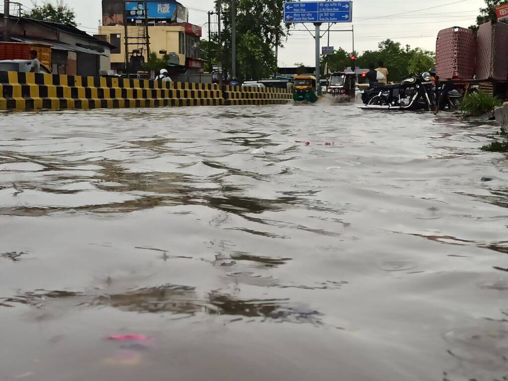
About 30-35 kilometres away, in Gurugram’s Sohna Road, 21-year-old college student Disha Ivne found herself stuck in a piquant situation too. “I missed my final semester exams that day as we ran to save our livestock,” she narrated to Question of Cities. She still remembers the deadly flood of 2018 which submerged nearly 38 areas identified by the Municipal Corporation of Gurugram.[2] “This is a no-man’s land, daily wagers suffer the most,” Ivne says. Every year, when it threatens to flood, residents of Sohna Road slums move to a temporary shelter, only to be removed by the municipal corporation. Even for people better off than Ivne, floods present a host of issues. Jonathan Immanuel, a resident of DLF Phase 2, says, “It doesn’t require much time for the roads to get waterlogged when it rains. This causes traffic snarls.”
Gurugram, the newly-built city with a buzz featuring tall towers and swanky complexes, floods every year without fail. This year too, the city flooded when it rained in late March and then again on the last Sunday of June when several arterial roads and junctions were inundated and followed by long power outages. Environmentalist Vaishali Rana Chandra, living near the Badshahpur drain for the past 10 years, has seen it flood every year and watched the local administration concretise drains on the pretext of restoration. “This stops the stormwater from seeping in,” she said. She had filed a case against the concretisation of the 28-km-long drain. “The promise was to increase the water-carrying capacity of the drain. But irresponsible construction has narrowed the drain, even smaller sewers have been covered.”
Urban floods, distinct from rural floods, disrupt a large number of lives and livelihoods besides damaging thousands of crores worth of physical infrastructure. For people like Indu Devi and Disha Ivne, floods also bring added threats to their fragile lives – the loss of their home and meagre possessions, the challenges of facing demolition squads, the uncertainty of temporary shelters, and so on.
Why does a planned and newly-built city like Gurugram flood the way it does – does planning not consider flooding? How has the crucial Yamuna floodplain been abused?
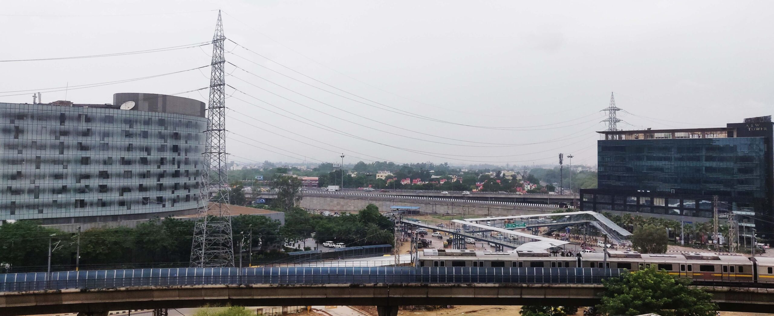
Photo: Creative Commons
Traversing the Yamuna
During the monsoon in August last year, sections of the Yamuna floodplain were inundated in low rainfall; the flood was attributed to obstructions caused by an under-construction bridge – one of the many. “Overall, there are 22 existing bridges on the 22-kilometre stretch of Yamuna in Delhi including three barrage-cum-bridges, six double-lane and one single-lane road bridge, four metro and two railway bridges. Moreover, two double-lane, one metro and one railway bridge are under construction, which means in the coming years there will be 28 bridges on the limited stretch of the river. While these have facilitated vehicular mobility, they have (also) narrowed down the width of Yamuna and altered flooding pattern of the river in Delhi,” observed this essay.
The Yamuna has played a crucial role in shaping the landscape and influencing lives of millions in New Delhi and Gurugram besides Agra and Mathura. The river has been a lifeline for centuries, irrigating land and supporting ecosystems[3] Much of the construction on the Yamuna has been challenged in courts and has happened despite orders of the National Green Tribunal.
The floodplain is explained as land next to a river or stream which stretches from its banks to the outer edges of the valley. It is seen in two parts: floodway, a part of the main channel of the river closest to the riverbed, dry in other seasons but fills up in the monsoon; and flood fringe, which extends from the outer edge of the floodway to the valley where heavy flood is less likely. The Yamuna floodplain has witnessed rapid urbanisation with human settlements and built structures over the past decades – in the floodway itself. As the river swells during the monsoon, flooding becomes a recurring issue especially in low-lying areas where informal settlements are built by marginalised communities. The water does not overwhelm the city, instead the city has encroached into the water’s way.
When the flood rises, its intensity and frequency worsened by Climate Change, it hits the poor and marginalised on the Yamuna floodplain the hardest. The lingering vulnerability of the urban poor[4] remains a stark reality often unnoticed in our cities. The flood water, contaminated with untreated solid waste and faecal matter, moves through the makeshift settlements and spawns diseases such as malaria, dengue, and diarrhoea. There has been an alarming increase of 217 per cent of malaria in the past decade, as this World Bank report revealed.[5]
Illness can put them in debt for years. As Rahul Yadav, a 25-year-old construction worker from the same block as Indu Devi, says, “Illness is not the only problem, my work stops which worries me.” He lost his house too. To blame only the rainfall for the flood is simplistic; an honest analysis would point to many factors such as rapid and haphazard urbanisation, at the cost of declining open and soft landscapes such as the floodway of the Yamuna.
Unplanned city-making
Gurugram’s urbanisation may be modern with formal plans, but it is hardly sustainable taking into account the natural topography of the region including water channels. This, critical thinking urbanists say, is developer or builder-led.
“The completely developer-led model of Gurugram worsens its case,” explains Nidhi Batra, urban planner and founder of Sehreeti Development Practices. Batra told Question of Cities about “the detrimental impact of large-scale construction such as Ambience Mall and Hotel Leela on Gurugram’s drainage system…projects erected on top of crucial drain channels, resulting in the obstruction of the city’s natural drainage pathways” which impedes the rainwater. The result: Gurugram floods, always.
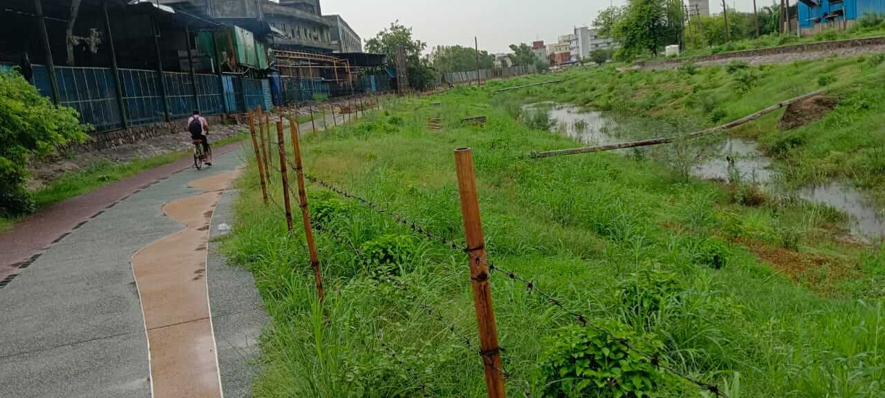
Photo: Latika Thukral
The urbanisation of Gurugram, or then Gurgaon, began in the 1970s when Maruti Suzuki India Limited established a manufacturing plant and was followed by IT and BPO companies later. In the 2000s, Gurugram’s urbanisation was rapid, in the 2010s Gurugram became one of the most populous cities in India.[6] The city of around 8.7 lakh, according to the Census 2011, has galloped to an estimated 1.2 million – nearly 25 percent rise in a decade.[7]
“In two decades, Gurgaon was transformed from a small rural town to a global hub for the outsourcing industry. This real estate sector-driven rapid urban makeover, through conversion of peri-urban agricultural land to create production and consumption spaces for the new economy, is leading to a fragmented landscape that contains glaring inequalities,” says researcher Tathagata Chatterji.[8]
Before this rapid city-making where construction took precedence over natural water channels, flooding was virtually unheard of. Areas such as Palam Vihar and DLF had ample open spaces to absorb rainwater. A report titled “Hotspot Identification for Urban Flooding in a Satellite Town of National Capital Region of India” noted that water bodies and lakes which once spanned acres have shrunk and approximately 100 bunds lost due to the expansion of the Delhi-Gurugram Expressway.[9]
Also lost were the large and small ponds which were water receptors, even as traditional nullahs and streams were encroached upon by housing complexes and unauthorised structures. “The Ghata Lake which once spread across 370 acres was reduced to around two acres…the city had 388 water bodies, of which only a handful are left,” noted a study on the ecology of Gurugram.[10] “The system is designed to handle a certain amount of water, but when it is exceeded, the excess water can back up into streets and homes,” explained Batra about the haphazard developer-led construction leading to flooding.
Gurugram administration’s study [11], submitted to the National Green Tribunal (NGT), showed the city lost a staggering 389 water bodies over the past 66 years; only 251 remain compared to the 640 recorded in 1956. Once, its unique natural drainage system comprising over a hundred nullahs or drains and water bodies at Ghata, Nathupur, Chakkarpur, and Jharsa contributed to rainwater storage and groundwater replenishment. However, their presence and importance were hardly factored into Gurugram’s urban plans.
Such unsustainable urbanisation meant that the Badshahpur nullah, the main stormwater drain, saw its carrying capacity reduced, later worsened by encroachments. There’s now a backflow of rainwater. Studies[12] found that the drain width near Khandsa village was only 10 metres compared to 30 metres elsewhere, which was responsible for flooding on NH-48 and at Hero Honda Chowk. Despite the Haryana government’s decision in 2016 to widen[13] the drain, the situation has not improved. Instead, thousands of buildings were granted occupation certificates (OCs) in areas such as DLF, Sushant Lok 1, Vipul World and similar colonies. A parallel drain was built but not connected to the Badshahpur nullah; added to the non-functional Bandhwari waste plant and the loss of natural ponds, flooding was inevitable.
Gurugram has also seen inconsistent and irregular rainfall, as this study[14] showed; there was a major increase in the average rainfall in January, February and April of 2019 – a staggering 803.9 mm – as compared to previous years which contributed to the floods. Changing climate patterns means that Gurugram experiences rainfall in about three hours that was otherwise spread across two-three days. Yet, the groundwater level remains low – the impervious concretised surfaces of buildings and roads means the rainwater does not seep into the ground and the massive runoff leads to floods.
All this points to an inescapable truth: Urban planning and city-making which do not respect or incorporate the natural ecology of an area set it up for flooding.
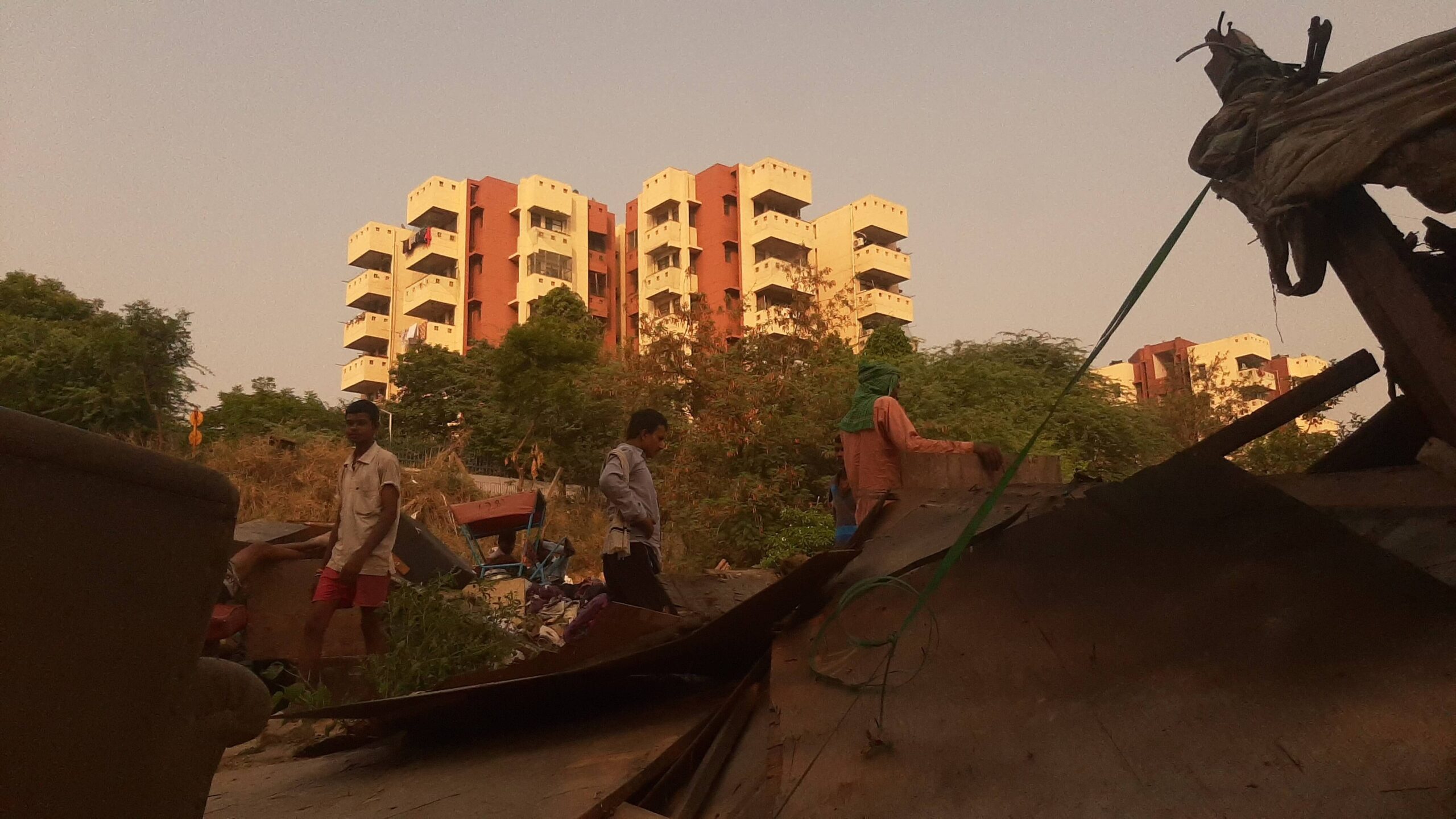
Photo: Sejal Patel
The way forward
For the Yamuna floodplain and Gurugram to overcome the annual flooding, a number of steps are needed. In the words of the United Nations, ‘resilience’ needs to be built to mitigate the devastating impacts of heavy rainfall and safeguard city dwellers.
The action so far has been to throw money at the human-created problem. The Haryana government allocated Rs 100 crore last year, according to NITI Ayog, to restore bundhs which means removing encroachments and planting trees.[15] The project has been able to revive Badshahpur[16] and Chakarpur[17] bundhs to an extent. “This restoration means a linkage between wetlands and the drainage pass,” said Nidhi Batra. Urbanists like her believe that the flood resilience in Gurugram must be firmly grounded in urban planning and design.
“The preservation of the natural slope of the land during the construction of new localities” is necessary, according to Sohail Hashmi, historian and professor of International Relations and Politics, because as he emphasises, altering the natural pitch comes with significant costs and challenges such as flooding. The geological scale plays a pivotal role in shaping the topography of regions such as Rajasthan, Delhi, and parts of Gujarat, he said. The Aravalli mountain range influences the slope of the land – its natural landscape and ecological balance. Recognising this and incorporating into urban plans would possibly reduce flooding.
Latika Thukral, from the organisation ‘I am Gurugram’, has been working to restore the natural drain channels here for the past 14 years and managed to connect Badshahpur drain to Sikandarpur Forest. “We study every region, our aim is to release stormwater in the forest. The budget can be as low as Rs 20 lakh,” Thakur told Question of Cities, “The government’s order to not use vehicles during floods is discriminatory…rickshaw pullers, pedestrians, and thelawallahs bear the brunt of it.”
Shubhi Kesarwani, founder and CEO of ‘GuruJal’, remarked that flooding had to be approached at a systemic level: “The district administration has made attempts to construct creeks but a lot of the area has been privatised making it a challenge to work there.” Emphasising that Gurugram needs green space for water to percolate, she asserted, “We need to prioritise water governance, and map the remaining floodplain and depression points to create channels for the water to flow.”
Comprehensively addressing the flood challenge means going beyond small-scale mitigation measures – they are essential but not enough – to focus on re-building the area’s natural water channels and drainage systems, and ensuring that development plans recognise and include ecological, geological, topographical elements. Flood-resilience is a buzzword; flood management starts with ecologically-sound and sustainable urban plans that include the lives of the most marginalised like Indu Devi.
Sejal Patel, an independent journalist and documentary filmmaker currently working from Delhi, keeps a strong research focus on rural communities and data journalism, as well as the application of artificial intelligence (AI) to the fields. Patel holds a postgraduate degree in Convergent Journalism from AJ Kidwai Mass Communication Research Centre, Jamia Millia Islamia. Through her work, she aims to challenge established norms, foster social justice, and instigate transformative change.
Cover photo: Parvesh Sharma via Twitter