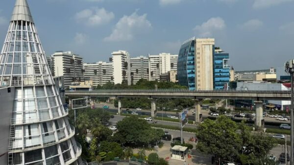

Since the advent of industrialisation, cities have become centres of human growth and development. The youth from rural regions migrate to cities in search of better jobs, education and healthcare infrastructure, and improved living standards, leading to an increase in the population in cities. To cater to this, cities either develop more intensively within their existing limits or expand outwards, turning peripheral areas into new sites of urban development. As political scientist Dr Sushmita Pati rightfully points out in her book Properties of Rent: “We live in cities whose borders have always been subject to expansion. For the monstrous city, the periphery is the space waiting like a sacrificial goat, for its turn to be consumed.”
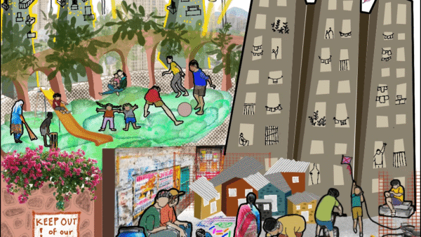
As cities continue to evolve, their rapidly growing peripheries engulf the hinterland villages and their agricultural lands. This leads to economic, physical, social and cultural changes in the villages. There is a shift in the traditional livelihoods and concerns arise about food security and environmental sustainability. Even as these areas are planned to be developed, gaps remain in the planning, especially for the infrastructure, mobility and public spaces in the villages. Meanwhile, buffer roads, boundary walls and security gates are built and become means of segregation, reinforcing physical, social and economic divides between the villages and the urbanised areas.
This approach does not facilitate a seamless and mutually beneficial rural–urban transition. Instead, it produces fragmented landscapes in which villages remain isolated from city level infrastructure, services and opportunities. And demands attention to how peripheries are imagined in the arc of urbanisation. Delhi showcases this phenomenon.
Case study: Delhi
Its transformation is deeply tied to incorporating villages, particularly those in the city’s hinterland into its urban fabric. Over time, as the population grew, the agricultural lands of hinterland villages were acquired for residential, institutional, and commercial projects. This left the villages in a paradoxical state, giving rise to what are now known as “urban villages”.
Delhi has 357[1] such urban villages, where historical residential clusters (abadi areas) remain but the surrounding agricultural land has been replaced by planned colonies, industrial estates, and urban infrastructure. Although the Delhi Development Authority (DDA) planned to integrate these villages into the city’s planning, it failed to implement the 1962 Master Plan. As a result, these “urban villages” grew as unplanned rural islands of the national capital.
This excerpt from the Report of the Expert Committee on Lal Dora[2] highlights the situation: “The first Master Plan of Delhi (1961-81) prescribed principles for the development of rural areas in Delhi, but detailed planning remained partial, especially in respect of the development of rural villages. The revised Master Plan — MPD-2001 — implemented in 1990 emphasised the integrated development of rural areas. Unfortunately, the zonal plans, area development plans, and redevelopment plans prepared by different authorities did not indicate abadis (Lal Dora and extended Lal Dora) on the maps, and attempts to develop abadis alongside the surrounding areas remained thoroughly inadequate. Instead of making allowance for the natural increase in the village population and reserving adjacent land for the same, new colonies were planned on such lands, e.g., East of Kailash, Dwarka, Rohini, and Vasant Kunj. These were developed on the acquired agricultural land of villages.”
Delhi’s approach to development has changed markedly in 25 years but little has changed for the urban villages. The focus has shifted from land acquisition to land pooling with the DDA introducing the Smart Cities concept. Under this, private landowners acquired agricultural land, pooled it, and developed 60 percent of it, while the DDA used the remaining to provide infrastructure and amenities. The DDA recognised six zones for land pooling – P-I, P-II, K-I, L, N, and J – to develop into three Smart Cities namely Rohini, Dwarka, and Narela. This involved building new roads and restructuring agricultural land to create planned sectors.
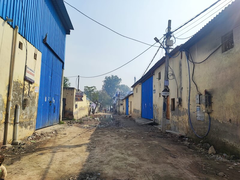
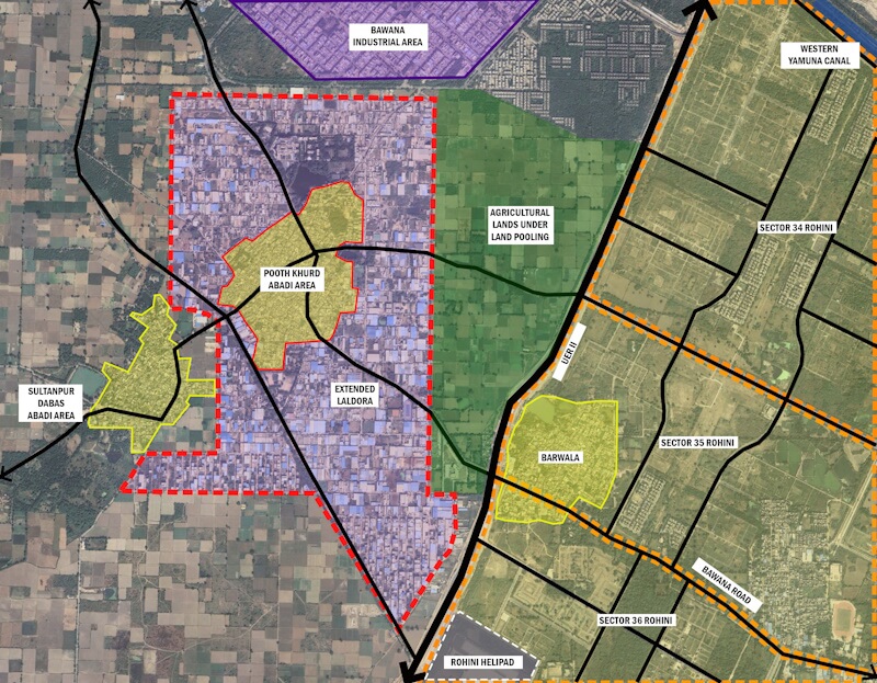
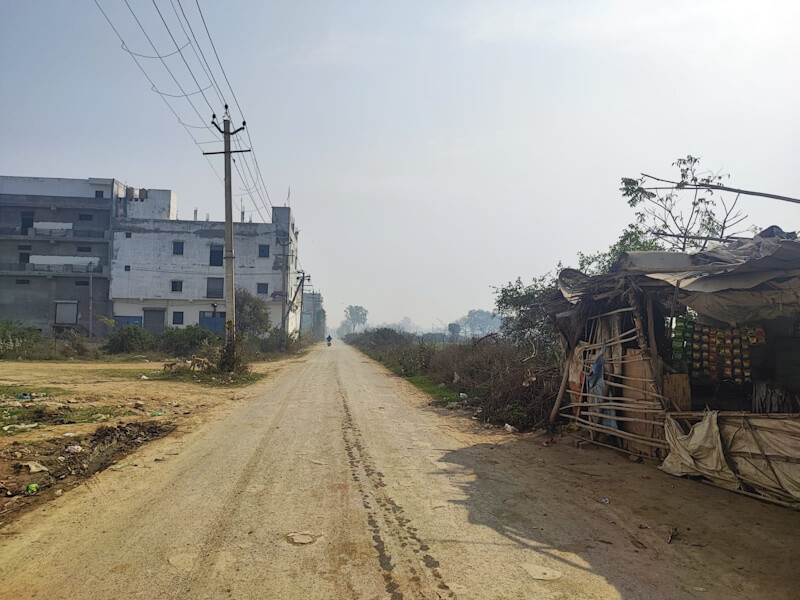
Pooth Khurd, one of the identified villages under the land pooling scheme, is located in Zone N, in the northwestern part of Delhi. An agrarian Jat settlement with 300-year history, it has experienced major changes over the last 20 years due to rapid urban expansion. About two decades ago, the DDA acquired 30 percent of its agricultural land to construct the Urban Extension Road (UER II) and compensated the villagers with money and plots in the village’s extended Lal Dora area. Most of these plots were designated for residential use; a small share was allocated for industrial development. However, the poor infrastructure and weak regulations made many residents rent their residential plots also to factories and warehouses for income.
In 2011, the remaining agricultural lands were identified and proposed for inclusion in the land pooling policy and acquisition by private developers to construct gated residential enclaves and high-end commercial developments, particularly along the UER-II. Although 60 percent of the villagers agreed, there has been no concrete action so far. But the strategic location of the village and good connectivity to Delhi made it an important node for development. The development of the UER-II, proposals for metro extensions to Narela, and the establishment of a heliport in Rohini have significantly boosted land values in the village, especially along the highway. Private developers offer high prices for commercial use, ranging from Rs 22-25 crore per acre for land directly adjacent to UER-II and Rs. 4-5 crore per acre for interior agricultural lands without direct frontage to UER-II.
However, an important yet often-overlooked question emerges: Does it really benefit the village community or is it only the short-term economic gains for developers? A total of 500 responses from primary surveys and interviews done in November-April 2025 reveal contrasting perspectives of the impacts of development. Many villagers were unsure how this would improve their quality of life. Women and young girls emphasised concerns related to their mobility and safety. Many said that movement outside the village after dark is already limited due to the perceived insecurity of the adjoining industrial areas.
Respondents identified the upcoming metro station along UER-II as a positive development but also emphasised that access to it would require traversing industrial areas and future urban developments. Thus, it meant that if the new residential enclaves are developed as isolated, inward-looking buildings, it would be difficult and unsafe for them to access the metro station. Male respondents were more concerned about the loss of agricultural land and open green spaces that have been integral to the village livelihood system. Many also highlighted that the high-rise apartment complexes around the village would sever its connection to the city, creating a landlocked situation for the village core.
Real estate but no spatial or social integration
There are several examples of other Indian cities which expanded by large-scale conversion of peripheral agricultural land but no attention was paid to the spatial and social integration of the villages. In Gurugram, the adopted development model favoured real estate-led growth. Private developers acquired agricultural land from surrounding villages and transformed them into gated residential and commercial enclaves. This led to villages such as Basai, Chakkarpur and Kapashera becoming disconnected from the adjacent urban fabric. This generated concerns regarding inequitable development and the exclusion of local communities (Narain, 2009).[3]
Similarly, in Greater Noida, villages such as Shahberi witnessed the acquisition of agricultural land for planned development. The resulting urban form was characterised by large housing complexes and industrial parcels, but with little integration between existing village settlements and new developments (Singh & Singh, 2021).[4]
Ahmedabad also presents a similar scenario, in which the village settlements (gamtals) were formally recognised within planning frameworks but were often encircled by buffer roads to physically separate them from adjacent urban extensions, thereby preventing meaningful spatial and functional integration with the developing city.
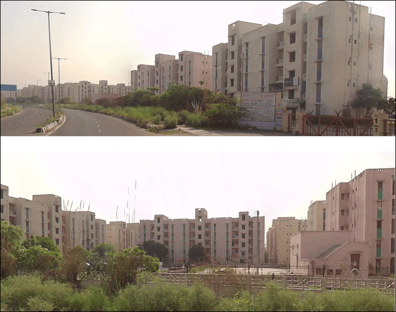
If these development patterns persist, Pooth Khurd will likely see the acquisition of agricultural land by private developers and the construction of high-end residential societies and commercial developments along the UER-II. These will introduce standardised, high-rise, inward-looking built forms that prioritise exclusivity, security, and real estate value over connection with existing settlements. The village core will be neither fully rural nor fully integrated into the emerging urban fabric. There will likely be a physical, functional, spatial separation between the village settlement and the industrial zones-gated complexes. This spatial division would translate into inequitable access to infrastructure, transport systems, public spaces, and so on. Eventually, the village could be increasingly marginalised in the wider city system, weakening its social cohesion and ecosystems.
Therefore, the important question is: How can peripheral villages be envisioned, not merely as residual spaces awaiting urban absorption, but included in urban growth?
The Rurban development model
The thesis I authored on peripheral villages and envisioning them as part of an inclusive and resilient model of urban growth proposes a Rurban development model with a design-driven typological framework that enables seamless integration among various morphologies, fosters interconnections, and transforms socio-economic condition while keeping cultural diversities. Based on a collaborative framework, the model seeks to reflect the interests of diverse stakeholders as peripheries become urbanised. Rather than treat the rural-urban edge as a hard threshold, it re-imagines the boundary as a meeting ground where infrastructure, public spaces, and mobility networks connect the village core to the highways and metro corridors. The existing village assets, like the village temple and the chaupals transform into important nodes for community engagement in the larger public realm.
Ecologically, the green-blue network can be created by maintaining the existing village ponds and some agricultural lands while introducing new greens and wetlands in the city, thus safeguarding ecological continuity and food security. Industrial areas can be equipped with health and education infrastructure for migrant workers which reduces pressure on the village health systems.
The proposed built form in the urbanised areas should ideally have gradual – not sudden – transition in density and building heights so that it is not an intimidating environment. It should foster human-scale, mixed-use neighbourhoods, incorporating principles such as walkability, active streets, and a continuous public realm. And it should challenge the existing model of gated enclaves by creating porous built forms, active frontages, and shared green and public spaces that improve safety through collective use rather than exclusion.
To put this model in practice will require a fundamental shift in the existing on-ground approaches. The inward-looking, gated enclaves would have to be replaced by urban forms that align with their surroundings and promote public life through active frontages, permeable edges, and well-distributed public spaces. While building bye-laws provide a regulatory framework, they are often insufficient in ensuring socially and spatially integrated environments. Therefore, it is essential to create and mandatorily adopt form-based codes and urban design guidelines for building safe, inclusive and vibrant neighbourhoods across the new urban and old village areas that can promote interaction.
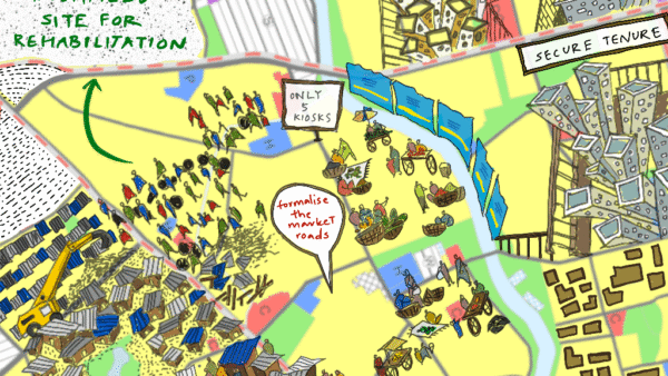
It is also crucial that urban development in peripheries moves beyond models driven primarily by individual interests and promotes collaborative planning systems. This should involve all stakeholders including the village communities besides planning authorities, private developers, and industries. This approach can go a long way to generate shared benefits and more equitable, context-responsive results. Land pooling can be a powerful planning tool to guide the creation of infrastructure while protecting public spaces and ecological networks. This model can help balance the three imperatives of sustainable development – economic, social and environmental – thus integrating the villages into the urban, and creating resilient and inclusive urban-rural settlements.
References
- Narain, V. (2009). Growing City, Shrinking Hinterland: Land Acquisition, Transition and Conflict in Periruban Gurgaon, India. Environment and Urbanization, 27, 501-512.
- Pati, S. (2022). Properties of Rent: Community, Capital and Politics in Globalising Delhi. India: Cambridge University Press.
- Shrivastav (Chairman), P. P., Ansari, J., & Gupta, R. G. (2007). Expert Committee Report on Lal Dora and Extended Lal Dora. New Delhi: Union Ministry of Urban Development
- Singh, Kamini & Singh, Anant. (2021). Dynamics of Urban Villages: Mapping the Transformation of Shahberi Village Greater Noida.
Chetna Garg is an architect, urban designer and researcher based in New Delhi, interested in the complexities and evolving layers of cities. She writes about urban issues, spatial transformations, and the way people experience and shape their environments. Beyond the built environment, she enjoys reading thrillers, dancing and learning new things.
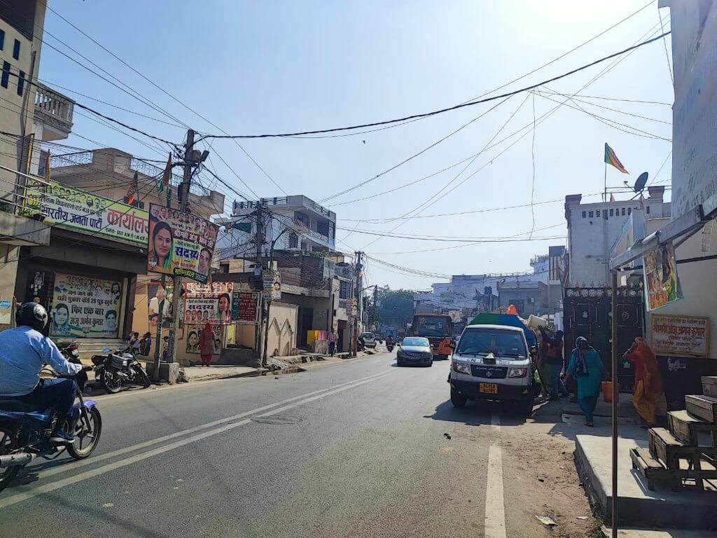
Cover photo: Bawana Road cuts across Pooth Khurd village.
All photos: Chetna Garg