Three weeks after the north-eastern state of Assam was ravaged by deadly floods, the second in two years, it is painfully picking up the pieces. At its worst, nearly 5.5 million people were affected across 32 of the state’s 36 districts, including the state capital Guwahati, as the Brahmaputra and its tributaries wreaked havoc. At least 192 people have died. Hundreds of villages and many cities, which were inundated or submerged, are reeling under the aftermath and are still struggling for food and water.
Floods are not new to Assam but the intensity of floods has been increasing every year. In fact, not only Assam but large parts of north-eastern India have seen a huge rush in infrastructural development in the past decade. The rapid and unplanned nature of this “development” has resulted in ecological ruptures which are now manifesting themselves in such catastrophic disasters. The lack of proper scientific studies and floodplain mapping in the river basins of the region, and the overemphasis on structural measures to mitigate Climate Change risk in comparison to non-structural measures has contributed to increased disasters over the years.
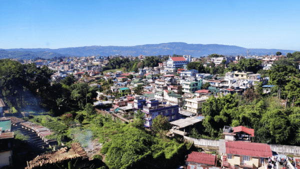
While the catastrophic annual floods along the Brahmaputra in the rural hinterland of Assam received national and international attention, it is often missed that the situation in the city of Guwahati has an entirely different flood pulse. Guwahati is heralded as the “gateway to Northeast India” as it sits near the mouth of the Siliguri Corridor, known as the Chicken’s Neck, which connects this region with mainland India.
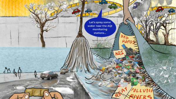
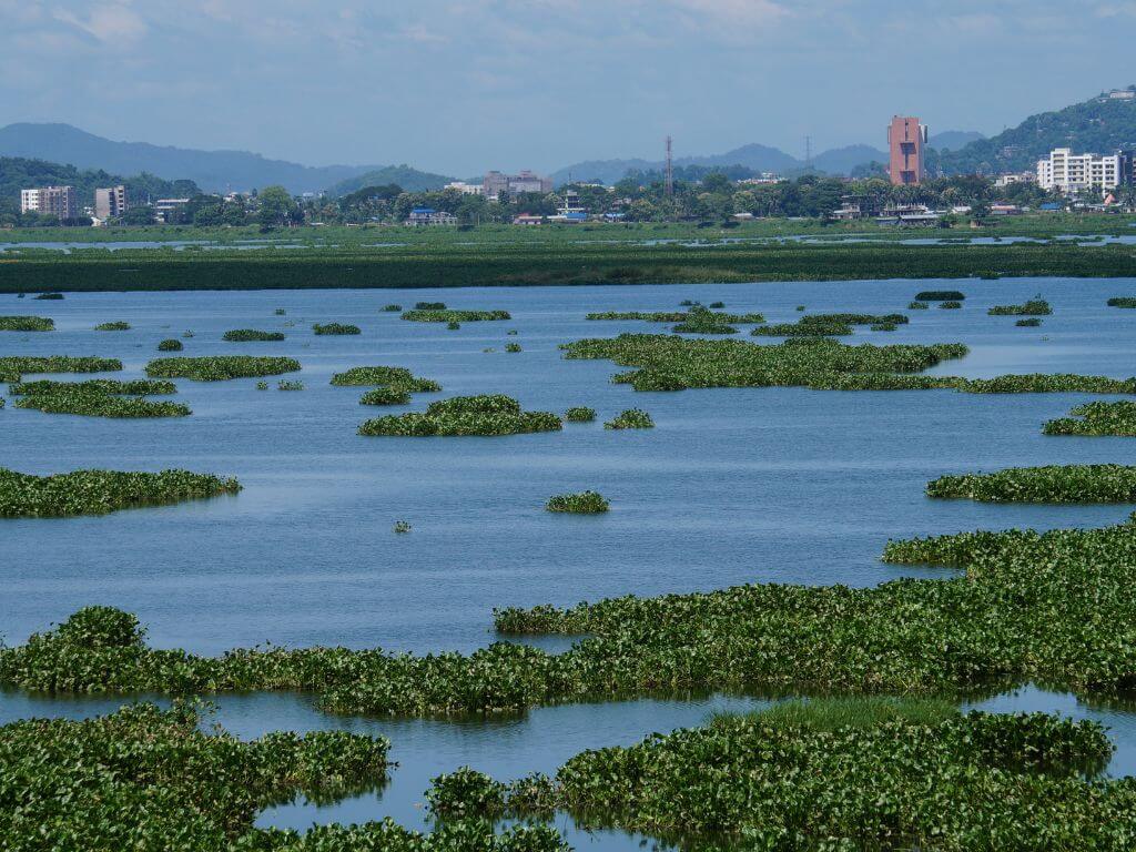
The past two decades have brought about rapid urban growth and development in Guwahati. The urban development has trapped the city in a planning disaster of its own making. Flooding in rural Assam is mostly caused by river embankment overflows during and after heavy monsoon rainfall spells, often exacerbated by the impact of Climate Change, but Guwahati is a different story. Following a heavy downpour, the flooding is such that the streets of Guwahati resemble small tributaries of the Brahmaputra. The city is inundated nearly every monsoon but residents have learnt to live with this urban planning disaster which has decimated, among other ecology, the Ramsar site Deepor Beel (in photo above).
In August 2020, the city launched its own urban Flood Early Warning System (FEWS), a web-based tool developed by the Energy and Resources Institute (TERI) in collaboration with the National Disaster Management Authority (NDMA), Assam State Disaster Management Authority (ASDMA) and the India Meteorological Department (IMD), to support urban disaster management and help mitigate the annual rainfall-induced artificial urban floods that render the city’s urban infrastructure dysfunctional. The FEWS is both critical and, somewhat, futile mainly because within Guwahati’s cityscape there is no place for residents to escape the flood waters reaching their localities and entering their homes; the disaster has to be met with a sense of inevitability.
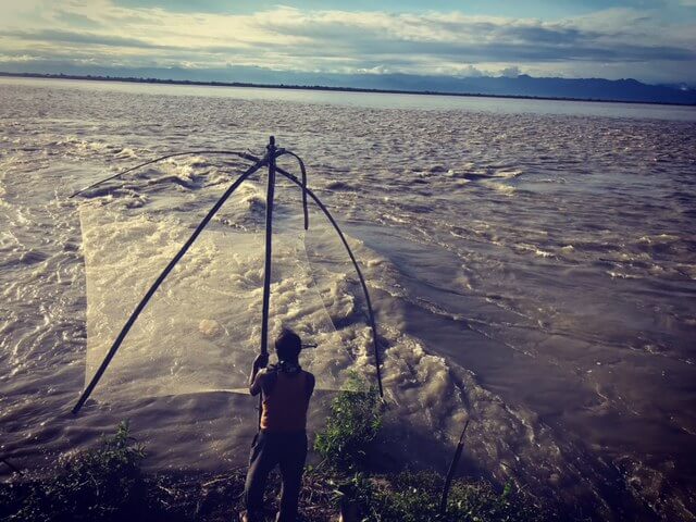
Photo: Dr Mirza Zulfiqur Rahman
Climate Change exacerbates infrastructure decisions
The impact of Climate Change has to be understood in the context of the larger bio-region or eco-region of the Eastern Himalayas. It cannot be limited to narrow framing of floods only in Assam given that the entire north-eastern India, as well as Bhutan and Bangladesh, are affected by floods and landslides. The variability of rainfall patterns and the changing timeline of intense rainfall episodes determined the intensity of floods. We have seen that the intensity of floods in the region has been increasing year after year.
Climate Change impact is to blame, as is the usual refrain from politicians, but it is not the solitary reason. What is leading to such disasters is that Climate Change or extreme weather events exacerbate the failure of the infrastructure that has been laid on the ground. The “development” infrastructure such as embankments, dams, roads, tunnels, and railways have all disrupted the ecological connectivity of the larger region, which in turn is leading to such disasters resulting in economic losses and hardship to local communities. The entire north-eastern India faces threats in terms of higher intensity of floods and greater incidence of landslides which collectively cause enormous destruction to life and property.
The rapid and unsustainable infrastructural transformation of the region is a major driver of such disasters being catastrophic. There is hardly any learning from the disasters that have happened given that governments are rapidly pushing the growth of oil palms which is going to be another Climate Change risk which has the potential to further change rainfall patterns over time and exacerbate the misery of local communities across the entire region. We have little data to be able to predict the outcomes and less capacity to implement mitigation strategies on the ground.
Environmental democratic deficit
The inequality and mismatch created between the natural environment and the unsustainable development patterns is also in terms of local communities not being able to participate meaningfully in environmental decision-making processes of the government. This has led to an environmental democratic deficit in the region. The local communities are not able to meaningfully sustain their traditional knowledge systems about their own ecology and rivers which they have been living with for decades in order to confront floods. This makes them increasingly vulnerable to flooding and landslides.
The large-scale infrastructural interventions such as embankments, dams and levees are not comprehensible to the communities and their traditional knowledge of the flood pulse of the rivers. This rupture between the natural environment and “development” agenda being implemented forms the inequality on the ground, in terms of comprehending or mitigating disasters, and adapting to changing patterns in nature – especially by using local understandings of changes in the natural environment – which local communities have been doing for centuries.
Between economic and ecological connectivity
Guwahati’s position as a regional hub of economic connectivity is in stark contrast with the ruptures in the ecological connectivity that created the conditions for the devastating floods. The city’s rapid expansion, accompanied by an infrastructural maze within the city and the highways and railways crisscrossing the peri-urban space, destroyed critical natural infrastructure such as wetlands, floodplains, and forests which are vital to the natural flood management capacity of the landscape.
Several wetlands and forests surround Guwahati, the most significant of them being the Ramsar site Deepor Beel, have been decimated; the site has been reduced to just one-tenth of its original size, covering just four square kilometres today. Over time, a systematic process of ruptures has happened to the natural ecology, with railway lines bisecting parts of the Deepor Beel and several institutions ranging from government facilities, residential colonies and markets, universities, private hotels, small-scale businesses, and brick kilns filling up encroached parts of the wetland. Further, the city’s primary garbage dumping site borders the Deepor Beel, creating further problems for the survival and functioning of the wetland.
The Deepor Beel has been the historical natural sponge to soak the excess rainwater of Guwahati, balancing significant parts of the rising water levels of some of the important tributaries of the Brahmaputra during the peak monsoon months. However, due to the shrinking size of the wetland and the disruptions to its essential quality, this function has severely diminished over the years. The direct impact is seen in the growing intensity of the rainfall-induced artificial floods in Guwahati, which threaten the city’s reliability as a regional economic hub. A recent case of an oil well blowout in June 2020 left an Important Bird Area (IBA) called the Maguri Motapung Beel, near the Dibru-Saikhowa National Park, in Tinsukia district of Assam, devastated with several commentators calling it ‘catastrophic for the ecosystem’.
This economic-ecological issue has received minimal attention, though it holds important lessons for cities and towns in north-eastern India.
Social rupture flows from ecological rupture
While the conflict between ecological and economic connectivity through the development of physical infrastructure at the expense of the environment is evident from the issues of the region, there is another level to this conflict – the social. Community and civil society participation levels in decision-making structures and processes related to urban development and city planning, such as in Guwahati, Imphal, Itanagar and Shillong, leave a lot to be desired.
Such ruptures in social connectivity have an impact on the core foundation of community participation and environmental democracy in north-eastern India, and the consequent marginalisation of community-based traditional knowledge systems which can inform modern natural resource governance policies and its systems.
The way forward requires the harmonisation of these three types of connectivity, with physical infrastructure imitating and working with natural geography of the region and incorporating civil society and traditional knowledge systems in urban planning processes. The conservation of sacred forests and wetlands by local communities have been time-tested and offer insights into how the north-eastern region can move forward. An excellent example is the conservation of a high-altitude sacred wetland by local monks, which feeds important rivers adjoining Tawang in Arunachal Pradesh. The borderland cities of north-eastern India are well-positioned to learn these lessons and prevent the unsustainable development trajectory of mega-cities in other regions of India, particularly Assam.
Dr Mirza Zulfiqur Rahman, an independent researcher based in Guwahati, holds a PhD in Humanities and Social Sciences from the Indian Institute of Technology – Guwahati. His research in north-eastern India focuses on issues of transboundary spaces, water sharing and hydropower dams, roads and connectivity infrastructures, conflict and insurgency, peacebuilding, development politics, migration and cross-border exchanges. He is an avid photographer and traveller, and engages with various mediums for his research. An earlier and abridged version of the essay appeared here.
Cover photo: Creative Commons