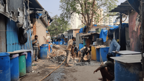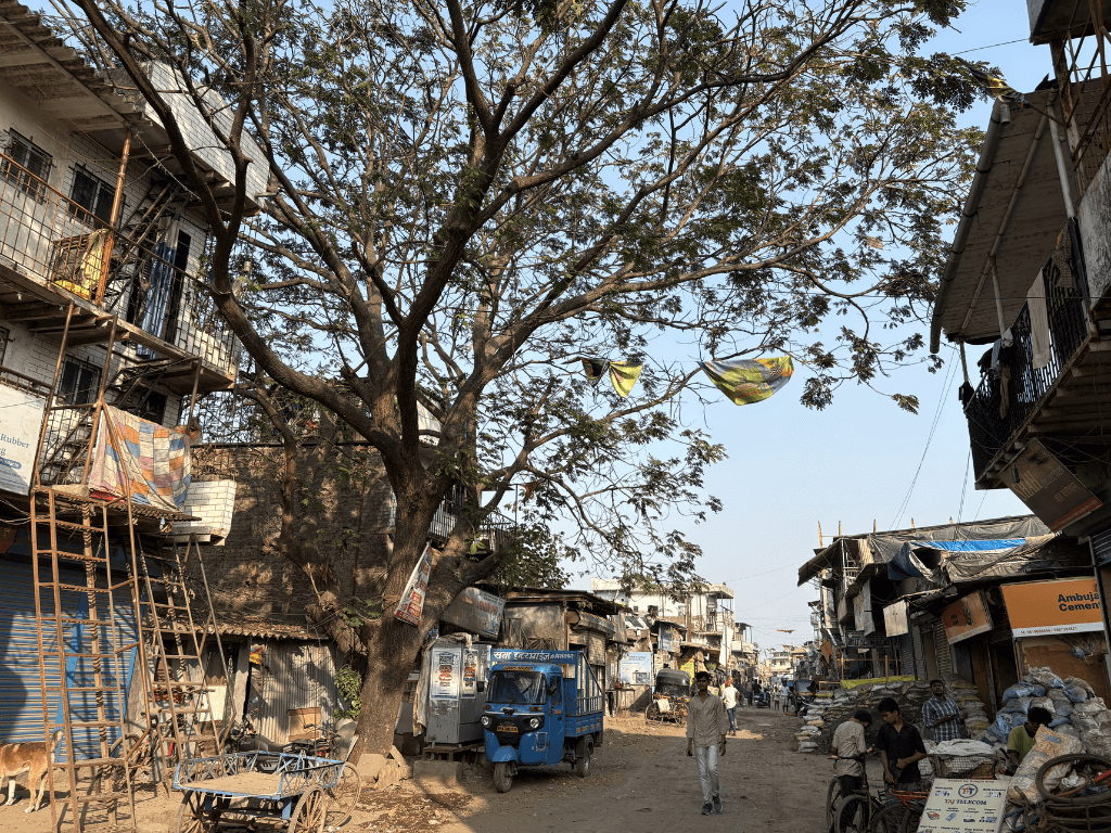
On the north-western edges of Mumbai, in the marshes where the land meets the sea, is Ambojwadi. An informal settlement that seems forgotten by the civic authorities given its lack of basic amenities such as water supply, storm water drains, garbage collection, primary health centres, schools, and the reliable BEST bus routes. In layout, appearance, and habitation, Ambojwadi stands in stark contrast to the well-serviced commercial-residential area of Mindspace, barely seven kilometres away. These could be two different worlds.
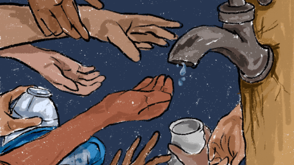
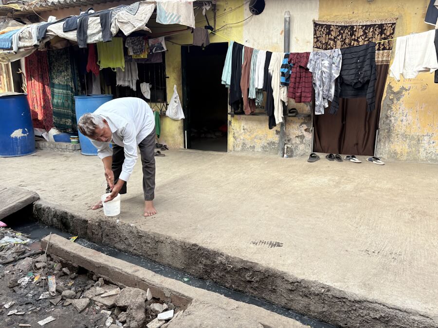
Mumbaikars living in Ambojwadi are the city’s service providers – autorickshaw drivers, chauffeurs and garage mechanics, delivery men, office boys and girls, domestic staff, home-based workers and so on. Among the most marginalised in the city making a life despite the wretched conditions. An estimated 53,600 people live here, many of them for 30 years. Some clusters in Ambojwadi got electricity only in 2014, reliable civic water supply in 2020, and the first storm water drain in 2022.
This means, in the times of climate change, they are highly vulnerable to climate-driven extreme weather events. Flooding and water-logging, heat stress and Urban Heat Island effect, higher levels of air pollution and toxic fumes have been more intense here and recovery slower than in surrounding localities. Climate vulnerability overlaps with, and exacerbates, socio-economic vulnerability, as is now well understood.[1] In Ambojwadi, Shahenshah Ansari, 28, was among those who took this understanding a step ahead with the intervention of non-profit Youth for Unity and Voluntary Action (YUVA) where he works as Senior Program Associate.
The informal settlement engaged with climate issues and mapped their area – community climate vulnerability mapping, as it were. The concept as well as its potential application shows why it must be taken seriously in the corridors of power. While cities across India have drawn or are drawing up city-based climate action plans, the ground-level community-led mapping for vulnerability has the potential to strengthen these plans and bring in the much-needed participatory aspect. After all, people who live or work in an area know their turf in ways that professional planners, climate scientists and urban consultants may not; they can point out precise and hyper-local climate impacts.
By themselves, ranged against the expertise of professionally prepared climate action plans, people feel inadequate or overwhelmed. However, when their knowledge and experiences are factored into city-based plans, the strategies and policies to address climate challenges can become more comprehensive. As Ambojwadi shows, community-led climate vulnerability mapping must be seen in the context of a city’s climate action plan.
How Ambojwadi and other areas did it
A climate study-in-progress by YUVA across the Mumbai Metropolitan Region (MMR), covering an estimated 20-21 million people, has identified as many as 27 climate hotspots; Ambojwadi was among them.
Between December 2022 and March 2023, five young men from the community facilitated Focus Group Discussions (FGDs) with pre-planned questionnaires among residents based on livelihoods, gender, age, and so on. This was complemented by individual interviews with Anganwadi teachers and health-post workers, and with the elderly and the disabled in the community to get in their perspective of climate-related events.
Then followed the use of applications to track contours of areas with trees and open spaces, doing geo-tagging and using Geographic information system (GIS) to identify the flood and heat-prone spots. This mapping spanned ten themes or lenses to track issues – housing, open spaces, water, toilets and sewage, storm water drainage, solid waste management, transport and road network, livelihood, education, and health.
The information and people’s responses were collated into a Community Climate Action Plan (CCAP) which highlighted the clusters with the highest vulnerability to climate events. This information was also matched to clusters lacking in basic services – overlaying social or civic vulnerability with climate vulnerability in a powerful way.
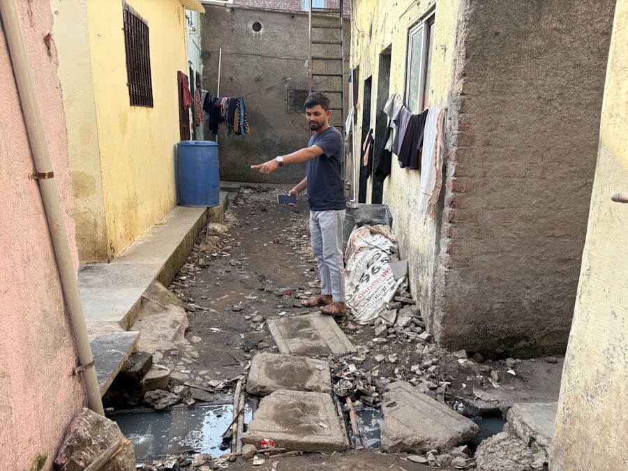
It was found that many houses in Ambojwadi were prone to flooding and storm ravages because they lay in the intertidal zone. In the dense clusters, several residents identified extreme heat, with temperatures going up to 38 degrees Celsius although the city’s reading was lower, as a problem too. Shanti Nagar, along the Malvani Creek, and the low-lying Garib Nawaz Chawl were at the top of the list of clusters that needed immediate attention. “The lack of infrastructure worsens the impact of climate change in Ambojwadi,” says Shahenshah Ansari.
The CCAP, whose framework has been elaborated in this essay by YUVA’s Executive Director Roshni Nuggehalli and researcher Dulari Parmar, was then submitted to department officials of the P-North ward office, the civic ward of the Brihanmumbai Municipal Corporation (BMC) under which Ambojwadi falls. Community leaders worked closely with BMC officials to make pucca roads, lay storm water drains and connect them to the main lines, and turn open spaces into green areas to hold water where possible. It is still work in progress.
For many in Ambojwadi, mapping meant becoming aware of climate change itself, joining the dots between their lived realities of heat stress and flooding to larger global phenomena. Their participation took conversations beyond the typical “it’s getting too hot” levels bringing in new understanding.
In Mumbai’s south-east, at the other end of a diagonal line across the city, is the resettlement colony of Lallubhai Compound. A group of 70 buildings near Mankhurd that was built in 2004 to rehabilitate slum dwellers evicted for various infrastructure projects, it falls in the sub-par M-East civic ward.[2] This too was identified as a hotspot in YUVA’s study. The involvement of residents here in climate issues has been different but equally important.
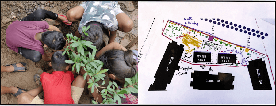
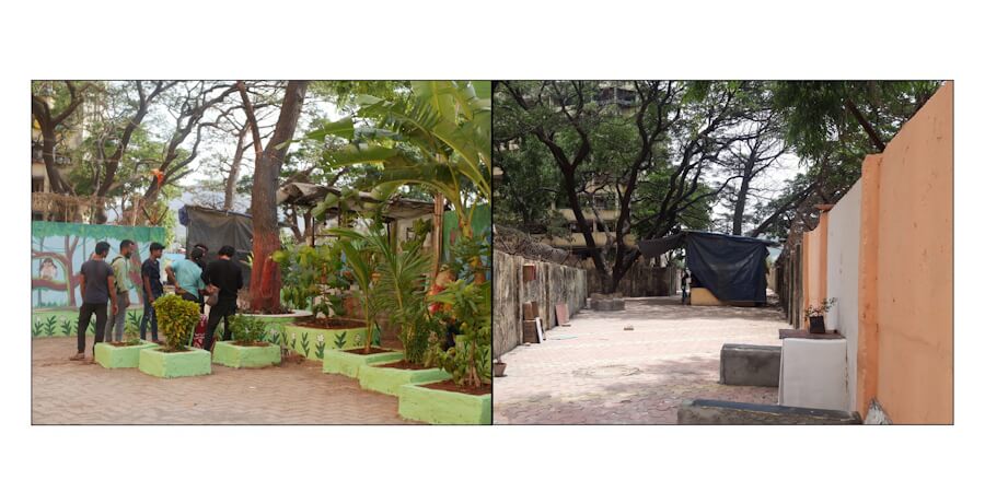
The women and youth used community knowledge to reclaim open spaces like Lal maidan and the space outside Star Tower, used by drug and alcohol addicts till 2024, and used them as spaces for exercise, children’s play or studies. In the summer camps conducted here, children discussed climate-related issues through adapted games; Ludo, for example, had a climate challenge at every step. Young people expressed to facilitators in YUVA and World Resources Institute (WRI) that they would like full-fledged gardens and planted native trees. They also wrote and directed a play Paryavaran Don’ personifying nature and what it tells us, humans, now on a building spree.
Deepti Talpade, Program Lead (Urban Development And Resilience) at World Resources Institute, was a part of the workshops here. If community actions to adapt to climate hazards “are bolstered by formal resources and amenities, and driven by localised community-led climate action plans, if stewardship is incentivised, it could create a more robust and effective climate action framework for the city,” she remarked.
The context is important
The CCAP must not be seen in isolation given the inter-connectedness of every geography within a city and the urgent need for a comprehensive city-level climate action. Yet, without it, the city-level climate strategies, policies, and action can miss the mark for the most marginalised urban populations.
The Ambojwadi and Lallubhai Compound initiatives must be read in the context of the Mumbai Climate Action Plan (MCAP) released by the BMC in 2022.[3] While it’s not a statutory plan – therefore, not enforceable – it has become the guiding document for climate policies in Mumbai and is frequently used as a model in other cities. It broadly highlights the vulnerabilities that the city faces and lists action along six tracks – sustainable waste management, urban greening and biodiversity, urban flooding and water resource management, energy and buildings, air quality, and sustainable mobility with the departments responsible for them.
Volunteers involved in Ambojwadi’s community-led mapping studied the MCAP and found that it did not address mitigation for gaothans and coastal communities, and that there were hardly any direct action points for bastis. They also studied Mumbai’s Development Plan 2034 (DP 2034) and found that the two plans were isolated. Ansari gives an example about the Poisar river. “The DP reserved a plot along the river for a hospital but river rejuvenation, as part of climate action, means river widening in which case where will the hospital go,” he asks. The CCAP takes care of such anomalies.
The participatory mapping ensured that the lived experiences of the community were documented, something that the MCAP lacks. In their review of MCAP, researchers Hussain Indorewala and Shweta Wagh wrote, “Unlike statutory plans, there was not even the pretense of participation with the broader public, nor a call for “suggestions and objections” to its proposals.”[4]
The CCAP is unique in that it documented ground-level data, authentic voices and lived experiences, and focused on basic services as a part of climate action. Where they exist, it recommended making them climate adaptive such as improving the flow of storm water drains, greening open spaces, and doing cool-roof interventions. The mapping helped bring residents together in a problem-solving process.
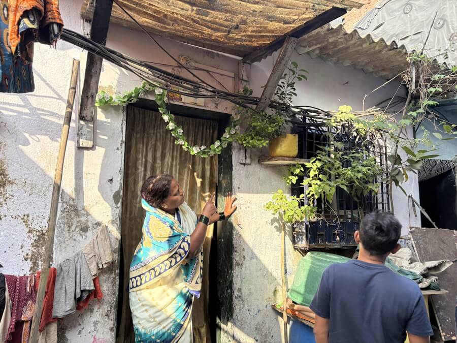
The exercise also revealed other information. For example, Ambojwadi has at least 50 religious places including temples and mosques – outnumbering schools and hospitals – often at an elevation with open space and shade. These could serve as climate safe spaces. Under the shade of a Peepal outside a temple, Anita Chauhan, 37, told me this is where they spend most of their summer days when “it gets suffocating inside.” Shakuntala Wagle, 55, said they now use white cement to seal leakages in the monsoon instead of plastic sheets.
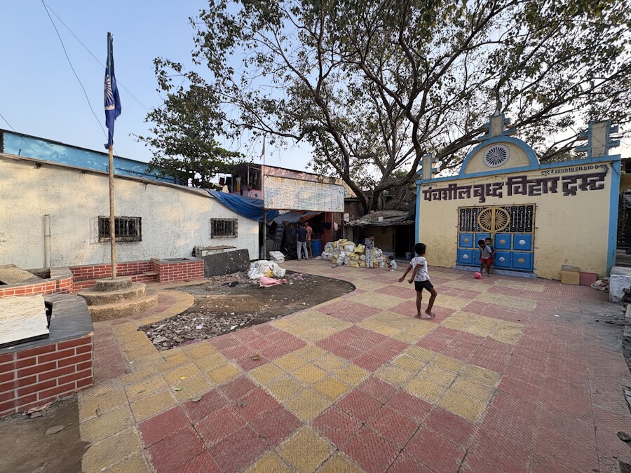
The CCAP achieved something significant – it showed them how the lack of basic amenities compounded climate impacts. Though the BMC’s P-North ward office took interest, action did not follow. The community then submitted cluster-wise issues and solutions to different civic departments; residents liaised with the authorities. Eventually, the BMC helped turn an open space in Buddha Vihar that became sludgy in the monsoon into a public space with trees; I spotted children playing there.
Language matters
Schools having environmental studies as a part of their curriculum eased the job of teaching climate-related terms. For the rest of the community, however, facilitators had to find innovative ways to explain in their native tongues Marathi and Hindi. “Climate change has little vocabulary in regional languages,” pointed out Shahenshah. Climate terms had to be linked to real-life occurrences.
Even so, it was a challenge for Ambojwadi’s residents to prioritise climate issues while struggling for basic amenities. Volunteers persisted. Interventions like the seed-balling workshop introduced kitchen gardening. Trees were made into climate responses and children were encouraged. Nilesh Agrahari, 14, planted trees as he was told to. “We planted a bottle gourd plant which made our house cooler. We also got fresh vegetables,” he said. Shraddha Amar Gupta, 13, grew money plants and tomatoes outside her tenement.
Wagle rallied to have trees planted in New Babrekar Nagar; the Neem she nurtured outside her house has become a space for women to gather. She also grows bitter gourd and guava. While Ambojwadi learns the new, the old is disappearing. With changes in the creek, fruits like karvande, or black currants, that grew by the creek have disappeared since 2018, and with it, migratory parrots too. So has a species of the Palm tree; the Pardhi community, which lived off making toys out of its wood, has seen a setback in its livelihood. The women in New Babrekar Nagar suggested to the civic authorities to turn an empty plot into a garden with trees; it did not come to pass. The community mapping or CCAP may not be able to address all issues, especially of land, but residents become confident and feel empowered to engage with authorities.
Why this is the future
An assessment of India’s climate vulnerability in 2021[5] found that Maharashtra was the third most vulnerable to the compounded impacts of climate change and Mumbai among its five most vulnerable districts. The Climate and Air Pollution Risks and Vulnerability Assessment for Mumbai done as a part of MCAP identified M-East ward as the most vulnerable to heat stress.[6]
While the risks and hazards are now known, top-down and professional plans often leave communities and their lived realities out of climate plans. The community mapping leading to the Community Climate Action Plan fills in this critical gap. It is imperative that this is adopted more and more as climate action plans are drawn up.
Talpade from WRI told Question of Cities that people are best positioned to understand their priorities; community-led plans at the neighbourhood or ward level could provide step-by-step guidance to manage hazards and to mitigate them. She says that the way forward lies in decentralised planning and action at the neighbourhood level that can effectively integrate a people-centric approach into existing climate action plans.
“People can be educated about climate change and sustainability so that they can demand better from the government,” remarked Dilshad Ansari. As Ambojwadi and Lallubhai Compound show, it takes NGOs to facilitate and communities to learn to engage with climate issues which, they soon recognise, are issues of daily lives and civic infrastructure too. Climate justice is social justice, after all.
Jashvitha Dhagey is a multimedia journalist and researcher. A recipient of the Laadli Media Award consecutively in 2023 and 2024, she observes and chronicles the multiple interactions between people, between people and power, and society and media. She developed a deep interest in the way cities function, watching Mumbai at work. She holds a post-graduate diploma in Social Communications Media from Sophia Polytechnic.
Photos: Jashvitha Dhagey