In an interview aired on national television last year, the then Environment Minister of Maharashtra, Aaditya Thackeray, referred to Mumbai’s controversial Coastal Road project as a sustainable infrastructure project. The car-only eight-lane freeway, he said, will be a carbon neutral road, and by creating 96 hectares of green open space that will consist of holding ponds, percolation tanks and even an urban forest, it will become a carbon sink for the city.
The idea of creating a “forest” on concretised land by reclaiming the intertidal rocky shore is laughable since unlike a natural ecosystem, it will lack the function of enabling groundwater percolation and reducing surface run-off. After spending crores of rupees to concretise the coast, and build a destructive and futile[1] freeway, the city now plans to spend crores in greening interventions to re-brand this newly reclaimed expanse as a project of coastal resilience.
The increasing vulnerability of the city to climate events has exposed the failure of our urban-infrastructure and planning system[2]. Yet, every time cities flood, authorities are quick to term them as natural calamities rather than considering their socio-ecological dimensions at the global or local scale. The Intergovernmental Panel on Climate Change (IPCC) has highlighted[3] the vulnerability of coastal cities and communities to sea level rise and extreme events owing to “non-climatic anthropogenic drivers”.
But despite these warnings, there has been little or no focus on the shift in the planning system since the 1980s, that is oriented increasingly towards real estate speculation. Environmental and planning regulations that directly or indirectly protected ecosystem services in coastal cities have been watered down almost to non-existence. Since liberalisation, as public controls on private capital are relaxed to promote finance and real estate, planning has been recast as piecemeal mitigation measures and “green infrastructure” fixes – proffered as substitutes for degraded and depleted ecosystems.
The response of the authorities to address the threat of flooding has been of two kinds. The first relies on hard engineering interventions, attempts to push back the sea, and divert or flush out the storm water. To achieve this, a number of infrastructure projects have been proposed in Mumbai – sea walls, underground tanks, river channelisation. However, more recently, politicians, officials and engineers in the city have begun to adopt the language of international think tanks and academics, acknowledging the failures of conventional approaches. And so, while the Brihanmumbai Municipal Corporation (BMC) is continuing to build “grey infrastructure,” it also seems keen to invest in “soft technologies” and “nature-based solutions” for flood risk mitigation and coastal resilience. This approach is one of the highlights of the recently released Climate Action Plan[4] for Mumbai.
Nevertheless, the sincerity of this green talk is open to question, judging by the current approaches to flood mitigation in the city. These are of three kinds: green-washing or re-branding ‘maladaptive’[5] mega projects as green infrastructure; green-signalling or interventions that seem to compensate for greater ecological destruction elsewhere; and green-swapping or substituting (rather than conserving) existing ecosystems with infrastructure as solutions to environmental problems.
Seawalls and bulwarks: Disregarding natural defences to coastal risk
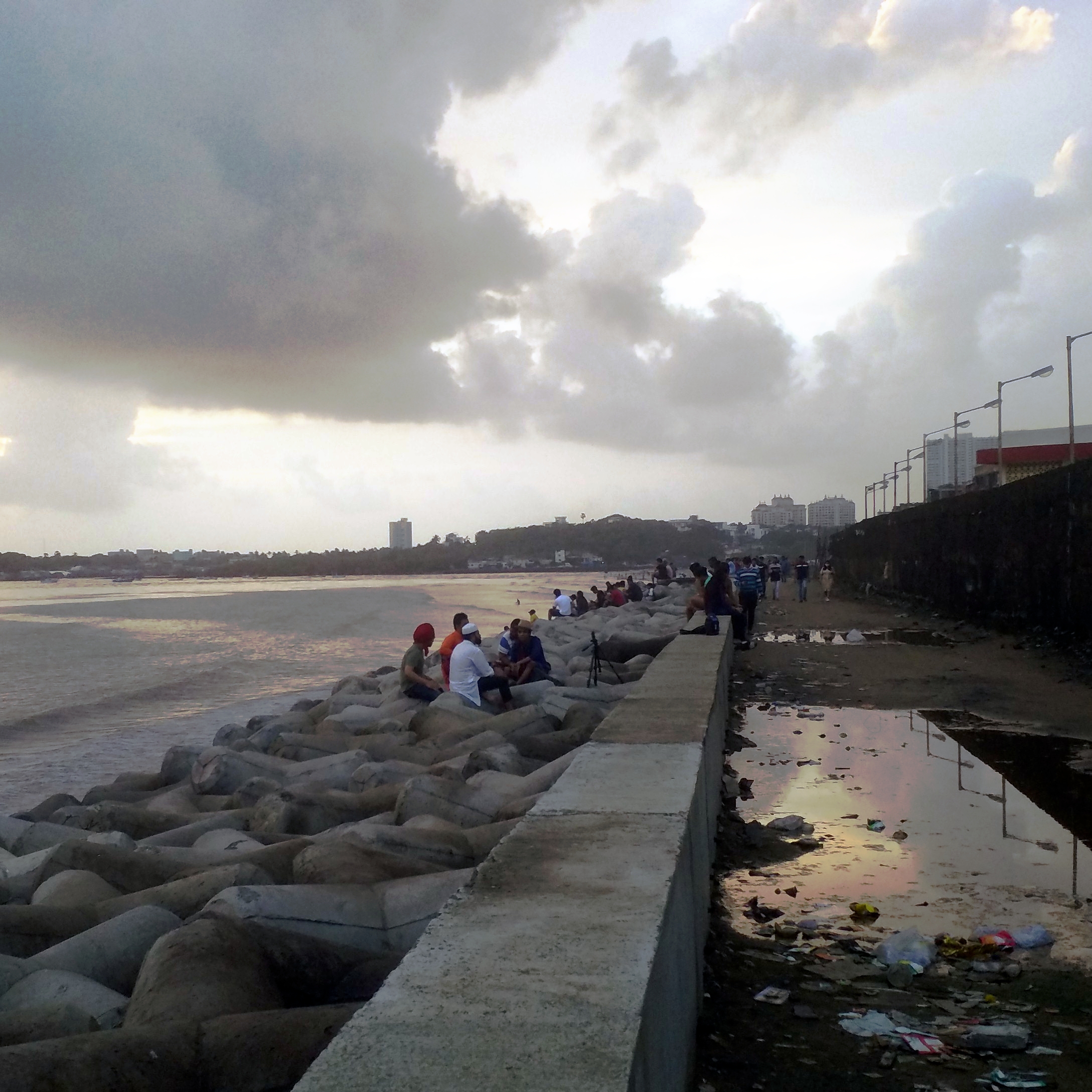
Photo: Shweta Wagh
In Mumbai, seawalls are being built along beaches to counter coastal erosion and protect coastal areas from storm surges. Seawalls are an attractive option to officials and politicians, despite the scientific wisdom[6] that militates against them. Coastal landscapes are dynamic and evolving ecosystems, an outcome of geo-morphic processes of erosion and deposition; building impediments like seawalls disrupts these processes.
Mumbai’s coast comprises rocky headlands and sandy bays, interspersed with estuaries where freshwater drainage courses come under tidal influence. The CRZ Notification of 1991 was introduced to protect this zone (CRZ-I) along with the sub-tidal areas (CRZ-IV), or the permanently inundated continental shelf below the high-tide line, and the nearshore land areas (CRZ II and III). But ever since it was introduced, the regulation has been subjected to an onslaught of amendments, as and when it was seen to pose a hindrance to developers and mega project proponents.
The significance of these coastal ecosystems came to light during the disastrous flood of July 2005. The biggest contributor to this was Mumbai’s centrepiece real estate megaproject, the Bandra Kurla Complex (BKC), which was carved out of the Mithi river. This was only recently admitted officially, when a Supreme Court-appointed panel accurately described the Mumbai Metropolitan Region Development Authority (MMRDA) – the planning authority of the BKC – the “biggest encroacher” of the Mithi river. Nevertheless, despite the common knowledge that estuarine ecosystems that absorb both storm and tidal water can play a crucial role in mitigating urban floods, land reclamation and the construction of embankments or sea walls in intertidal areas of the city continue.
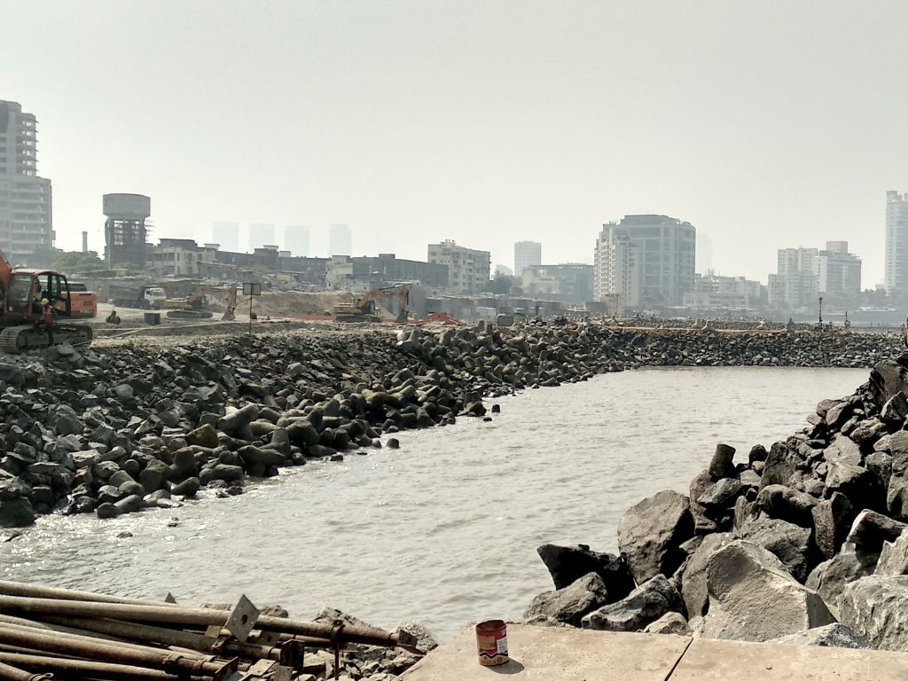
Like the BKC, the Coastal Road is the city’s latest big-ticket project. The project was made legally possible in 2015, as just months before it was cleared, the CRZ was amended to permit reclamation of the seabed for constructing roads –frustrating the very intent of the law it was introduced under. In fact, reclamation has even been justified as a climate adaptation strategy. At a conference on climate crisis organised by a corporate think tank[7] a few years ago, one of the speakers argued that the creation of more land for the city will make climate adaptation financially viable.
Nevertheless, the site of the coastal road construction is the least vulnerable to coastal erosion risk. The intertidal rocky shore – which the project has buried under debris and concrete – is an outcome of the processes of wave and tidal action. This geomorphic feature allows the absorption of waves and tidal water and helps mitigate urban floods while also providing a natural defence against sea erosion. Scientists anticipate that massive land reclamation along the western coast of the island city will significantly affect tidal activity and cause an increase in wave and tidal attack on structures along the shore – exacerbating the risk of urban floods.
Another cause for concern is that infrastructures such as seawalls displace the threat of erosion elsewhere. Seawalls are now being proposed and constructed along sandy beaches in Mumbai’s western suburbs, and promenades are replacing fragile coastal habitats. The question is: do all sandy beaches need shore protection?
The Maharashtra Coastal Zone Management Authority (MCZMA) does not hesitate to grant CRZ clearance to such projects, even on beaches that are not eroding. Recently, it approved the construction of a seawall along the sandy shore at Aksa beach in the northern suburbs. A sandy beach is an outcome of deposition of loose particles of sand carried by waves. Aksa beach has a large extent of sand dunes with dune vegetation – a sign that this stretch of coast is not eroding. While on the one hand the BMC is promoting “nature-based solutions”, on the other, ecosystems that help maintain the stability of beaches are being destroyed in the name of coastal risk mitigation.
Channelisation and concretisation: Undermining the ecosystem
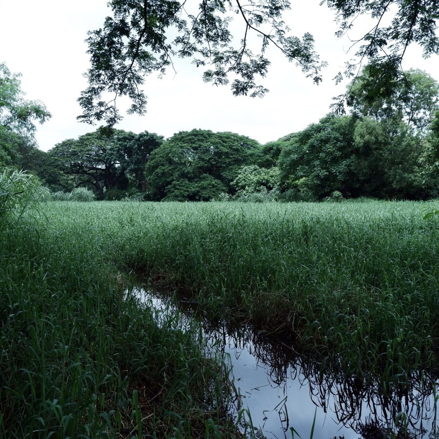
Photo: Shweta Wagh
The undermining of natural ecosystems can be attributed to lack of systematic surveys of the city’s diverse and complex ecological systems in urban development plans. In Mumbai, many of these ecosystems have survived because of the No Development Zone (NDZ) chalked out in earlier development plans. The NDZ, however, has been gutted in the Development Plan 2034. Large swathes of the city’s areas marked as such have now been released for high intensity development. Even the recently published Mumbai Climate Action Plan for the city provides a highly impoverished view[8] of the city’s ecology, that only recognises legally “protected” areas such as forests and mangroves as areas worthy of protection.
Mumbai’s four major rivers – Dahisar, Mithi, Poisar and Oshiwara – originate in the densely forested hilly core, a large part of which has been designated as Sanjay Gandhi National Park. Contiguous with this area is the Aarey Milk Colony which supports a range of ecosystems including hillocks with natural vegetation, forest and scrub, valley floors with seasonal freshwater marshes, grassland and fields. The vegetative cover of these river catchment areas[9] play a key role in reducing run-off by allowing groundwater percolation. Until recently, the NDZ status of Aarey set restraints on real-estate capital, thus enabling the preservation of its green cover and critical ecosystems.
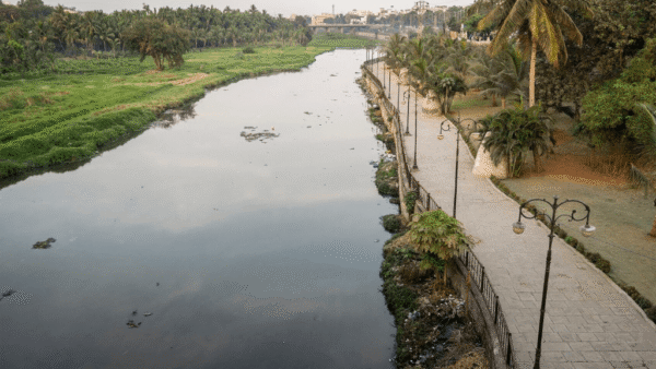
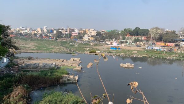
However, the natural streams and rivulets in Aarey are being channelised with concrete embankments, destroying their riparian areas. Last year, the concretisation and diversion of one such stream caused unprecedented flooding and the submergence of staff houses, buffalo sheds and fields.
A natural stream is a complex ecosystem; the interface of the stream and its adjacent areas constitute a surface and subsurface hydrological exchange zone. From the perspective of river engineers, channelisation helps flush water out at a rapid pace, while freeing up surrounding land for construction. River channelisation clears the way for subsequent land-use changes[10] that exacerbate the risk of downstream flooding.
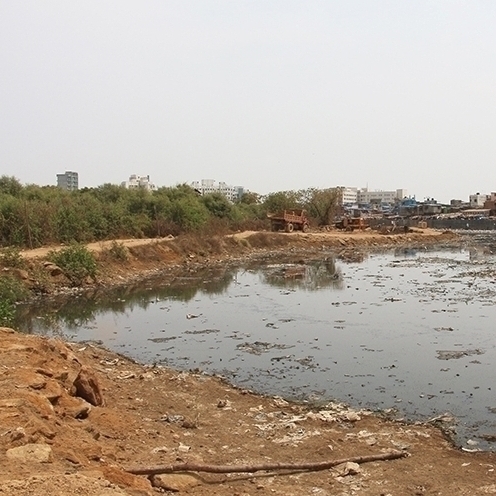
Photo: Shweta Wagh
Channelisation and concretisation formed an integral part of the Brihanmumbai Storm Water Disposal (BRIMSTOWAD) project – through the creation of a network of storm water drains, increased drainage capacity, deepening and widening nullahs by constructing concrete embankments, repairing dilapidated drains and the construction of pumping stations at various locations along the coast to flush out tidal water. The devastating floods of 2005 were partly blamed on the failure to implement the BRIMSTOWAD project. However, in a dense city like Mumbai where hard infrastructure for storm water drainage may be necessary, it is counterproductive if these are built at the cost of the existing natural ecosystems.
The BMC now plans another megaproject for harvesting rainwater in the form of Japanese-inspired underground concrete cisterns to hold excess storm water. This might work, it is believed, as a strategy to prevent water-logging in chronic flooding hotspots if located below existing roads or buildings. Ironically, two large open spaces in Central Mumbai were identified for building such holding ponds. Local residents and politicians opposed[11] them, fearing loss of their neighbourhood parks. However, the former environment minister reassured them that the surface of the massive concrete tank would be resurfaced to “normal” after the construction. One wonders what is the rationale for undermining the percolative capacity of an existing open space to create impervious underground tanks?
Nature-based solutions for floods: A palliative for disrupted ecosystems
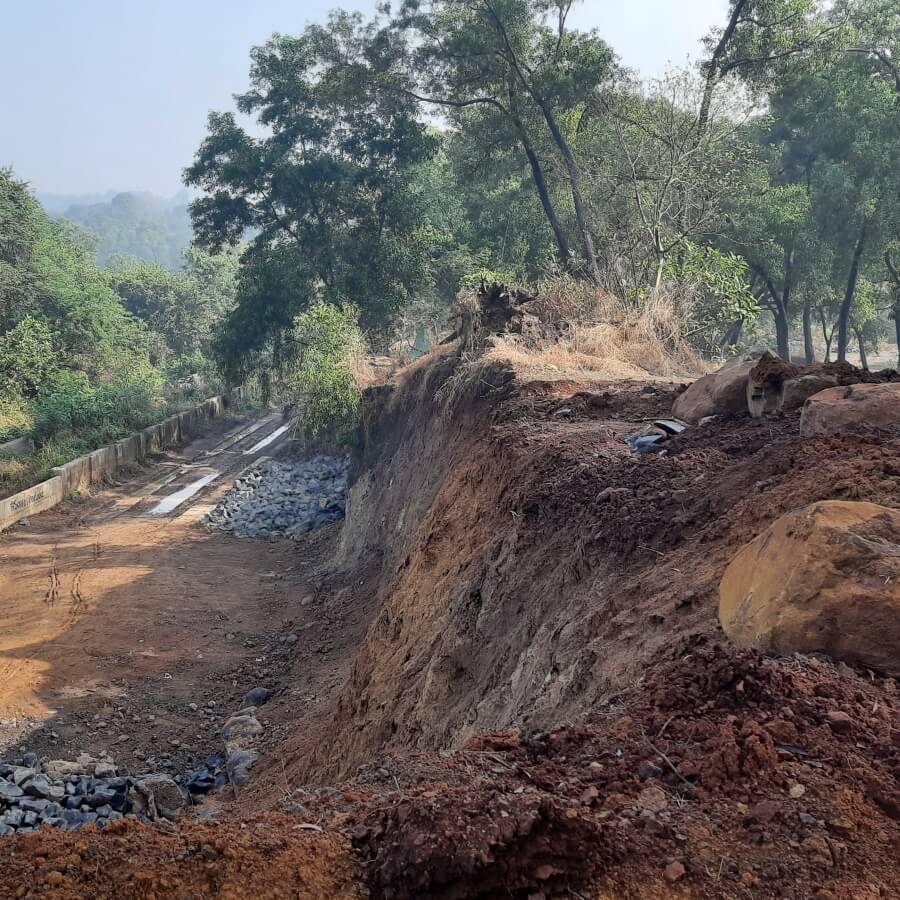
Photo: Shweta Wagh
In recent years, concepts such as “blue-green infrastructure” in place of “grey infrastructure” and “nature-based solutions” have been gaining popularity. Ideas such as “slow, spread and soak” are contrasted with technologies for draining or flushing out water. An official recently argued[12] that Mumbai needs a ‘paradigm shift’ for which “the whole city must become a drain”. This, however, is not a call for conservation, but for massive re-engineering projects, in the form of “soft infrastructure” such as permeable pavements, bioswales, Miyawaki forests, rain gardens, absorbent landscapes, and man-made wetlands.
All of this sounds promising on paper but many of these projects seem to work at cross-purposes with one another – de-concretising some parts of the city while others continue to be concretised. As techno-fixes to the existing paradigm of real estate-oriented planning, these interventions have a limited scope – as tactical palliatives for strategic blunders. While nature-based solutions may find resonance in public relations campaigns, the indiscriminate destruction of the city’s ecological defences and flood protection barriers continue. By failing to challenge the status quo, they appear as piecemeal solutions to detract attention from systemic irrationality.
Urban resilience has now become the buzzword around which many interventions to tackle urban floods and extreme weather events are being framed. But as Ashley Dawson argues[13], resilience has become a “key discursive trope” in most parts because many varied meanings can be attached to the term, allowing people and institutions with very different agendas to “embrace superficially similar ends”.
Resilience-related adaptive measures provide a way out for policy makers, and a way in for investors and green technology firms, all eager to convert crisis into opportunity. But most of all, when this is all that is done in the name of resilience, they build a false sense of security[14] while confronting an extremely precarious future.
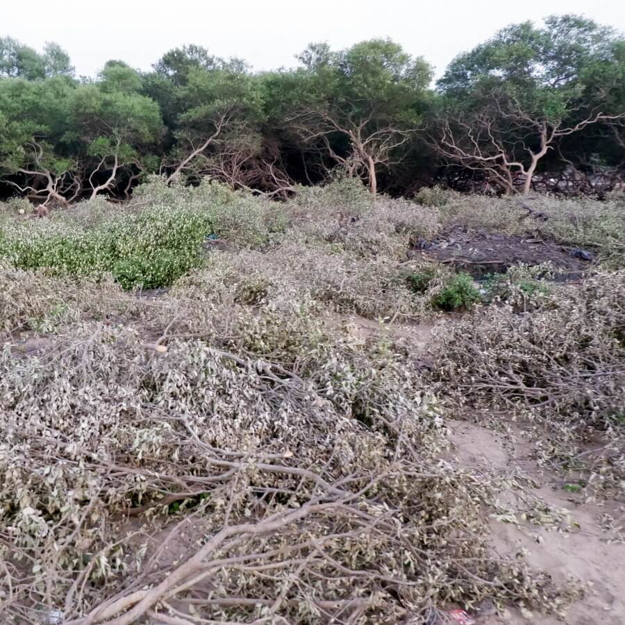
Photo: Shweta Wagh
So, we need to ask: how effectively do the proposals for climate action alter the city’s current planning and development paradigm? If Mumbai’s planners are really serious about alleviating the extreme threats that the city faces, they must first take the precautionary principle[15] seriously.
This would involve undertaking a systematic and comprehensive review of the existing plans and projects in the city with an open mind to assess which ones are and which are not in the interest of the city’s long-term health and security. A comprehensive and careful assessment of the existing land cover and ecological processes at the scale of the Mumbai region is, therefore, critical. It would also involve undertaking a systemic change as climate action, not simply an assortment of projects that deflect attention from business as usual.
What Mumbai needs, in other words, is progressive environmental action, rather than innovative ways of profiting from a crisis.
Shweta Wagh is an architect, urban researcher and associate professor at the Kamla Raheja Vidyanidhi Institute for Architecture and Environmental Studies (KRVIA), Mumbai. Her research work has focused on urban and environmental policy and planning, political ecology and the coastal commons. She is currently pursuing a PhD in sociology at Indian Institute of Technology-Bombay.
Cover photo: Shweta Wagh

