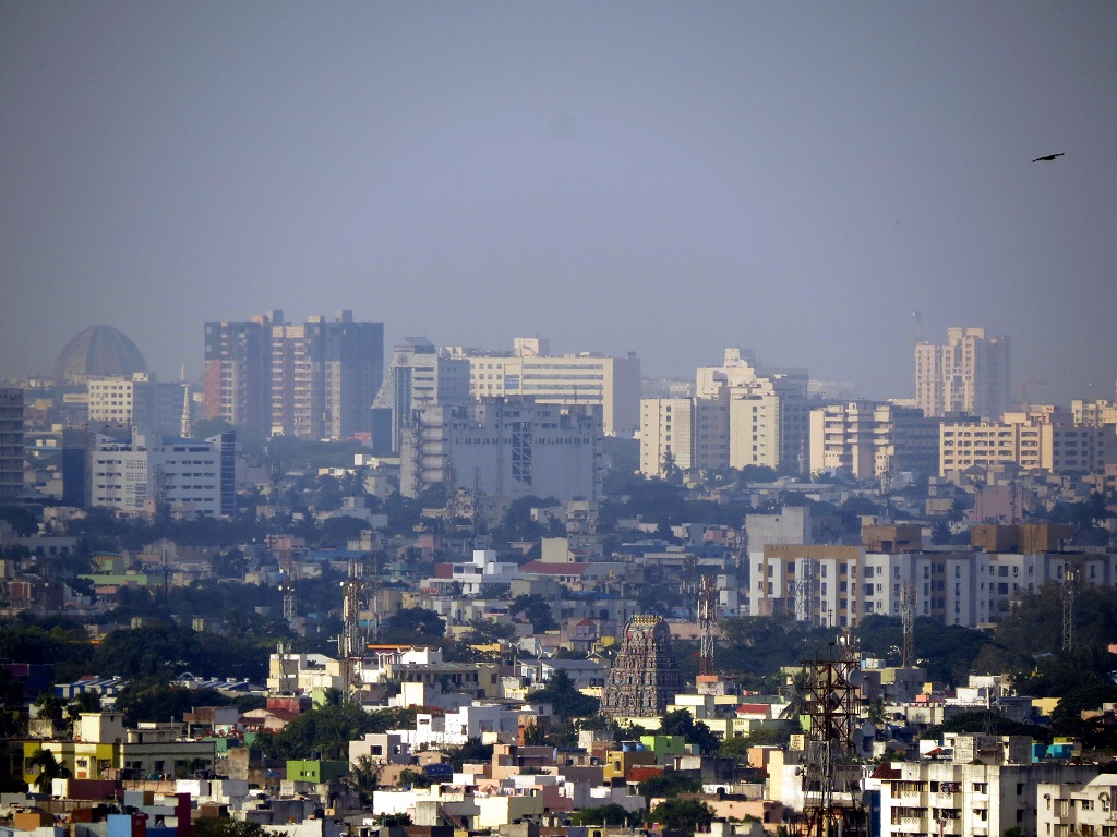
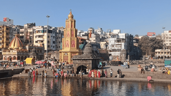
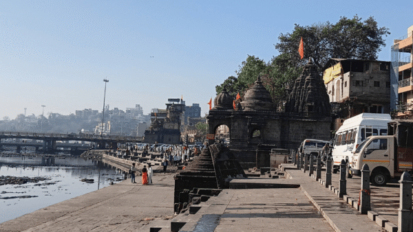
The city of Chennai wants to grow. But can it do so without hurting itself, its residents and the people and environment of distant places? If one were to listen to water – the city’s defining element – Chennai’s tryst with growth is fraught with danger. Bound by the Bay of Bengal and watered by the erratic northeast monsoon, Chennai’s flat coastal terrain offers little room for painless growth and no tolerance for hydrological mistakes. It is little wonder that this rapidly growing south Indian metropolis has made a dubious name for itself as a flood-prone and water-scarce city.
Chennai exemplifies the dilemma of opportunity and urban malaise; it also highlights the tendency of growth to worsen environmental risks and reproduce socially unjust apportioning of goods and ills. Successive administrations promised to weather-proof the city but Chennai’s notoriety as a disaster city has only grown, and will continue to do so as long as it is addicted to growth as commonly understood today. That is because this addiction flies in the face of topographical limits that have already been exceeded and the risks presented by an increasingly violent climate.
After every disaster, commentators blame climate change and “unplanned” growth for Chennai’s predicament. But what if it is not unplanned growth, but growth itself that is behind the urban quandary? New catchphrases qualifying the kind of growth that is desirable speak of green, sustainable or climate-smart cities but these perpetuate a false dualism that sees urban social processes as separate from urban ecological processes, and underplay the fact that a city’s environmental footprint extends far beyond the boundaries of its metropolitan area.
Growth so far
Urban growth now correlates to an increase in the built-up area to accommodate homes, infrastructure and businesses. This increase is simultaneously a response to and a trigger for more such growth. Chennai’s growth is not unlike the trajectory of other urban megapolises. Planned or unplanned, a city’s growth comes at the cost of land and resources. Even within its own borders, growth is spatially predatory. Well-planned growth that is sensitive to environmental factors can mitigate risks and allow for an environmentally healthy urban space, but only as long as growth respects the limits imposed by local topography and climatic conditions. Chennai, I argue here, has long exceeded its limits; any further development will only aggravate risks.
Chennai’s growth was to have been regulated by two master plans – one from 1976 to 1996 and the other 2006 to 2026. In these, the built-up area was projected to increase by 330.58 square kilometres over 50 years from 1976 to 2026. But according to the Comptroller and Auditor General’s (CAG) audit report [1] of the 2015 floods, the built-up area increased by 450.26 square kilometres between 1979 and 2016 and “the area under water bodies declined by 9.67 square kilometres”. This, according to CAG, pointed to “large-scale illegal constructions”
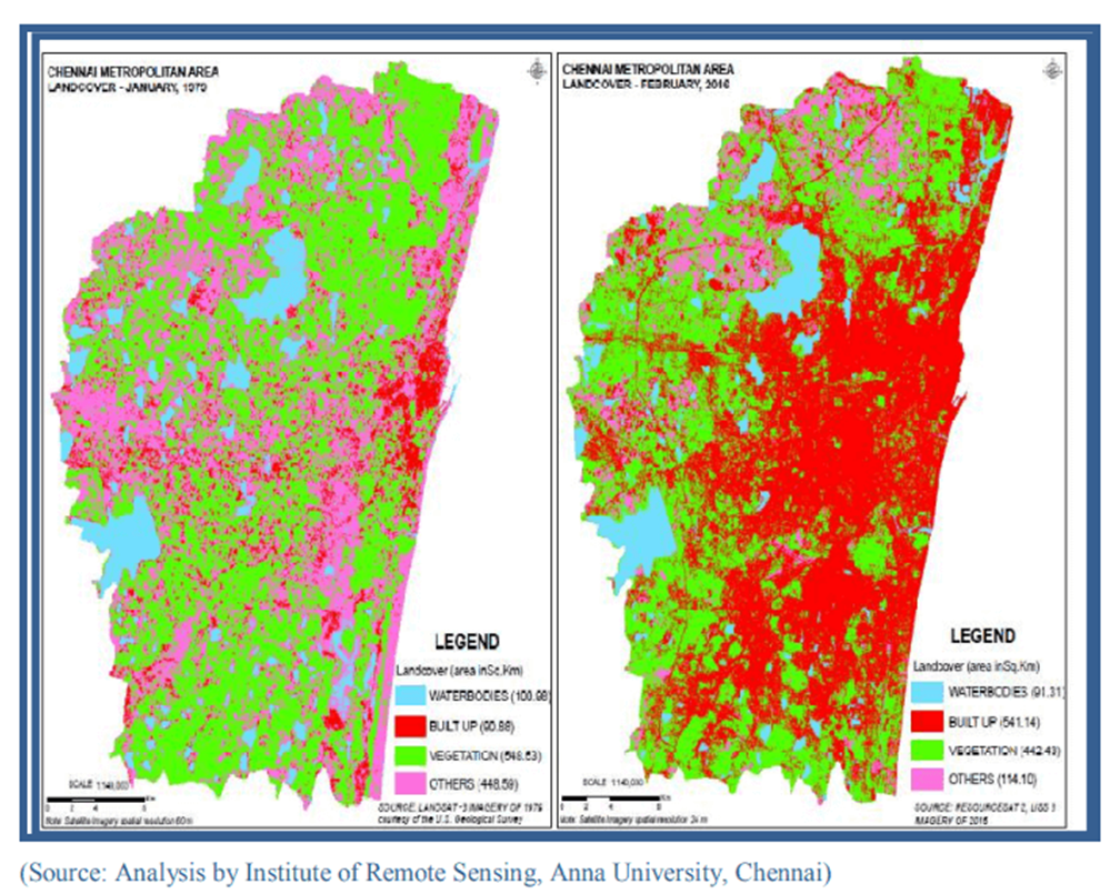
Change in metropolitan area land cover
In the wake of the November 2021 floods, the Tamil Nadu government announced [2] that the third master plan for 2026-2046 would adopt a “flood-sensitive planning permission regime”. Word around town is that the master plan area is to be increased between 6,000 and 8,800 square kilometres from the current 1,189 square kilometres. All the extra land will come from the neighbouring districts of Chengalpattu, Kanchipuram, Thiruvallur and Ranipet.
Agricultural wetlands and waterbodies constitute a significant portion of the unbuilt lands in these districts. The proposal to bring them under the metropolitan planning area has triggered sharp reactions. While the Chennai Metropolitan Development Authority (CMDA) [3] argues for expansion citing the threat of haphazard and unplanned growth in the absence of a master plan, critics point to CMDA’s failure in regulating 1,189 square kilometres to suggest that the expansion would be a recipe for a much larger disaster.
A city’s spatial growth closely follows economic investments in urban and inter-urban infrastructure. Given the infrastructural investments in the pipeline, expansion is as much a given as is its consequences; there will be heightened disaster risk and vulnerability. As a tropical city on a high-energy coast and subject to the capricious northeast monsoon, Chennai is faced with multiple challenges: heat waves, cyclones, heavy rainfall events, prolonged droughts and creeping sea-level rise. A city that is unmindful of its natural limits will not only make itself vulnerable by turning these phenomena into heat stress, floods, water scarcity and salinity intrusion, but also degrade distant places that it colonises in order to grow.
Limits to growth
The city’s refusal to confront unfettered growth as the cause of urban malaise mirrors the world’s reluctance to acknowledge it as the cause of planetary disease. Driven by a growth-based economic model, both Chennai and the world are bumping up against natural thresholds. As early as in 1972, the Club of Rome’s classic report “Limits to Growth” warned that the unceasing pursuit of economic growth came with the risk of a “sudden and uncontrolled collapse” of the world system.
The term “sustainable development”, popularised by the 1987 Brundtland report, gave the growth agenda a fig leaf to surge ahead unchecked. After more than 30 years of “sustainable development”, the world sits at the brink of ecological collapse amid an unfolding climate crisis. The old catch phrase has been replaced by new ones – such as green growth and green economy – of equally dubious viability. Meanwhile, aided by governments of developed nations, bilateral and multilateral banks, and multinational NGOs, cities in the rest of the world continue with their expansionist project by declaring their commitment to climate smart and green urbanisation.
CMDA’s glib promise to prepare a master plan that will “ensure the natural flow of water is suitably channelised” flies in the face of history and hydrology.
Historical folly: The East Coast Road
In 1994, I recall participating in a series of protests against the then proposed East Coast Road (ECR) project that ran due south and parallel to the coast from Chennai. The road that promised to reduce travel time to Pondicherry also threatened to drastically alter land-use along the alignment, by triggering strip development on either side of the ECR. To the east of the ECR, between the proposed road and the Bay of Bengal lay the sparsely populated dune-studded beaches extending all the way to the Kovalam estuary. To its west, the land cover was predominantly low-density housing, agriculture and horticulture, marshlands on either side of the Buckingham Canal and the sprawling Kovalam backwaters. ECR as an infrastructure of commerce was slicing through and replacing Chennai’s infrastructure of water.
Beaches alongside the ECR and falling within the metropolitan area are marked as an Aquifer Recharge Region in the second master plan. The plentiful east coast aquifer is not merely a source of sweet water, but a defence against salinity intrusion. As long as the sand is open to the skies, the groundwater recharges with every rain and pushes the fresh water down and out towards the sea to keep the seawater at bay.
Overdrawing groundwater and densification of built-up area on the sand would compromise annual recharge of the aquifer and aggravate salinity intrusion. The road itself – a north-south expressway – rises like a dam across the undulating coastal terrain trapping the east-flowing floodwaters. Marketed as a scenic coastal expressway, the ECR did exactly what it was designed to do: pushed up real-estate prices and triggered intense urbanisation on either side of the road. This urbanisation aggravated floods, triggered salinity intrusion into the aquifer, and exposed large numbers of people to the fury of the sea. The Indian Ocean tsunami on December 26, 2004, sends nightmares even 18 years later.
In a review of post-tsunami relief and reconstruction efforts, the CAG noted that violation of Coastal Regulation Zone (CRZ) norms and the resultant overcrowding of coastal areas “played a major role in loss of human lives and property during the tsunami”. It also noted that the “Ministry [of Environment and Forests] had amended the CRZ Notification and the range of amendments presented a trend that allowed commercial and industrial expansion in coastal areas”. That was in 2006. The current CRZ notification has willfully diluted a 2011 reference to a hazard line within which development was to be regulated, and okayed certain kinds of structures as close as 10 metres from the High Tide Line.
Building the ECR was human policy, but once built, the mushrooming urbanisation in the aquifer recharge region was literally a force of nature. To think that such development can be controlled by good enforcement of the master plan is to ignore the nature of a road and deny the power of politics and money. The road to hell is a road like the ECR – and paved.
Understanding water, knowing land
On December 2, 2015, world leaders who gathered in Paris for the United Nations Conference of Parties to the Framework Convention on Climate Change were greeted with images of planes floating in the floodwaters that had swamped the Chennai airport. The airport’s predicament has been blamed on its second runway that extends into – and blocks – the Adyar river. The rain on December 1st was the heaviest over the river’s catchment; the rain gauge in Tambaram recorded 494 mm in 24 hours while Chembarambakkam lake near the source of the Adyar river registered a rainfall of 470 mm. Nearly half of the annual rainfall quota had fallen in just one day.
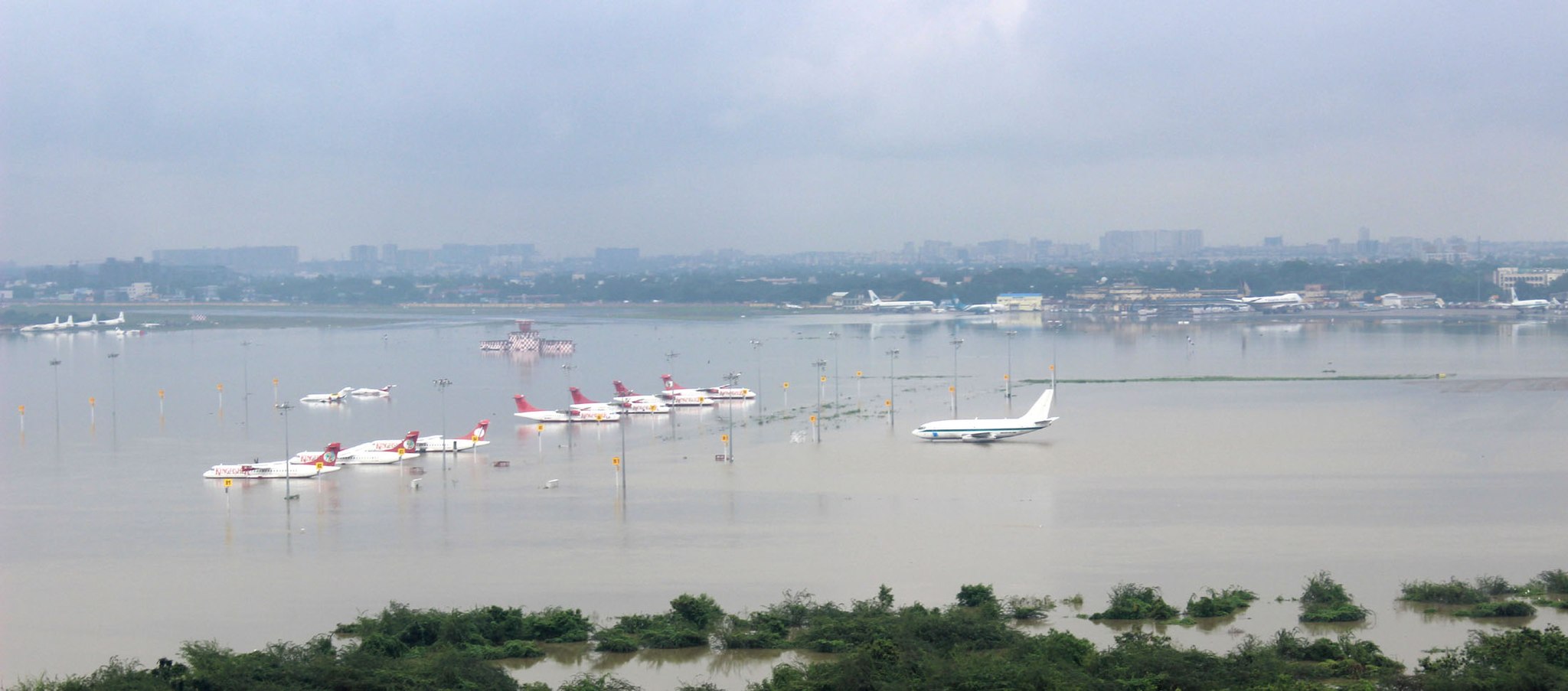
Credit: Creative Commons
The 2015 floods are locally referred to as the Adyar floods because it was this river that was overwhelmed by the inflows from its catchment. Acknowledging the limits of the Adyar, for instance, will allow us to accept the limits of the city’s growth within its catchment.
Understanding floods requires a commonsensical appreciation of how water behaves on land. When rainwater hits land, its tendency to percolate (infiltration) and flow (run-off) along the surface depends on the intensity of rainfall (expressed as quantum of rainfall per hour) and land-use and land-cover. Open, unbuilt and vegetated land will allow more water to percolate and less to run off for any intensity of rainfall. For the same amount of rain, less water will infiltrate and more run-off will be generated on paved land. All run-off will have to be either stored in surface water bodies or drained to the sea through a network of micro-drains connected to artificial or natural macro-drains like rivers.
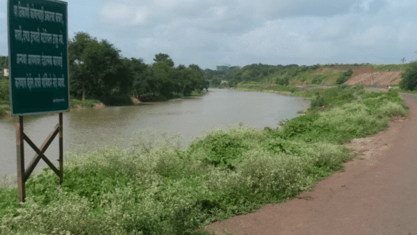
Chennai is located at the tail-end catchment of four large natural drains that open up to the sea. The Kovalam backwaters and estuary drain the Pallikaranai marshland, the IT corridor and the areas to the west of the ECR. The Adyar and the Cooum run through the south and central parts of the city respectively; their floodplains are almost entirely built-up. The Kosasthalaiyar river along the city’s northern edge meets the sea at Ennore estuary. As the city’s largest river capable of carrying more than the combined discharge capacity of Adyar and Cooum, this is the only river with a sprawling backwater that extends all the way up to the Pulicat Lagoon, India’s second-largest brackish waterbody.
Each river drains a dedicated catchment, the run-off from which will find its way out if the route is unobstructed. In the flat coastal plains characteristic of Chennai’s location, water tends to flow off, albeit slowly. Early settlements in the region needed to find ways to make water stay. They designed eris and thangals (tanks), kulams (ponds) and ooranis (drinking water ponds) to harvest rainwater, irrigate fields and grow villages. The landscape of Chennai, Thiruvallur, Kanchipuram and Chengalpattu is a mosaic of such wetlands. By trapping and storing rainwater, these water bodies mitigate floods by diverting run-off from the drain network. They will have to fill up and overflow for their waters to contribute to river flows.
The Adyar has 450 eris and thangals within its 720 square kilometres catchment. The Adyar floods have been blamed on uncontrolled release of waters from the Chembarambakkam reservoir. However, a seminal study [4] of the floods by the Interdisciplinary Centre for Water Research at the Indian Institute of Science explains how other factors were at play. The December rains in 2015 came at the end of a wet November – only the second November in 100 years to record more than 1,000 mm of rainfall. All tanks in Adyar’s catchment were filled to the brim. The land was saturated and incapable of accommodating any rainwater through infiltration.
According to the study, release from the reservoir was only 800 m3/s, whereas “the flood flow from the parallel catchment (uncontrolled by the [Chembarambakkam] reservoir and flowing from Manimangalam, Perungalathur and Tambaram) alone may have contributed as much as 3,000 m3/s. Together, the flood at its peak when it entered the city has been estimated to be about 3,800 m3/s (1,34,195 cusecs), whereas the flood carrying capacity of the Adyar river is only about 2,038 m3/s (72,000 cusecs)”.
This limit – a flood carrying capacity of 2038 m3/s – of the Adyar river or 3,540 m3/s for the Kosasthalaiyar are hard hydrological ceilings that the city has to reckon with. While the carrying capacity of micro-drains can be enhanced, not much can be done to increase flood flows within large natural drains.
When urbanisation means only growth, growth involves an increase in built-up area which in turn involves an increase in rainwater run-off that ends up overwhelming the river.
Repeating history: A second airport
Since 2008, a number of sites have been earmarked for Chennai’s second international airport – Cheyyar, Cheyyur, Mamandur, Parandur, Gummidipoondi. All the identified greenfield sites involve substantial conversion of agricultural wetlands, water bodies and village commons. Responding to a question in the Rajya Sabha, minister of state for civil aviation VK Singh clarified that while Mamandur in Thiruvannamalai district and Parandur in Kanchipuram district had been shortlisted, the state government was yet to take a final decision.
The Mamandur site falls within the catchment of the Palar river which was in spate last November, and Parandur drains into the Adyar. I located a project layout map [5] of the latter site and verified its authenticity by speaking to Capt Mohan Ranganathan, an aviation safety expert who was part of the site assessment team that visited Parandur more than a decade ago.
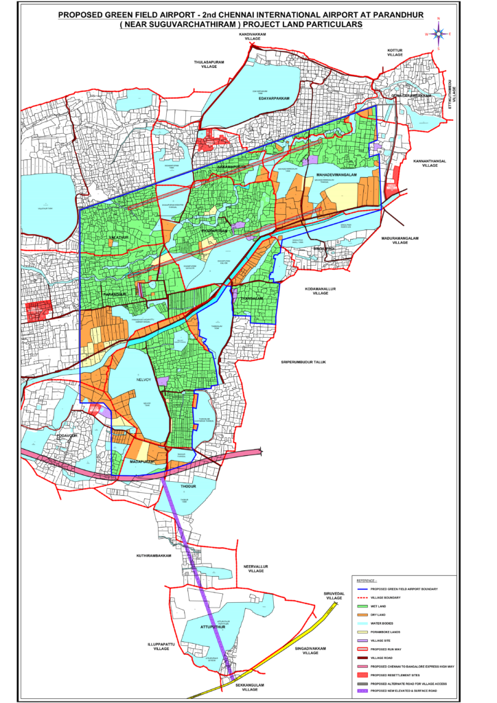
At first glance, the 4,500-acre layout in the Parandur-Sunguvarchatram area near Sriperumbudur, around 40 kilometres from Chennai, would seem inappropriate due to the extent of wetlands it would impact. Nearly 90 per cent of the site is either agricultural wetlands (green), poromboke water bodies (blue) or other poromboke commons (yellow). But even if it were not wetlands, the establishment of an airport would involve an increase in built-up area and land-cover under impermeable surfaces.
In 2015, Adyar was overwhelmed by floodwaters from its south western catchment where Parandur is located. Even if only 50 per cent of the 4,500-acre (18 square kilometres) site was to be paved, that would result in a rainwater run-off of 177 m3/s for a not-so-abnormal rainfall intensity of 70 mm/hr. That is very high for a 9 sq km site, considering that the 3,000 m3/s that overwhelmed the Adyar came from the river’s rural catchment of about 500 sq km of which Parandur is a part.
Not factored in these calculations are the increases in built-up areas triggered by various infrastructure projects planned for the peri-urban and inter-urban regions. Airports – like roads – trigger further growth and urbanisation when industries, hotels and establishments sprout as part of the industrial ecosystem created by this development. The conventional engineering response to such development would be to provide an efficient stormwater micro-drain network and rainwater harvesting structures on site. However, such interventions would be inadequate.
Paving over natural rainwater harvesting infrastructures like water bodies and wetlands cannot be compensated for by human-made rainwater harvesting structures. Micro-drains are only as effective as the capacity of major drains to receive their discharge. As Chennai’s experience in 2015 proved, the city has grown in excess of its natural limits. Growth of the same kind is no longer an option and shrinking may be the only route to resilience. If climate change is all that it is made out to be, the disasters of this decade should be seen only as teasers. The real show is yet to begin.
Nityanand Jayaraman is a Chennai-based writer and activist, and co-founder of Vettiver Koottamaippu, an anti-corporate social action collective.
Cover photo: Creative Commons
There is 1 comment
All residents of coastal cities like Chennai and Mumbai should read the above article explaining why the current rapid development of coastal cities puts them and neighbouring areas at tremendous risk of more severe flooding and fresh water scarcity.