The talk about Musi riverfront development has been around since 1997-98. Finally, on March 13 this year, a PowerPoint presentation was made in Hyderabad but the Detailed Project Report has neither been presented nor people consulted. However, work has been underway, especially the work of displacing people and demolishing homes that stand in the way of the grand plan. The presentation alone cost Rs 160 crore.[1] It rests on an unsubstantiated assertion that “Cities around the world are turning riverfronts into economic powerhouses” and proceeds to ask a misplaced question: “What could 55 kilometres of fully realised riverfront unlock for Hyderabad?”
From what is known, the Musi riverfront development project is less about the river and more about “unlocking” high-value land for economic ends-–at the cost of thousands who have lived and worked along the river for generations. Demolition drives have razed nearly 300 homes and, reports say, notices have been issued to acquire 53.82 acres, including 10.34 acres in Bandlaguda Jagir village for the Gandhi Sarovar, a key part of the project.
The Musi riverfront development’s first phase, covering 21 kilometres of its entire length of 55 kilometres in Hyderabad, is pegged at nearly Rs 7,000 crore;[2] the total cost is estimated from Rs 56,000 crore to a staggering Rs 1.5 lakh crore, drawing criticism from the opposition.[3] If these figures hold, it will be the most expensive riverfront work in India.
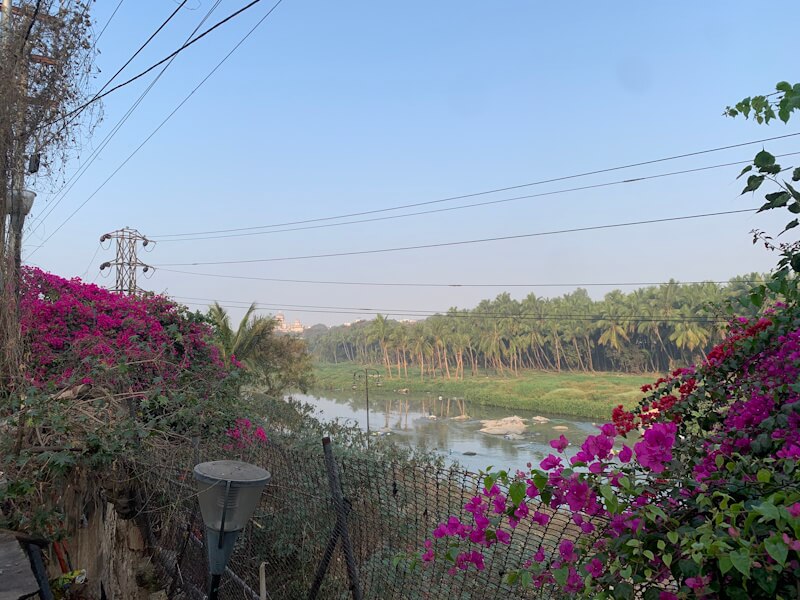
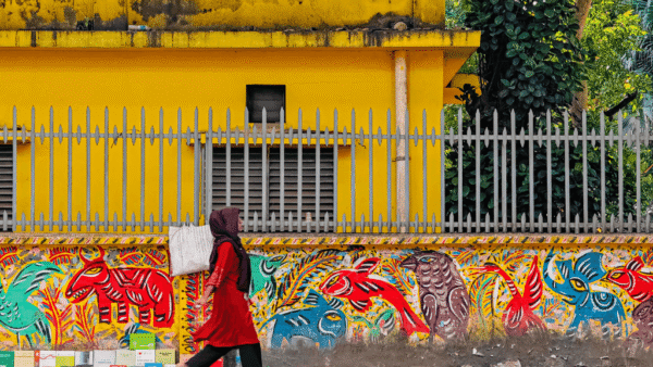
Photo: Shobha Surin
Telangana Chief Minister A Revanth Reddy, speaking in the state Assembly in January against allegations of inflated costs, widespread demolitions, and non-consultation with people, defended the project as “a civilisational necessity”.[4] The Congress leader said he had studied riverfront models in London, New York, Japan, South Korea and Singapore; he also cited the Sabarmati riverfront project in Ahmedabad, Gujarat, and the Ganga rejuvenation work in Uttar Pradesh-–both states led by Bharatiya Janata Party governments.
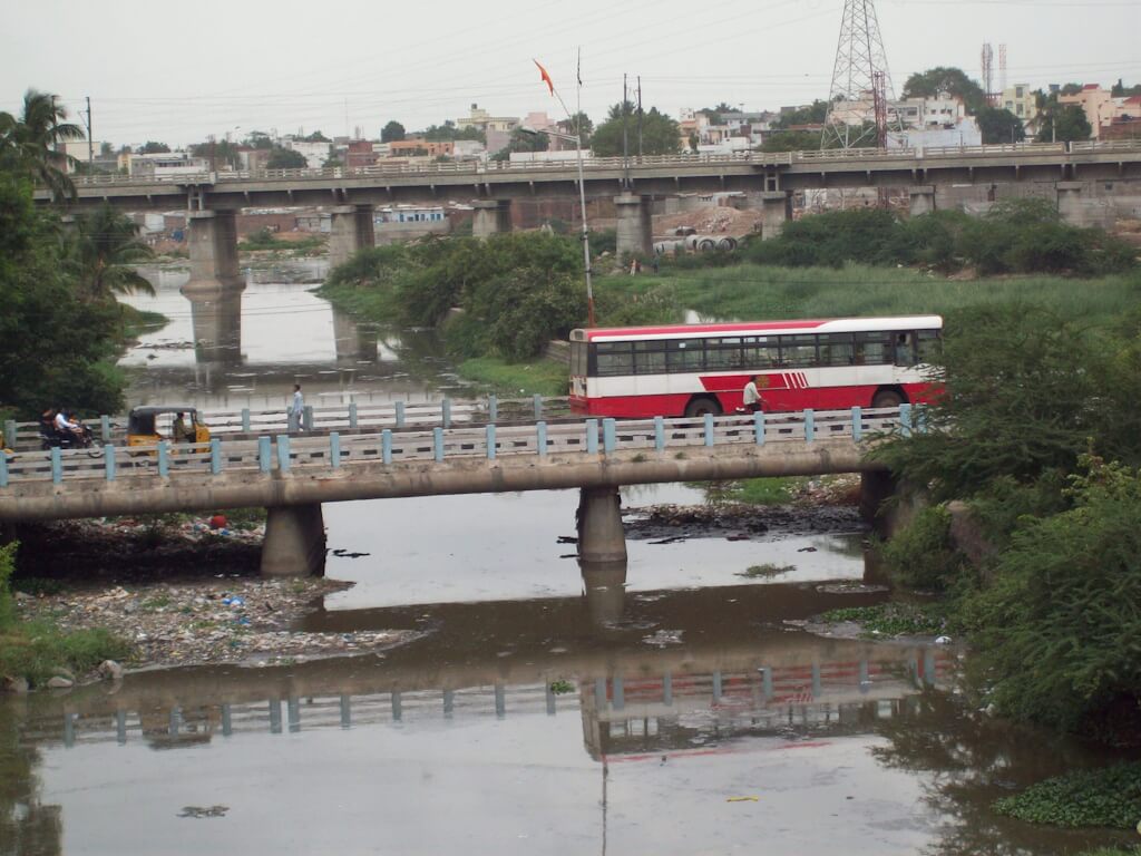
A walk along a stretch of the Musi, from Salar Jung Museum to Afzal Gunj and Petlaburj, shows the rain-fed river choked by garbage, industrial effluents and sewage. The river snakes through the centre of Hyderabad flowing under 17 bridges, including Chaderghat and Nayapul. Everywhere, it stinks and struggles to be visible. The monsoons bring floods. The confluence of the Musi and the Esa, where Mahatma Gandhi’s ashes were immersed in 1948, will have the grand Gandhi Sarovar comprising his statue of 150 metres costing Rs 200 crore, a museum, and a meditation centre.[5] For this, ironically, demolitions will be done.
Critics have relentlessly asked questions about the project, none fetching cogent answers from the government. The most significant question remains: Is the riverfront project about reviving the Musi and restoring its ecology or about creating prime real estate and ‘beautification’? If the Sabarmati riverfront project is the model, as Reddy stated, which has now become the template for riverfront projects across India, then the jury need not be out—the Musi project will do little for the river itself. 0
The plan and what’s missing
At its core, the Musi riverfront development project was always about commercial exploitation of the river banks and floodplain areas. Back in 1997-98, when the then Chief Minister of undivided Andhra Pradesh N Chandrababu Naidu launched the project, he proposed relocating slums along the Musi and developing the land; it was scrapped after strong opposition, especially by slum dwellers. Successive governments attempted to revive it, in vain. In the intervening decades, the Musi was pushed into further neglect and pollution.
The Reddy government now proposes a five-phase work. The Musi Riverfront Development Corporation Ltd (MRDCL), helming the project, will develop the Gandipet–Gowrelly stretch from Hyderabad west to east including 46 villages. This first phase of 21 kilometres[6] will also cover a stretch of Esa River too. Here, at the confluence, a V-shaped structure has been designed to create the Gandhi Sarovar to re-position the Musi as an international tourist destination.[7] This will require huge land acquisition, including slums and apartment complexes. The designed tourism circuit connects Hyderabad’s historical buildings like the Charminar, Taramati Baradari and others along the Musi’s catchment areas.
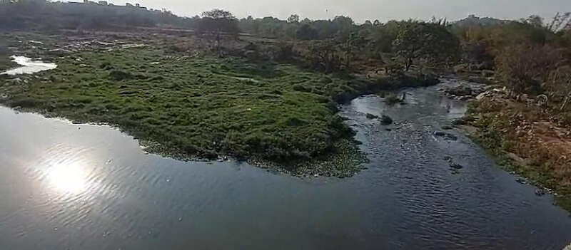
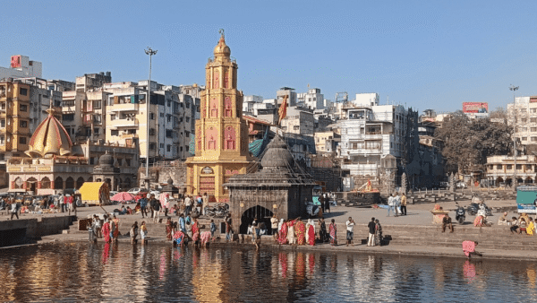
Photo: QoC File
The plans also include, according to Reddy, diversion of the Godavari waters-– proposed at 20 thousand million cubic feet-– to solve the dry-months problem of the Musi and provide drinking water. However, it is the cleaning of the Musi that presents the primary challenge. Hyderabad generates around 1,950 million litres per day (MLD) of sewage; 26 percent of Greater Hyderabad draining the untreated sewage into all waterbodies, including the Musi.[8]
The existing 25 sewage treatment plants (STPs) with a capacity of 772 MLD are inadequate to handle the sewage from housing colonies, townships, and industries. The PowerPoint presentation lists “sewage interception before it enters the river” among the seven components of Phase 1 and declares there will be “prevention of sewage joining this stretch”. But questions linger regarding feasibility and implementation. Shifting polluting industries, especially the pharmaceuticals, may help but no one is sure if this forms a part of the plan.
However, what is clear is that people who have lived along the Musi, legally and otherwise, are not part of the plan. Nor is restoring the ecological biodiversity of the stretch. As activist Lubna Sarwath remarked to Question of Cities, these are big capital, big technology projects but with less people and less ecology; “what we want is ecology, people and our heritage”.
The designed displacement
As many as 10,600 to 10,775 houses would be demolished and 3,279 acres of land acquired for the riverfront development, according to a MRDCL drone survey in 2024. Only after the sewage has been tackled, “…the task of discussion, dialogue, persuasion with the people living along the banks and in the riverbed be undertaken, and rehabilitation provided within two-five kilometres. Beautification is something that must be done for the people. It is not something to be done by removing and excluding the people,” wrote N Venugopal, editor of Telugu monthly Veekshanam, in this scathing piece in South First.[9]
But removal and exclusion have dominated the project so far. People’s ire has been rising at being made sacrificial lambs for the multi-crore project. After the 2024 survey which identified over 10,000 homes (2,116 on the riverbed and 7,850 in the buffer zone), the displaced were assured of no forced displacement besides a 2-BHK flat.[10] Protests had erupted then.[11] Yet, people have been forced out.
There is greater worry now. The Government Order No 921, issued on February 16 this year, quietly exempted the project from the mandatory Social Impact Assessment as per the Land Acquisition, Rehabilitation and Resettlement Act, 2013. This means the displaced may not be able to claim the Right to Fair Compensation and Transparency. This was troubling, as social activist Medha Patkar, who expressed solidarity with the displaced, remarked.[12]
The phase-wise plan—and the lack of Detailed Project Report so far—means that the affected and the activists have little sense of the cumulative impact of the riverfront development. They react to the government’s moves. Activists like Sajaya Karkala reckon that the large-scale acquisition of land “will likely displace nearly 1.30 lakh people across all classes—from the economically backward to the upper middle class”.
Some of the slums along the Musi, like at Shankar Nagar, already faced demolition in 2023-24. Sheikh Mujayat, 61, pointed to scattered bricks where his home once stood. “They did not give us a reason, just bulldozed 297 houses,” he recalled. The debris of partly-demolished huts is a constant reminder of how little they matter to the riverfront development. In October 2024, nearly 200 structures in the bastis of Moosa Nagar, Rasoolpura, Vinayak Nagar, and Shankar Nagar were demolished overnight.
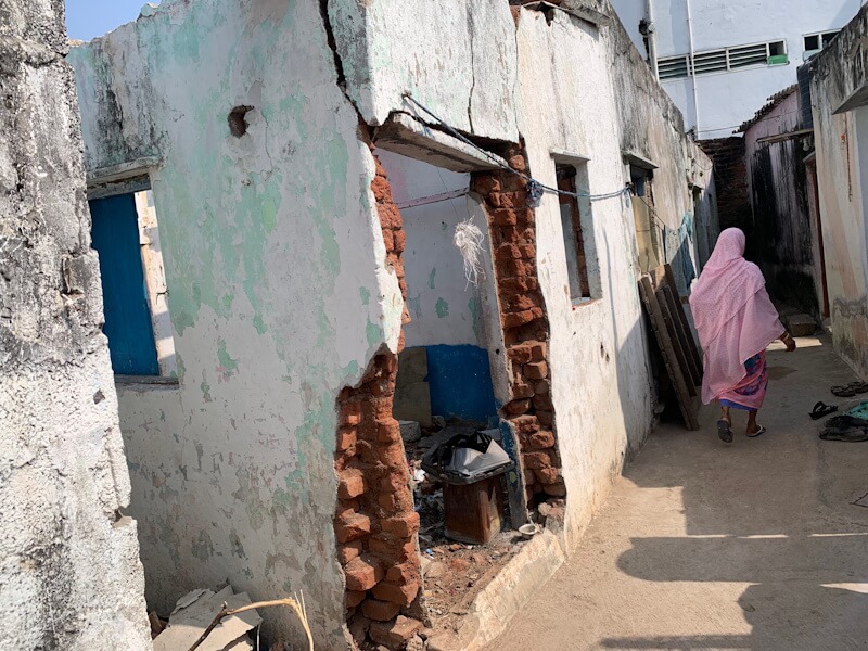
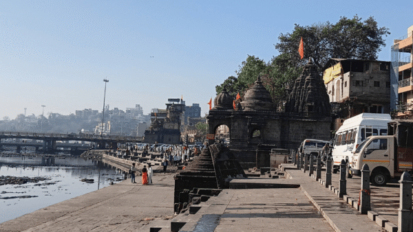
Photo: Shobha Surin
But not all are dismissed this way. The MRDCL issued a notification inviting voluntary surrender of land within the 50-metre buffer/floodplain area on both sides of the Musi. “Properties falling within the Full Tank Level or Maximum Flood Level of lakes and rivers would receive TDR equal to 200 percent of the built-up area surrendered. Lands in designated buffer zones would qualify for 300 per cent. Parcels outside buffer zones but required for public purposes connected to water body conservation would receive 400 per cent,” explained this news report.[13]
A clear discrimination emerges—hundreds of slum families displaced as their homes are summarily demolished while the landed are invited to surrender and offered Transferable Development Rights.
The pushback, social and environmental
Faced with the loss of homes, people have grouped. The Musi Jan Andolan (MJA), a people’s movement, represents the communities that have long lived along the river. In various statements, the MJA has criticised the displacement, including of people who lived here for 70-80 years, and the concrete-heavy riverfront work which is bound to destroy natural ecosystems and worsen climate change impact. It has repeatedly demanded that the Detailed Project Report is released with boundaries and zones marked.
Here lies the crux. The definition of “buffer zone” has been changed by successive governments. Satellite maps of the old ‘unencroached’ river do not exist or cannot be found. In 2004, the zone was set at 12 metres, then expanded to 30 metres five years later, and marked at 50 metres in 2012. What happens to permitted constructions in the clear zone or unauthorised construction subsequently regularised there before land was marked as “buffer”?
The shifting definition has touched the better-off too. Residents of Madhu Park Ridge Apartments at Bandlaguda Jagir like Sudha Goparaju formed the Hyderabad Musi Joint Action Committee; nearly 425 families in the complex may lose their apartments. “What really put us off was when CM Revanth Reddy stated that this property has zero value and later said it was illegal,” said Goparaju, “When our complex came up, it was in the city’s outskirts but suddenly with the riverfront development, the 6.5 acres have become prime land.” Reddy later contradicted that the land was not sought[14] but residents remain unconvinced.
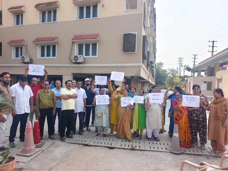
Photo: Vishali Naidu
Among the houses identified for demolition is Vishali Naidu’s independent house at Hyder Shahkot. She and others have opposed the project and forwarded their demands to the government. “We want Musi regeneration but zero displacement,” says Naidu, 40. Among the protesters is the opposition Bharat Rashtra Samithi (BRS) whose leader Patlola Kartik Reddy challenged the project in the National Green Tribunal; it was dismissed on April 2.[15]
Veteran geo-hydrologist Dr BV Subba Rao asserts the river rejuvenation should be done from its origin to the confluence. With the project focusing only on the middle portion of the Musi, a stretch within Hyderabad, “what about the pollution coming from upstream,” he asks. Adds well-known environmentalist Purushotham Reddy, bringing water from the Godavari will only increase flooding in Hyderabad: “There’s a serious objection to this…A heavy rainfall in Hyderabad will cause massive submergence.”
The two reservoirs — Osmansagar and Himayatsagar — built after the massive 1908 floods have kept Hyderabad relatively safe from floods. How the riverfront development interconnects with these defining lakes besides scores of small streams and other water bodies remains unaddressed. How the people of Hyderabad – beginning with the people of the Musi itself – will be reconnected with the river is a question that also lingers.
After the 1908 floods, the 14 sprawling gardens built along the Musi changed the landscape of Hyderabad, providing public spaces that strengthened the river-people link. “The current project must have some fundamental principles on how to reconnect people with the river,” said Rao, “Musi has its unique geomorphological and historical geographic background. We have to respect that. We need to design according to the river’s behaviour.” If only the multi-crore project had room for people’s voices.
Shobha Surin, currently based in Bhubaneswar, is a journalist with more than 20 years of experience in newsrooms in Mumbai. An Associate Editor at Question of Cities, she writes about climate change and travelled to Hyderabad for this story. She was most recently a Fellow of the Earth Journalism Network working on the issue of Non-Economic Loss and Damage suffered by communities due to climate change in Odisha.