On Mumbai’s Western Express Highway that connects more than a dozen suburbs before transforming into National Highway 48, as the street signs read Goregaon, there’s a sudden large expanse of green towards the inner side of the city, an oasis in the concrete jungle around it. A road winds off the highway. As you head inwards, the high-rises seem farther on the horizon and a vast expanse of grass and trees is all that is around. The air feels cleaner, breathing is easier, it is cooler than in the rest of Mumbai, and bird songs interrupted by the rustle of leaves replace the constant humdrum noise of the city. This is Mumbai’s Aarey Colony.
It’s also called Aarey forest because a part of it was finally declared a “reserve forest” in 2020 and the Colony is contiguous with the Sanjay Gandhi National Park, the only such protected natural area in the heart of any metropolis in the world. The bounties of the National Park are to be found here too. The Aarey Colony is home to several rare species of flora and fauna and also to tribal communities such as the Warlis who live in hamlets amidst the greens.
The fight to save trees in the Aarey Colony became national headlines three years ago when the then Maharashtra government led by BJP’s Devendra Fadnavis authorised the cutting of more than 2,000 trees overnight to skirt the protests by environmentalists and activists pushing back on the car shed for Metro Line 3. The car shed and metro offices, planned and part-constructed inside the Aarey Colony, had raised the hackles of several Mumbaikars who saw it as a direct assault on the only large green expanse in the city, its lungs as it were.
After the government headed by Shiv Sena’s Uddhav Thackeray took power in November 2019, there was a brief pause in the construction activities. In September 2020, the then state environment minister Aaditya Thackeray declared almost 800 acres of the Aarey Colony’s nearly 3,000 acres as “reserved forest” which meant no construction – or development as it’s euphemistically called – could take place. But it still left more than 2,000 acres open, without statutory protection. The part protection was welcome but there’s no guarantee that the next government will not overturn the decision.
Even if the newly reserved forest continues to be protected, nearly two-thirds of Aarey is up for grabs. The ‘development’ or construction inside Aarey has happened by design, through conventional urban planning. There lies the tragedy.
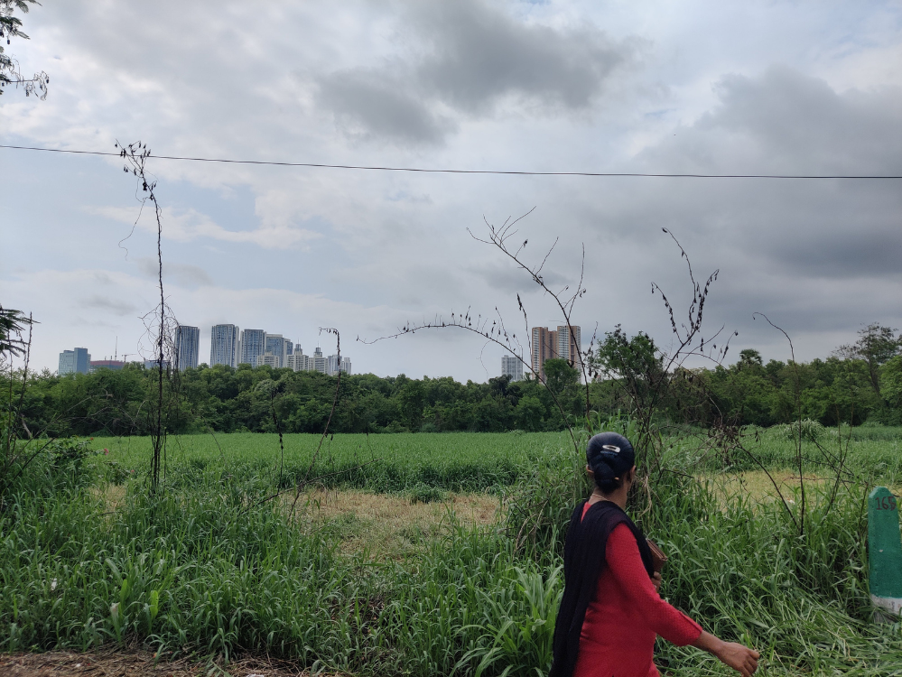
In Mumbai’s Development Plans (DP), Aarey should have been a protected natural area; instead, it has been marked No-Development Zone (NDZ). Contrary to popular understanding, the NDZ tag does not mean that there can be no construction. It means that the land does not have any ‘development’ but can be opened up for construction in the future in small land parcels for one project after another. Mumbai’s DP 2034 marks it as a growth centre on the lines of the Bandra Kurla Complex and Mindspace in suburban Malad, both developed on marshy or mangrove land which were part of Mumbai’s natural ecology and acted as drainage for the city during intense rainfall.
The Aarey Colony has been earmarked for constructions including a large zoo, gardens and theme parks, educational and research institutes, offices, and of course, the car shed of Metro Line 3 and Metro Bhavan. The Mumbai Metro Rail Corporation alone wants nearly 82 acres and the project estimates cutting down more than 5,100 trees. Mumbai is, once again, by deliberate design, planning to construct on a rich and diverse natural area rather than conserve it and build around it.
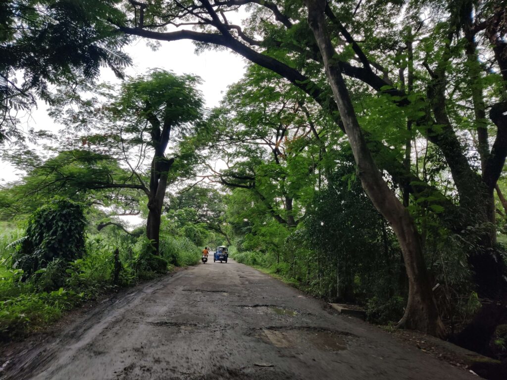
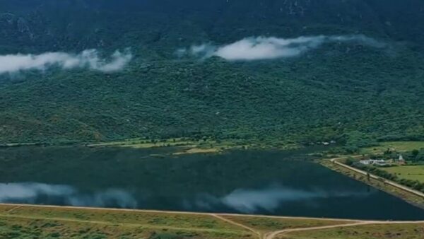
rocky outcrops and moist deciduous forest.
Photo: Jashvitha Dhagey
Aarey ‘Forest’
A raging debate has been going on for the last several years about whether the Aarey Colony is a forest. Officially, it was not designated except the reserved forest declared in 2020 – finally notified in March this year – but surveys confirm that it is, indeed, a forest. Flanked by the expanding city on its eastern, western and southern sides, the Aarey Colony straddles along the Sanjay Gandhi National Park at its north, as an almost contiguous stretch of forest. A section in Aarey was marked in 1951 for the fledgling dairy industry, the Film City was established on the outskirts of Aarey in 1977, but it was not opened for ‘development’.
The flora and fauna found in the National Park are also seen in Aarey. Hundreds of trees, birds, and wildlife species – some of which feature in the International Union for Conservation of Nature (IUCN) – point to Aarey as a unique biodiversity hotspot within a metropolitan area. Its habitat comprises a scrub forest, seasonal freshwater marshes, hillocks, rocky outcrops and grass; the moist deciduous forest is dominated by a variety of trees ranging from Teak, Indian Beech and Golden Shower to Red Silk Cotton and sacred trees, and exotic species such as the Rat Poison and Jujube trees. It has vast pastures of Marutian Para grass, used as cattle fodder; cattle sheds were ordered to be moved out in 2007 by the courts but a few still remain.
Leopards, wild cats, civets and Rusty Spotted Cats listed in Schedule 1 under the Wildlife Protection Act of 1972 are known to move between the National Park and Aarey Colony. The latter is home to new discoveries like the Heterophrictus Aareyensis (Tarantula Spider), Lychas Aareyensis (scorpion), and rediscovery of at least three species of Trapdoor spiders that were believed to be extinct. The study ‘Biodiversity of Aarey Milk Colony and Film City’ by researchers Zeeshan Mirza and Rajesh Sanap in 2007-2009 confirmed that the Aarey Colony is home to at least 76 species of birds, 86 species of butterflies, 46 species of reptiles, 13 species of amphibians, 34 species of wild flowers, 16 species of mammals, five species of scorpions and several species of spiders.
Amidst this rich biodiversity live tribal communities. The Aarey Colony has at least 27 padas or hamlets of the Warli tribe with at least 9,000 Adivasis living in them, according to community chief Prakash Bhoir. When the Development Plan 2034 was drawn up, the Warlis requested the Brihanmumbai Municipal Corporation to represent their hamlets on the map so they would be protected, but in vain. “We were here before Mumbai even got its name. Only when the forest was destroyed for buildings and roads, we became visible. The city has reached our doorstep, our lands are being snatched from us,” said Bhoir to Question of Cities.
Mumbai’s growing development needs
The threat of displacement for the Warlis and the assault on Aarey come from the city’s development needs which require land. Affordable housing and east-west connecting roads in the city top this list of needs. However, the Warlis have been up in arms about housing. They contest that their hamlets cannot be tagged as slums, and therefore they cannot be made beneficiaries under the city’s Slum Rehabilitation Authority (SRA) schemes. Under the SRA scheme, a slum can be razed and slumdwellers resettled on a small portion of land while nearly two-thirds of the land can be used for commercial development.
Despite the fact that Adivasi hamlets do not fall under the SRA’s jurisdiction, the authorities prepared to survey them. “Ours is not a jhopadpatti (slum), it’s a gaothan or pada. Every house has trees and a courtyard, goats and chicken. We cannot be an SRA project,” Bhoir explained. The authorities tried to convince the Adivasis that their homes are unsafe because of snakes and leopards, and they would get water and electricity which some hamlets still do not have. “We are not scared of the animals, we are scared of people who want to remove us… Jal, jangal, jameen (water, forest and land) we Adivasis cannot live without,” he added.
Mumbai’s housing problem is real. Nearly half of its population – an estimated 5.5 million based on Census 2011 population of 12.4 million live in slums or informal settlements. Such housing, congested and with poor amenities, forms more than 40 per cent of all housing in the city. There have been many schemes for affordable housing over the years, all of them claiming natural areas such as salt pan land or Aarey Colony, but these are often a ruse to start ‘development’ on natural areas.
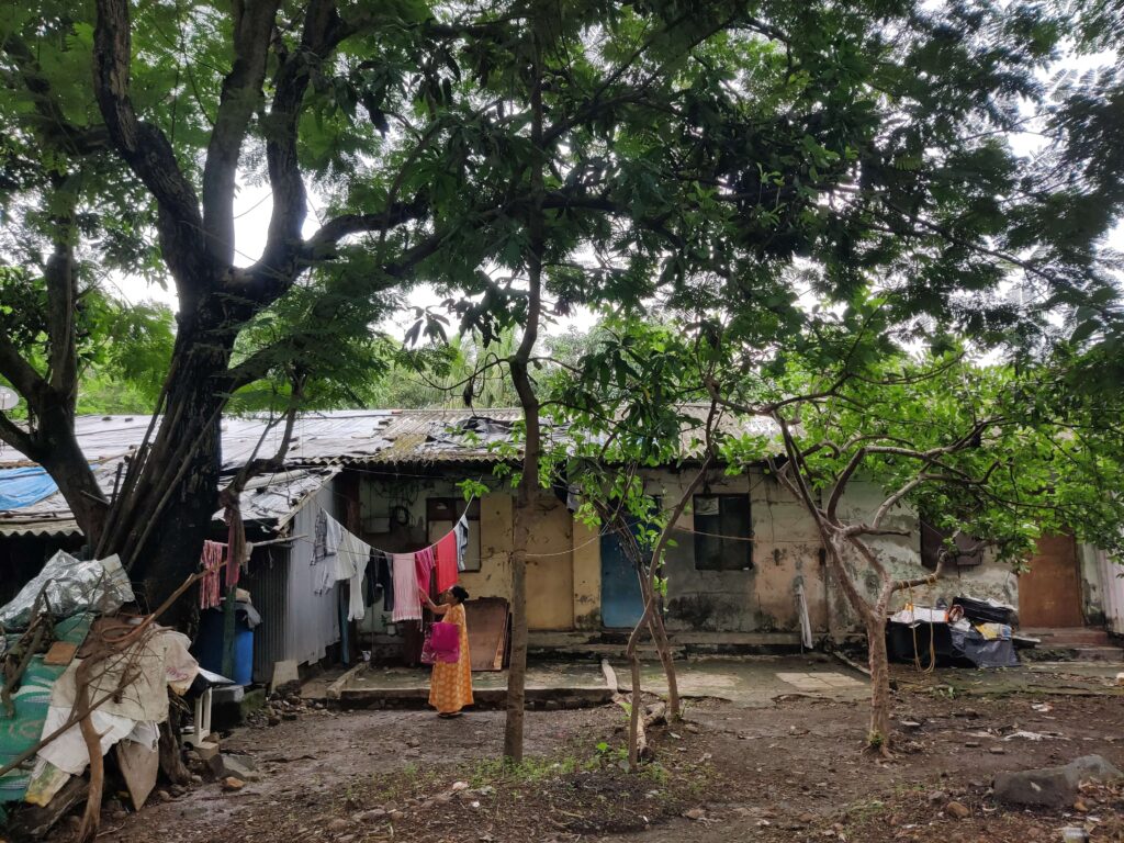
Photo: Jashvitha Dhagey
Floodplain of Mithi river
It’s often forgotten that the Aarey Colony is central to Mumbai’s flood management especially in the context of rising extreme rain events due to Climate Change. It is the floodplain of the Mithi river which became infamous during the catastrophic July 2005 floods. The metro car shed and other construction work have seen land-filling and concretisation along the floodplain which has already led to repeated incidents of water-logging in suburban Mumbai on heavy rainfall days.
The Mithi carries the overflow discharges of Vihar and Powai lakes, as well as excess rain runoff from industrial-commercial areas bordering the Aarey, the airport zone, and Bandra Kurla Complex and discharges all into the Arabian Sea at Mahim Creek. A government study[1] showed that construction on the Mithi’s floodplain would increase the chances of flooding downstream affecting millions when heavy rain during high tide – which occurs several times in a year – brings back sea water into the city; the absence of a flowing floodplain would lead to flooding or water-logging.
Fires threaten Aarey
The Aarey Colony is the largest accessible open space in the congested Mumbai and helps filter the polluted air of the city lending it the label ‘Mumbai’s green lungs’. It is also a picnic spot and a hub for nature lovers. It was not a surprise then that thousands gathered in a few hours to protest the cutting of more than 2,000 trees overnight in 2019. The metro car shed was to be moved to another location in Kanjurmarg, but it has not fructified yet. Activists fear that the car shed will be back in Aarey and become the start of another round of construction.
There have been consistent attempts to make Aarey into an island, an independent develop-worthy part. This, Sanjiv Valsan of the Save Aarey Movement said, was a ruse to turn it into prime real estate: “The Fadnavis’ government argued that Aarey was not a forest. The people who are after the land here want to separate it from the National Park…The concrete boundary between the two, the Film City, the Royal Palms residential complex, the proposed zoo, and the SRA projects all form a crescent of construction in an eco-sensitive zone.”
The metro work has been used as an excuse to “remove nearly 165 acres from the eco-sensitive zone…land is shown as reserved for a petrol pump in the Development Plan 2034 with signatures of high-ranking officials,” alleged Valsan. Police complaints against the land-filling and construction, and letters to Aaditya Thackeray, did not yield results.
The accessible areas around the crescent have seen a series of fires in the last few years, each blaze clearing the forest-like green zone. Between January 2022 and March 2022, Valsan said he had helped control 35 fires; there were 59 fire incidents last year. A forest fire in December 2018 at Dindoshi hills area damaged more than 3 kilometres of land owned by Raheja Builders, Valsan added.
While forest fires are a threat to Aarey, rampant tree-cutting along its periphery is damaging too. “Trees have been cut and burnt in the past 10 years,” explained Valsan, “It’s like a haircut. You will see that forest has disappeared in a straight line.”
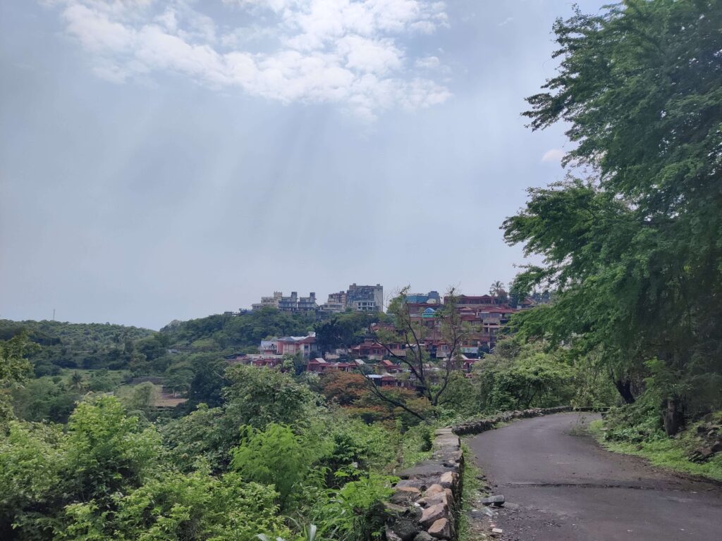
Photo: Jashvitha Dhagey
Future of Aarey
It is not the mere cutting of trees, even in thousands, that threatens the precious ecology of the Aarey Colony, but the land zoning and future constructions listed in the city’s Development Plan itself. In the official and conventional planning, Mumbai can have more infrastructure and affordable homes only at the expense of large tracts of Aarey.
Protecting the Aarey Colony from rampant and planned construction in the name of urban development has fallen on the shoulders of activists, sensitive planners, and the civil society at large. It should have been the responsibility and obligation of both the state government as well as the municipal corporation to plan Mumbai’s expansion around the unique urban biodiversity spot rather than on it. For this, nature-led planning has to become the norm.
The March 2022 notification, if not overturned for political reasons, protects at least 800 acres but on paper. Ensuring that it is not undermined or subverted is on citizens who must ensure, as activist Zoru Bathena said, that “developers do not get the permissions they need (to circumvent) the special protective tag that Aarey now has.” The area designated as forest land does not have major human presence, remarked Stalin D, director of environmental organisation Vanashakti, part of the Save Aarey Movement; the challenge will be in protecting large tracts of the non-designated land. “Going beyond what’s on paper and translating it on ground is going to take years,” he said.
The original inhabitants read it differently. They are worried that the March 2022 notification will displace them from their homes and land. “Our hamlets fall on what has been declared as forest. Though the hamlets themselves were left out of the forest demarcation, we don’t want to be ousted from the land we have been cultivating for years only because it has now become a ‘forest’,” said Prakash Bhoir. Aarey has survived because of us Adivasis, he asserted. “One Adivasi takes care of 500 to 1,000 trees. We sell flowers and fruits from them but we cannot sell oxygen. Aarey will survive if it has Adivasis. If Aarey survives, the city will have oxygen. Mumbai needs us.”
There is no doubt that Mumbai desperately needs Aarey. If only the city’s planners and authorities would recognise this.
Jashvitha Dhagey developed a deep interest in the way cities function, watching Mumbai at work. She holds a post-graduate diploma in Social Communications Media from Sophia Polytechnic. She loves to watch and chronicle the multiple interactions between people, between people and power, and society and media.
Cover photo: Jashvitha Dhagey

There is 1 comment
This totally makes me question what I have heard about this dilemma previously. The article is so informative and well articulated, thank you for this.