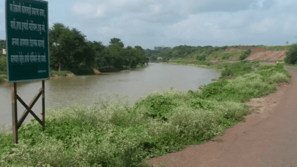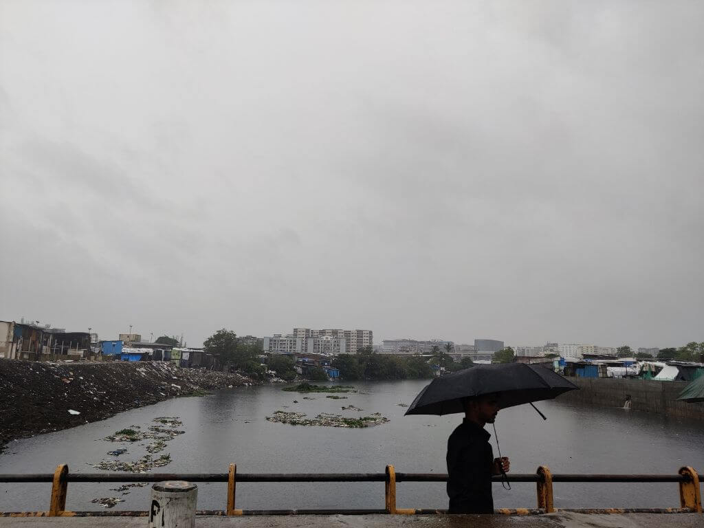
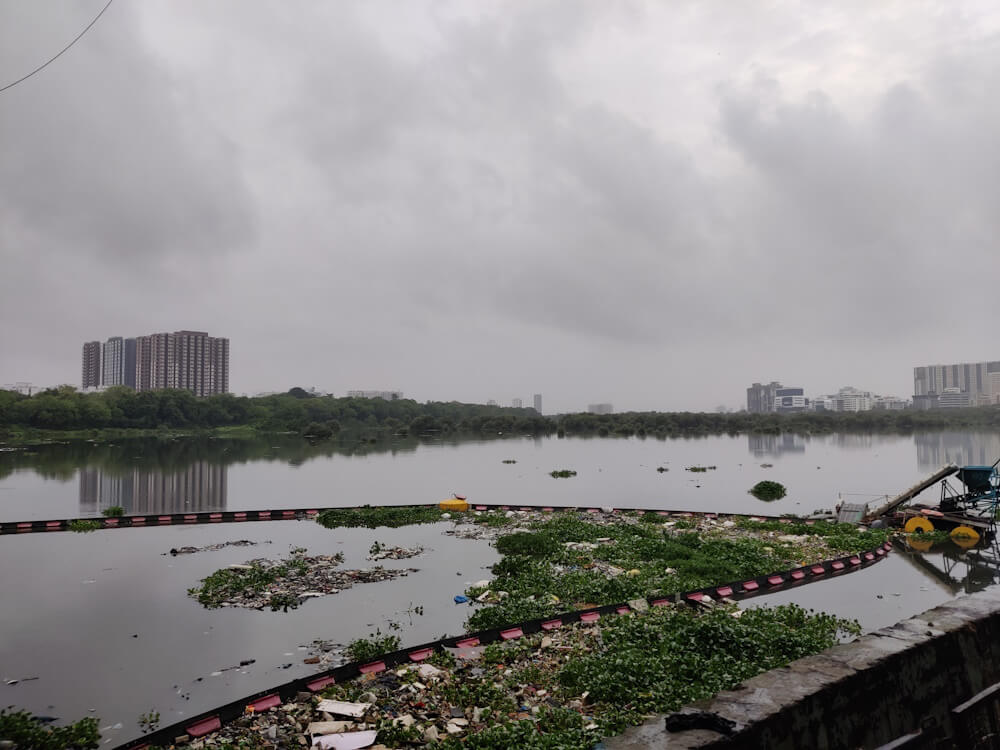
The Mithi, Mumbai’s longest river at 17.84 kilometres that most people see as a nullah, has the stench, brackishness, filth and flow that it has always had, most powerfully felt as it meets the Arabian Sea at the Mahim creek. The river had spectacularly failed the city on July 26, 2005, when a cloudburst led to a staggering 944 millimetres of rainfall in 24 hours, claiming nearly 1,100 lives, marooning lakhs of people, and damaging property worth Rs 5.5 billion.[1]
A crucial part of Mumbai’s natural storm water drainage system, the Mithi was heavily silted, filled with garbage, and several parts were constructed upon. It could not discharge the rush of water into the sea. Low-lying areas along the river were waterlogged for days, endangering many, especially in slums.[2] [3] As the 20th year of the floods rolls in, questions loom. Has the Mithi, and its complex ecology, been restored? Can it carry a larger amount of rainwater now? And, importantly, why is it only a drain for Mumbai’s rain?
A once-in-the-century rainfall like on July 26, 2005, may still inundate large parts of Mumbai; most systems are likely to fall inadequate for such a high level of precipitation. But in 20 years, with a comprehensive ecological approach, the Mithi could have been renewed to an ecologically-sound river which, in turn, would mean better flood control. Instead, a piecemeal approach has resulted in several engineering-led projects such as sewage treatment plants (STPs), concrete walls, widening and deepening.
Over the years, the Mithi itself was turned into a “project” with at least Rs 1,160 crore spent and tenders for another Rs 1,670 crore prepared last year, according to the Maharashtra government.[4] Add the annual expenses on desilting. It works out to over Rs 3,000 crore which, for nearly 18 kilometres, is a whopping Rs 166.66 crore per kilometre.
However, the river is far from the clean flowing watercourse it should have been – unlike the cleaned-up River Seine in which the mayor of Paris recently swam to show its readiness for the Olympics.[5] While officials insist that Mithi’s ability to drain the rain has improved, the Supreme Court-appointed expert committee has contested this.[6]
But the Mithi is more than merely a stormwater drain. It is an inalienable part of the city’s natural water network comprising major and minor streams, nullahs, wetlands, mangroves, creeks, and a host of lifecycles that thrive along the water’s edge. Without restoring this ecology, Mumbai’s chances against extreme rain events, their intensity and frequency increased by climate change, remain questionable.
The backstory
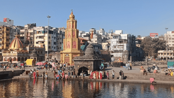
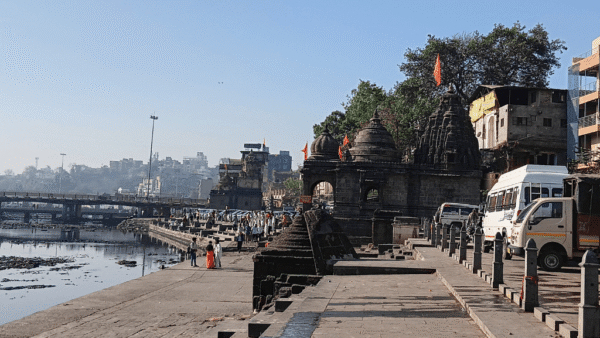
The Mithi originates in the hills east of the Sanjay Gandhi National Park, gathers water from many streams and discharges of the Tulsi, Vihar and Powai lakes, flows across the mangroves to the Mahim Creek and meets the Arabian Sea. The rain-fed river turns into a major stormwater drain during the monsoon. Along with the city’s other rivers – Dahisar, Oshiwara, and Poisar – and watercourses, it forms Mumbai’s natural drainage system.
The upstream of the Mithi, from Vihar Lake to Andheri-Kurla area, before its course was changed for the Mumbai airport, has a steep gradient; its downstream is relatively flat. Its catchment area is around 7,295 hectares (more than 18,000 acres).[7] Both its banks have had legal and illegal settlements for decades. Around 11.8 kilometres of the river is under the jurisdiction of the Brihanmumbai Municipal Corporation (BMC) and six kilometres under the Mumbai Metropolitan Region Development Authority (MMRDA).
The fact-finding committee into the July 2005 flood, chaired by Dr Madhav Chitale, hydrologist and former secretary of the union Ministry of Water Resources, among other aspects, showed the centrality of the Mithi to Mumbai’s rain water drainage. Officials claim that, by 2017-18, the conveyance capacity of the river during rain had increased by three times[8] and holding capacity by two times. But the Supreme Court-appointed expert committee rejected this.
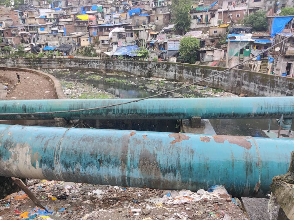
Subsequent reports of the expert committee show how the river has been treated – isolated from the city, engineered to a point of absurdity, walls contouring it, floodplains blocked by landfilling including the 620-acre Bandra Kurla Complex. The work has included desilting the river, constructing high-cost STPs to filter the filth from water that flows into it, building impervious retaining walls, widening the river though not at the trapezoid recommended by the committee, deepening it. The total budget for STPs is Rs 4,000 crore[9]
From 1975, at least six reports focused on cleaning the Mithi; the pace picked up after the July 2005 floods. But nearly 20 years later, and crores spent, the river is not back to its health.
Beyond flood control
The work overseen by the Mithi River Development and Protection Authority – the name does not focus on restoration and conservation – has meant construction and engineering-led interventions mentioned above. The cumulative impact has been to gradually cut the river off from the city, and disassociate it from inter-dependent ecological networks.
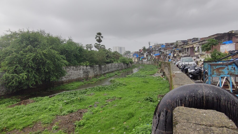
For example, the retaining walls have defined its boundaries and, under the guise of protecting the river, have segregated it from the land, trees, vegetation and biodiversity around; they have also isolated the areas through which the river flows. The walls are reportedly in the Coastal Regulation Zone.[10] These were not constructed as needed for an urban river with the 3-metre-high concrete walls hampering the visibility of rising water levels and affecting mangroves,[11] according to the expert committee.
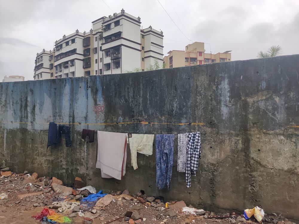
Most of its floodplains, buffer space during heavy rains for water to rise and fall, continue to be occupied by licensed or illegal settlements. This is contrary to the expert committee’s suggestion, in 2018, to make necessary policy provisions for their rehabilitation to free and maintain a 50-metre No Development Zone along the river’s length.
Though the river is confined within walls, the impact of rising water is still felt as localised floods by settlements along its length. In September 2019, nearly 1,000 people had to be evacuated from Kranti Nagar and Bamandaya Pada settlements as the Mithi swelled. Along the Kurla-Kalina flyover, shops of scrap dealers, whose solid waste seeped into the Mithi, were cleared this summer. The Mithi overflowed in Chunabhatti when it rained nearly 300 millimetres on July 8 this year.
The river’s danger mark is around 2.7 metres. Beyond that, people in settlements like Kranti Nagar and Bail Bazar scramble to safety, temporarily abandoning their homes or workshops.[12] The lack of proper rehabilitation over the years has forced them all to live next to the Mithi though it poses a flood threat.
Often, as seen in the Aarey section, the retaining walls have swallowed up the floodplains too. Water from the hills and the catchment areas cannot flow into the river, thereby flooding the areas around. Building walls has also meant that the flora and fauna on the river banks are affected. And despite the walls, the absence of floodplains means that flood threat continues to hover.[13]
Delinking ecology from floods
Beyond the walls-widening-desilting is the question that Mumbai’s environmentalists and the expert committee pose: how is the Mithi’s ecology being restored?
Delinking ecology from flood management plans since 2005 has meant a segregated and narrow approach to flooding. Draining the rainwater is one way but Mumbai, like other cities, has forgotten that it can soak into the earth too. This calls for more open areas with non-concretised surfaces and with an abundance of trees. More rainwater soaked means less drained out. This reduces the pressure on the stormwater drainage – including on the Mithi.
The Mithi authorities have installed trash booms at nine locations to collect garbage and prevent it from reaching the river, but the filth at the Mahim Creek tells a different story. The BMC and MMRDA have also focused on the installation of STPs but their role is questionable. For example, the one near Powai Garden collects water from close to the river’s source at Vihar Lake, processes it and pumps it back into the river – a futile exercise. Water hyacinth and debris were found along the wall here. Seven more STPs are planned at Worli, Bandra, Versova, Malad, Bhandup and Ghatkopar while the Dharavi STP is underway to treat 418 MLD sewage a day.[14]
While the BMC’s status report of 2019 dedicated several pages to STPs,[15] it did not even mention bio-remedial measures. These can be adopted with phytorid treatment, as seen in Irla Nullah.[16] Untreated sewage was found in 15 of the 19 culverts near Powai Lake in 2019-22; the lake feeds the Mithi.[17]
A river is not just the flowing (or filthy) water but includes its banks, floodplains, vegetation, and a mind-boggling range of biodiversity. This holistic way of seeing the Mithi has been missing from official plans; also, it has not been integrated into climate action plans.
Floodplain and encroachments (including the BKC)
Without adequate floodplains – 50 metres on both sides, recommended by the expert committee – there is no room for the river to swell during heavy rainfall, especially if it coincides with high tides. It must be underscored that protecting floodplain areas does not reflexively reduce the availability of land for housing and other purposes.
The floodplain ecology improves water quality[18] [19] and allows rainwater to soak into the ground. Floodplains are also spaces for people to interact with the river when it is not in spate.
The Mithi lost floodplain areas to the Mumbai airport decades ago[20] which caused flooding in the low-lying Kurla-Kalina area in July 2005 and many times since. “The Mithi (was) bent 90 degrees at the airport to extend the taxiway…Due to the expansion of the airport over 181 hectares, four out of five drains in Kalina which used to hold excess rainfall were choked,” wrote the late Darryl D’monte, environmentalist, editor and member of the Concerned Citizens Committee that examined the floods.[21]
The lesson was not learned at all. The posh financial-residential enclave of Bandra Kurla Complex was situated just before the Mithi meets the sea. Initiated in the 1970s, the plan took off in the past two decades, helmed by the MMRDA landfilling of a staggering 620 acres of the river basin and floodplains. This choking was responsible for the floods in 2005, the SC-expert committee pointed out.[22]It added that landfilling for roads and flyovers has further narrowed the mouth of the river at Mahim Bay. Yet, new connector roads to serve BKC are underway here.
The authorities strain to remove slums, terming them encroachments, but the largest encroachment – BKC – ironically thrives with some of the highest land prices in the world. Leaving floodplains vacant for water does not diminish land available to Mumbai; not doing so has cost it.
How Mumbai can reclaim the Mithi
If after nearly 20 years and thousands of crores spent, the Mithi is not the river it should be, what is the way out? Understanding the river ecology and restoring it. This would mean that the authorities – the special agency, BMC and MMRDA – see the rightful place of the river in Mumbai’s ecological network and move away from mere engineering-led interventions or techno-fixes towards renewing its life – waterflow, water quality, biodiversity and so on.
Unbridled construction has meant an assault on Mumbai’s natural areas including, but not limited to, the Mithi’s floodplains. The city continues to face floods, heat waves, and air pollution. The interventions in the Mithi, along with annual desilting, installing pumping stations across the city, widening other rivers – Dahisar from 30 to 45 metres, Oshiwara from 10 to 20 metres, Poisar from 20 to 25 metres – while deliberately ignoring the role of construction in undermining the city’s ecological wealth is myopic. To merely techno-fix the Mithi is like the classic band-aid on a bleeding wound.
“Mudflats, wetlands, floodplains, mangroves and wooded vegetation once slowed down the flow of storm water[23] …But now they are built over. Garbage spread everywhere clogs the waterways. Most channels and waterways that connect water bodies have been built over too, preventing streams from easily reaching the sea – forcing it to spread out into the low-lying areas of the city, adding to severe flooding. Mumbai’s extensive wetlands and mudflats, which had connected parts of the city since the early 19th century,[24] have disappeared. Their presence would retain the rain water and soak it into the ground,” wrote Dr Harini Nagendra, professor of sustainability, Azim Premji University.[25]
This study showed a relationship between increased greenhouse gas emissions and the changes in land use contaminating a river.[26] Mumbai, which saw several heat wave days[27] [28] this summer is more concretised than it was two decades ago.[29] Examples around the world show the benefit of an ecological approach – the Thames in London, the Cheonggyecheon Stream restoration in South Korea’s Seoul, or the Chicago Riverwalk all revived the relationship of these cities with rivers and created new public spaces, contributing to recreational, economic as well as ecological benefits.[30]
Mumbai was built on water, has been nourished or destroyed by water. This must lead to the logical next step – to renew its watercourses and their ecology so that water finds its way. It also means people see the rivers, including the Mithi, as a harmonious part of their life – not as a threat every monsoon. This cannot be unless the authorities course-correct their perception of the city’s ecology.
Photos: Jashvitha Dhagey